|
A22 Motorway (Netherlands)
The A22 motorway is a motorway in the Netherlands ) , anthem = ( en, "William of Nassau") , image_map = , map_caption = , subdivision_type = Sovereign state , subdivision_name = Kingdom of the Netherlands , established_title = Before independence , established_date = Spanish Netherl .... It is one of the shorter motorways in the Netherlands, with a total length of approximately 8 kilometers. The A22 starts at the interchange Velsen, where it splits from the A9 motorway. After interchange IJmuiden, exit IJmuiden, the Velsertunnel, and exit Beverwijk, it rejoins with the A9 motorway at the interchange Beverwijk. Wijkertunnel Until 1996, the entire A22 motorway was part of the A9, but due to the rising capacity problems in and around the Velsertunnel, it was decided to build an additional tunnel about a kilometer east of the Velsertunnel: the Wijkertunnel. When this tunnel was finished, the new road section and tunnel became part of the A9, while the old ro ... [...More Info...] [...Related Items...] OR: [Wikipedia] [Google] [Baidu] |
A9 Motorway (Netherlands)
The A9 motorway is a motorway in the Netherlands. The motorway starts off by going from the A1 at Diemen (junction Diemen) to the A2 at junction 'Holendrecht' (on the 'Gaasperdammerweg'). Overview Here one drives approximately two kilometers south by means of the combined A9/A2 before the A9 heads off to the west again towards Amstelveen, junction 'Badhoevedorp' ( A4), junction 'Raasdorp' ( A5), junction 'Rottepolderplein' ( A200) and on to junction 'Velsen' ( A22). Hereafter, the A9 goes further northward by means of the Wijkertunnel under the North Sea Canal, junction 'Beverwijk' ( A22) to Alkmaar. At this point, the A9 motorway becomes the N9 highway and proceeds until De Kooy (at Den Helder). In 1996, the Wijkertunnel was opened and integrated into the A9. The original route of the A9 ran through the Velsertunnel where there is also a connection with the A208. This part still exists but this portion of motorway has been re-numbered to A22. The part between A1 and A2 i ... [...More Info...] [...Related Items...] OR: [Wikipedia] [Google] [Baidu] |
Velsen
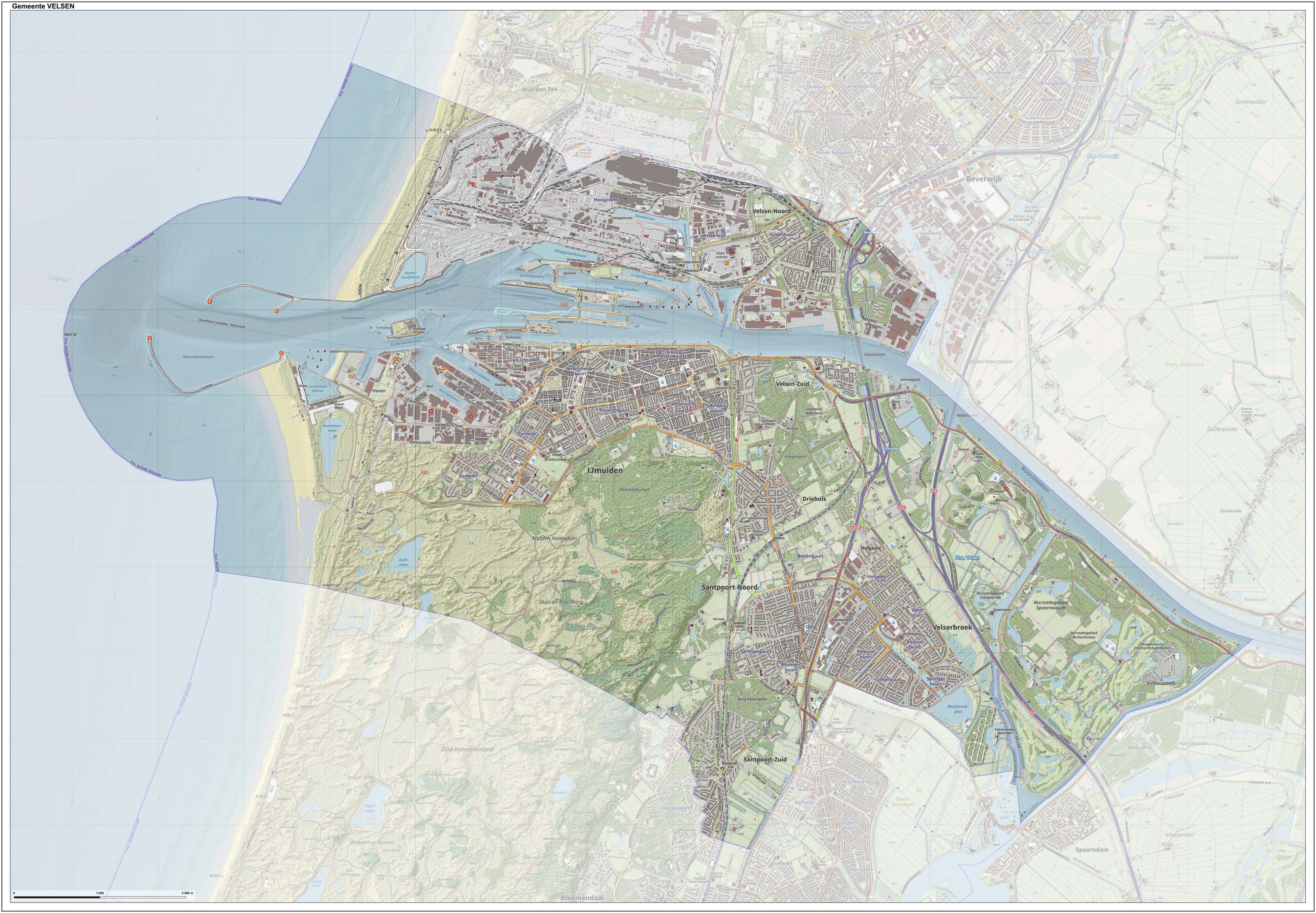
Velsen () is a municipality in the Netherlands, in the province of North Holland. It is located on both sides of the North Sea Canal. On the north side of the North Sea Canal there is a major steel plant, Tata Steel IJmuiden, formerly known as ''Koninklijke Hoogovens'' (the town of IJmuiden is actually located south of the canal). The headquarters of the Koninklijke Nederlandse Redding Maatschappij is located in IJmuiden. The Kennemerstrand beach on the south side of the canal is at the end of the Kennemerboulevard, which runs south of the Seaport Marina. To the south is the beach of Bloemendaal aan Zee. In between is a nude beach. Population centres The municipality of Velsen consists of the following cities, towns, villages and/or districts: * on the north of the North Sea Canal: ** Velsen-Noord * on the south of the North Sea Canal: ** Velsen-Zuid, Driehuis, IJmuiden, Santpoort-Noord, Santpoort-Zuid and Velserbroek, and the parts Oosterbroek and Buitenhuizen of the r ... [...More Info...] [...Related Items...] OR: [Wikipedia] [Google] [Baidu] |
Beverwijk
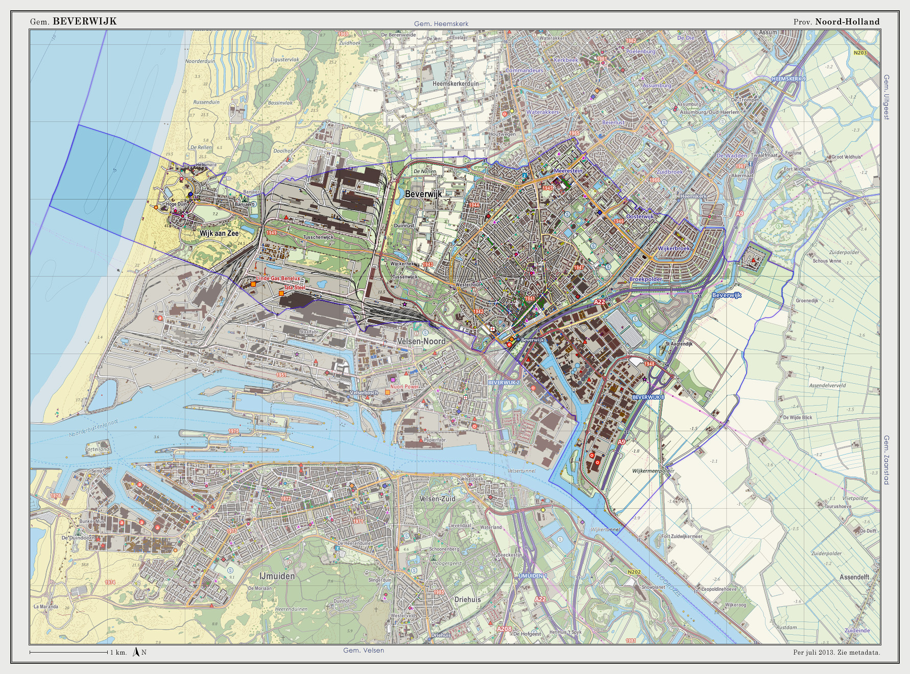
Beverwijk () is a municipality and a city in the Netherlands, in the province of North Holland. The town is located about northwest of Amsterdam in the Randstad metropolitan area, north of the North Sea Canal very close to the North Sea coast. A railway tunnel and two motorway tunnels cross the canal between Beverwijk and the nearby city of Haarlem on the south side of the canal. Around 1640, a town called Beverwyck was founded in the Dutch colony of New Netherland. That town's modern name is Albany, New York. Population centres The municipality of Beverwijk consists of two cores, Beverwijk proper and Wijk aan Zee, to the west, right on the coast. History The name Beverwijk comes from ''Bedevaartswijk'', meaning "pilgrimage neighbourhood". The town formed at the Saint Agatha Church which was a pilgrimage location in the Middle Ages. Allegedly Agatha of Sicily appeared there in the 9th century to a virgin from Velsen who was fleeing from the Count of Kennemerland. In 127 ... [...More Info...] [...Related Items...] OR: [Wikipedia] [Google] [Baidu] |
North Holland
North Holland ( nl, Noord-Holland, ) is a province of the Netherlands in the northwestern part of the country. It is located on the North Sea, north of South Holland and Utrecht, and west of Friesland and Flevoland. In November 2019, it had a population of 2,877,909 and a total area of , of which is water. From the 9th to the 16th century, the area was an integral part of the County of Holland. During this period West Friesland was incorporated. In the 17th and 18th century, the area was part of the province of Holland and commonly known as the Noorderkwartier (English: "Northern Quarter"). In 1840, the province of Holland was split into the two provinces of North Holland and South Holland. In 1855, the Haarlemmermeer was drained and turned into land. The provincial capital is Haarlem (pop. 161,265). The province's largest city and also the largest city in the Netherlands is the Dutch capital Amsterdam, with a population of 862,965 as of November 2019. The King's Commissi ... [...More Info...] [...Related Items...] OR: [Wikipedia] [Google] [Baidu] |
Motorway
A controlled-access highway is a type of highway that has been designed for high-speed vehicular traffic, with all traffic flow—ingress and egress—regulated. Common English terms are freeway, motorway and expressway. Other similar terms include '' throughway'' and '' parkway''. Some of these may be limited-access highways, although this term can also refer to a class of highways with somewhat less isolation from other traffic. In countries following the Vienna convention, the motorway qualification implies that walking and parking are forbidden. A fully controlled-access highway provides an unhindered flow of traffic, with no traffic signals, intersections or property access. They are free of any at-grade crossings with other roads, railways, or pedestrian paths, which are instead carried by overpasses and underpasses. Entrances and exits to the highway are provided at interchanges by slip roads (ramps), which allow for speed changes between the highway and arteri ... [...More Info...] [...Related Items...] OR: [Wikipedia] [Google] [Baidu] |
Netherlands
) , anthem = ( en, "William of Nassau") , image_map = , map_caption = , subdivision_type = Sovereign state , subdivision_name = Kingdom of the Netherlands , established_title = Before independence , established_date = Spanish Netherlands , established_title2 = Act of Abjuration , established_date2 = 26 July 1581 , established_title3 = Peace of Münster , established_date3 = 30 January 1648 , established_title4 = Kingdom established , established_date4 = 16 March 1815 , established_title5 = Liberation Day (Netherlands), Liberation Day , established_date5 = 5 May 1945 , established_title6 = Charter for the Kingdom of the Netherlands, Kingdom Charter , established_date6 = 15 December 1954 , established_title7 = Dissolution of the Netherlands Antilles, Caribbean reorganisation , established_date7 = 10 October 2010 , official_languages = Dutch language, Dutch , languages_type = Regional languages , languages_sub = yes , languages = , languages2_type = Reco ... [...More Info...] [...Related Items...] OR: [Wikipedia] [Google] [Baidu] |


