|
A226 Road
The A226 road travels in a west–east direction in southeast London and north Kent, from Crayford in the London Borough of Bexley, through Dartford, Gravesend to Strood. It is about 15.7 miles in length. Route The road begins with an end-on junction with the A207 to the east of the town of Crayford. in the London Borough of Bexley in Both roads are marked on street maps as being part of the Roman road Watling Street; although the A207 is ''Crayford Road'', the A226 being ''Dartford Road''. After the road becomes ''West Hill'' where the descent into the valley of the River Darent and the town of Dartford begins. At the foot of the hill the clockwise ringroad is encountered: the original road continued through what is now the pedestrianised High Street. Roads making up the Ring Road are (from the west): Highfield Road; Westgate; Home Gardens; Market Street; Lowfield Street (which continues south as the A225 road); and Instone Road. Beyond the Ring Road is ''East Hill'', ... [...More Info...] [...Related Items...] OR: [Wikipedia] [Google] [Baidu] |
Northfleet
Northfleet is a town in the borough of Gravesham in Kent, England. It is located immediately west of Gravesend, and on the border with the Borough of Dartford. Northfleet has its own railway station on the North Kent Line, just east of Ebbsfleet International railway station on the High Speed 1 line. The area Northfleet's name is derived from being situated on the northern reach of what was once called the River Fleet (today known as the Ebbsfleet River). There is a village at the other end of the river named Southfleet. It has been the site of a settlement on the shore of the River Thames adjacent to Gravesend since Roman times. It was known as ''Fleote'' by the Saxons c. 600 AD, ''Flyote'' c. 900 AD, and ''Flete'' c. 1000 AD. It was recorded as ''Norfluet'' in the Domesday Book, and ''Northflet'' in 1201. By 1610 the name of Northfleet had become established. A battle took place during the Civil War at the Stonebridge over the Ebbsfleet river. Northfleet became a town in 187 ... [...More Info...] [...Related Items...] OR: [Wikipedia] [Google] [Baidu] |
Stone, Kent
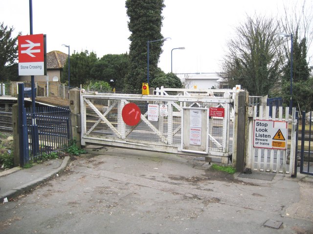
Stone is a village in the Borough of Dartford in Kent, England. It is located 2.5 miles east of Dartford. History Iron Age pottery and artefacts have been found here proving it to be an ancient settlement site. The 13th-century parish church, dedicated to St Mary the Virgin at Stone, was known as the "Lantern of Kent" from its beacon light known to all sailors on the river. It is one of Kent's most dramatic churches and is renowned for its Gothic sculpture made by the masons who built Westminster Abbey. The Grade I listing entry narrates each spandrel is either identical or almost identical to those at Westminster Abbey and therefore also dates to 1260, it also describes the North Chapel built for Sir Richard Wiltshire's death in 1527 The parish (including Bean) was part of Axstane Hundred and later Dartford Rural District. Stone Castle Located about a mile to the south of Greenhithe and just north of the Roman Watling Street, ''Stone Castle'' dates from the mid-11th centu ... [...More Info...] [...Related Items...] OR: [Wikipedia] [Google] [Baidu] |
A289 Road
List of A roads in Great Britain, A roads in List of A roads zones in Great Britain, zone 2 in Great Britain starting south of the River Thames and east of the A3 road (Great Britain), A3 (roads beginning with 2). __FORCETOC__ Single- and double-digit roads Triple-digit roads Four digit roads {{United Kingdom roads [...More Info...] [...Related Items...] OR: [Wikipedia] [Google] [Baidu] |
Higham, Kent
Higham is a large village, civil parish and electoral ward in the borough of Gravesham in Kent, England. The village lies just north-west of Strood, in the Medway unitary authority, and south-east of Gravesend. The civil parish had a population of 3,938 at the 2001 Census, increasing slightly to 3,962 at the 2011 Census. History The priory dedicated to St. Mary was built on land granted to Mary, daughter of King Stephen. In 1148, the nuns of St Sulphice-la-Foret, Brittany, moved to Higham. Higham priory was also known as Lillechurch.(Medieval Religious Houses, p. 259). On 6 July 1227, King Henry III confirmed the royal grant to the abbey of St. Mary and St. Sulpice of Lillechurch. The original parish church, the Church of St Mary, stands to the north of the present village. Now redundant, it is in the care of the Churches Conservation Trust, and is open to visitors on a daily basis. It contains much medieval woodwork and its pulpit is one of the oldest in Kent, dating from the ... [...More Info...] [...Related Items...] OR: [Wikipedia] [Google] [Baidu] |
Toll Road
A toll road, also known as a turnpike or tollway, is a public or private road (almost always a controlled-access highway in the present day) for which a fee (or ''toll'') is assessed for passage. It is a form of road pricing typically implemented to help recoup the costs of road construction and maintenance. Toll roads have existed in some form since antiquity, with tolls levied on passing travelers on foot, wagon, or horseback; a practice that continued with the automobile, and many modern tollways charge fees for motor vehicles exclusively. The amount of the toll usually varies by vehicle type, weight, or number of axles, with freight trucks often charged higher rates than cars. Tolls are often collected at toll plazas, toll booths, toll houses, toll stations, toll bars, toll barriers, or toll gates. Some toll collection points are automatic, and the user deposits money in a machine which opens the gate once the correct toll has been paid. To cut costs and minimise time delay, ... [...More Info...] [...Related Items...] OR: [Wikipedia] [Google] [Baidu] |
Arterial Road
An arterial road or arterial thoroughfare is a high-capacity urban road that sits below freeways/motorways on the road hierarchy in terms of traffic flow and speed. The primary function of an arterial road is to deliver traffic from collector roads to freeways or expressways, and between urban centres at the highest level of service possible. As such, many arteries are limited-access roads, or feature restrictions on private access. Because of their relatively high accessibility, many major roads face large amounts of land use and urban development, making them significant urban places. In traffic engineering hierarchy, an arterial road delivers traffic between collector roads and freeways. For new arterial roads, intersections are often reduced to increase traffic flow. In California, arterial roads are usually spaced every half mile, and have intersecting collector(s) and streets. Some arterial roads, characterized by a small fraction of intersections and driveways compared to ... [...More Info...] [...Related Items...] OR: [Wikipedia] [Google] [Baidu] |
Chalk, Kent
Chalk is a village and since 1935 a former civil parish which adjoins the east of Gravesend, Kent, England. As is intuitive, its name comes from the Saxon word ''cealc'' meaning a chalkstone. In 1931 the parish had a population of 563. One layer of the chalk carries ''flints'', stones embedded in the chalk, and these were used in building and in providing the means of fire for ''muskets''. The stone is often cut to provide a flat edge as a craft known as ''flint-knapping''. The trade was worked in Chalk from the 17th century onwards. Gun-flints were produced here in large quantities until the early 19th century. Current issues relating to the immediate environment around Chalk include a proposed new Lower Thames Crossing across the nearby estuary marshes, confirmed in 2017. History Chalk was known to people as early as the 8th century, as a ''witanagemot'' (a Saxon meeting) held here is mentioned in the Domesday Book. An Iron Age settlement was discovered near St. Mary's Churc ... [...More Info...] [...Related Items...] OR: [Wikipedia] [Google] [Baidu] |
A227 Road
List of A roads in zone 2 in Great Britain starting south of the River Thames The River Thames ( ), known alternatively in parts as the The Isis, River Isis, is a river that flows through southern England including London. At , it is the longest river entirely in England and the Longest rivers of the United Kingdom, se ... and east of the A3 (roads beginning with 2). __FORCETOC__ Single- and double-digit roads Triple-digit roads Four digit roads {{United Kingdom roads 2 2 ... [...More Info...] [...Related Items...] OR: [Wikipedia] [Google] [Baidu] |
Gravesend West Line
The Gravesend West Line was a short railway line in Kent that branched off the Swanley to Chatham line at Fawkham Junction and continued for a distance of 5 miles (8 km) to Gravesend where the railway company constructed a pier to connect trains with steamers. It was opened in 1886 and closed to passenger services in 1953, remaining open to freight until 1968 before reopening briefly between 1972 and 1976. Part of the railway's former alignment was incorporated into the Channel Tunnel Rail Link. History Authorisation to construct the Gravesend West Line was obtained by the Gravesend Railway Company in the shape of the Gravesend Railway Act 1881 (c.cxliv) which received royal assent on 18 July 1881. The Act envisaged a junction with the Chatham Main Line near the village of Pinden which lies between the larger settlements of Farningham and Fawkham from which a line would run to Gravesend, a town already well-served by the railway. The project was driven by Sir Sydne ... [...More Info...] [...Related Items...] OR: [Wikipedia] [Google] [Baidu] |
Northfleet Urban Country Park
Northfleet Urban Country Park is in Northfleet, in Kent, England. The site is land encompassed by Springhead Road, Thames Way, west of Vale Road and (on its northern boundary) the railway (the Dartford to London railway). The site is owned by and managed by Gravesham Borough Council. History The site was used for orchards / farming until the 1940s, when it (and others along the railway) was used as a chalk pit. This went down to about 8‐10m deep. On 7 May 1957, planning was given for a refuse tip on the site, and on 10 December 1992, landfill gas venting trenches were installed. Gravesend Council permitted the formation of an urban country park containing a lake, woodlands, meadows, wetlands and trim trail, play area and toilets/kiosk/seating area in August 1996. The site was landscaped with the importing of 130,000m3 of cleaned topsoil, to raise the level of the land between two and four metres. New resurfaced footpath and cycle routes were then constructed on the 2 plateaued ... [...More Info...] [...Related Items...] OR: [Wikipedia] [Google] [Baidu] |
Fastrack (bus)
Fastrack is a bus rapid transit scheme in the Thames Gateway area of Kent. It consists of three routes, operated by Arriva Southern Counties on behalf of Kent County Council with Prologis and Amazon respectively. Measures used to allow buses to avoid traffic include signal priority, reserved lanes, and dedicated busways. Routes Construction work on Fastrack started on Thursday, 23 September 2004, and it began operating with the introduction of Fastrack B on Sunday, 26 March 2006 between Temple Hill and Gravesend, serving Darent Valley Hospital, Bluewater Shopping Centre, Greenhithe station (and Ebbsfleet International station since it opened on Monday, 19 November 2007). Services operate from 05:30 until after midnight. The 9.5 km (5.9 mi) long Fastrack A was added on Sunday, 3 June 2007. It operates up to every ten minutes between Dartford and Bluewater along the western side of Temple Hill, The Bridge Crossways Business Park and Greenhithe station. Fastrack A ... [...More Info...] [...Related Items...] OR: [Wikipedia] [Google] [Baidu] |
Channel Tunnel Rail Link
High Speed 1 (HS1), legally the Channel Tunnel Rail Link (CTRL), is a high-speed railway linking London with the Channel Tunnel. It is part of a line carrying international passenger traffic between the United Kingdom and mainland Europe; it also carries domestic passenger traffic to and from stations in Kent and east London, and continental European loading gauge freight traffic. From the Channel Tunnel, the line crosses the River Medway, and tunnels under the River Thames, terminating at London St Pancras International station on the north side of central London. It cost £5.8 billion to build and opened on 14 November 2007. Trains run at speeds of up to on HS1. Intermediate stations are at in London, Ebbsfleet International in northern Kent and Ashford International in southern Kent. International passenger services are provided by Eurostar International, with journey times from London St Pancras International to Paris Gare du Nord in 2hours 15minutes, and Londo ... [...More Info...] [...Related Items...] OR: [Wikipedia] [Google] [Baidu] |


