|
A2100 Road
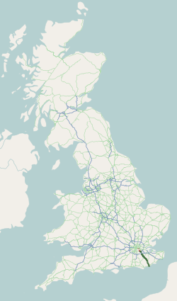
The A2100 is a non-primary A road in East Sussex, England. It runs from near Mountfield, East Sussex to Baldslow in the north of Hastings. It was part of the original A21 road from London to Hastings, and passes through Battle, the site of the Battle of Hastings. Going south, the route starts at the Johns Cross roundabout near Mountfield. From this point the current route of the A21 continues south-east through Vinehall Street, Whatlington and Kent Street, while the A2100 goes more or less due south. It initially travels through woods, and crosses the Hastings railway line at a level crossing. It later forms the main street of Battle, and then turns south-east towards Hastings, eventually meeting the A21 and the A28 at Baldslow Baldslow is a suburb in the north of Hastings, East Sussex, England. It is sometimes considered part of Conquest as Bohemia and Silverhill. The area lies on the A21 and the Hastings ring road, and the A28 road junction with the A21. Ore ... [...More Info...] [...Related Items...] OR: [Wikipedia] [Google] [Baidu] |
Johns Cross, East Sussex
Mountfield is a village and civil parish in the Rother District, Rother district of East Sussex, England, and three miles (5 km) north-west of Battle, East Sussex, Battle. It is mentioned in the ''Domesday Book''. The parish church is dedicated to All Saints; Mountfield and Whatlington Church of England Primary School is at the road junction in the nearby hamlet of Johns Cross by the A21 road (England), A21 and the A2100 roads further north. Governance The lowest level of government is the Mountfield parish council. The parish council is responsible for local amenities including two playing fields and a children's play area. Elections are held every four years. The May 2011 election was uncontested. Rother District council provides the next level of government with services such as refuse collection, planning consent, leisure amenities and council tax collection. Mountfield is part of the Darwell Ward. East Sussex county council is the third tier of government, providing ... [...More Info...] [...Related Items...] OR: [Wikipedia] [Google] [Baidu] |
Battle Of Hastings
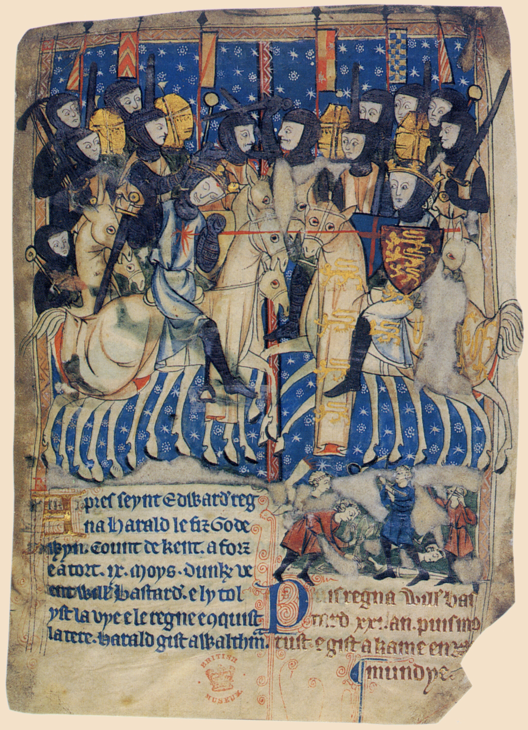
The Battle of Hastings nrf, Batâle dé Hastings was fought on 14 October 1066 between the Norman-French army of William the Conqueror, William, the Duke of Normandy, and an English army under the Anglo-Saxons, Anglo-Saxon King Harold Godwinson, beginning the Norman Conquest of England. It took place approximately northwest of Hastings, close to the present-day town of Battle, East Sussex, and was a decisive Normans, Norman victory. The background to the battle was the death of the childless King Edward the Confessor in January 1066, which set up a succession struggle between several claimants to his throne. Harold was crowned king shortly after Edward's death, but faced invasions by William, his own brother Tostig Godwinson, Tostig, and the Norwegian King Harald Hardrada (Harold III of Norway). Hardrada and Tostig defeated a hastily gathered army of Englishmen at the Battle of Fulford on 20 September 1066, and were in turn defeated by Harold at the Battle of Stamford Brid ... [...More Info...] [...Related Items...] OR: [Wikipedia] [Google] [Baidu] |
Roads In England
The United Kingdom has a network of roads, of varied quality and capacity, totalling about . Road distances are shown in miles or yards and UK speed limits are indicated in miles per hour (mph) or by the use of the national speed limit (NSL) symbol. Some vehicle categories have various lower maximum limits enforced by speed limiters. A unified numbering system is in place for Great Britain, whilst in Northern Ireland, there is no available explanation for the allocation of road numbers. The earliest specifically engineered roads were built during the British Iron Age. The road network was expanded during the Roman occupation. Some of these roads still remain to this day. New roads were added in the Middle Ages and from the 17th century onwards. Whilst control has been transferred between local and central bodies, current management and development of the road network is shared between local authorities, the devolved administrations of Scotland, Wales and Northern Ireland, a ... [...More Info...] [...Related Items...] OR: [Wikipedia] [Google] [Baidu] |
A28 Road
The A28 is a trunk road in the counties of Kent and East Sussex in south east England, connecting Margate, Canterbury, Ashford and Hastings. Starting at the seaside resort of Margate at the north-east point of Kent, the A28 runs inland and west-southwest to the cathedral city of Canterbury, before passing through the chalk hills of the North Downs via the gap cut by the River Stour, to the town of Ashford in the Vale of Holmesdale. From here, the A28 proceeds via the market town of Tenterden, to the East Sussex seaside town of Hastings, on the English Channel. Route The A28 leaves Margate via the seaside resorts of Westgate and Birchington, and then heads inland reaching open countryside at the village of Sarre, after which the road roughly parallels both the Ashford-Ramsgate railway line and the Great Stour river on their combined route to Canterbury and then Ashford. From Sarre, the road passes through the villages of Upstreet, Hersden and Sturry, and then to the cit ... [...More Info...] [...Related Items...] OR: [Wikipedia] [Google] [Baidu] |
Kent Street, East Sussex
Kent is a county in South East England and one of the home counties. It borders Greater London to the north-west, Surrey to the west and East Sussex to the south-west, and Essex to the north across the estuary of the River Thames; it faces the French department of Pas-de-Calais across the Strait of Dover. The county town is Maidstone. It is the fifth most populous county in England, the most populous non-Metropolitan county and the most populous of the home counties. Kent was one of the first British territories to be settled by Germanic tribes, most notably the Jutes, following the withdrawal of the Romans. Canterbury Cathedral in Kent, the oldest cathedral in England, has been the seat of the Archbishops of Canterbury since the conversion of England to Christianity that began in the 6th century with Saint Augustine. Rochester Cathedral in Medway is England's second-oldest cathedral. Located between London and the Strait of Dover, which separates England from mainl ... [...More Info...] [...Related Items...] OR: [Wikipedia] [Google] [Baidu] |
Whatlington
Whatlington is a village and civil parish in the Rother district of East Sussex, England. The village is located seven miles (11 km) north of Hastings, just off the A21 road. The village is in two parts, one in the valley on the road from Battle, where the church and the parish hall lie on either side of the stream, and one a mile or so further on the main A21 to Hastings, with a triangular village green in front of the ''Royal Oak'' pub. Like most country pubs, the ''Royal Oak'' is now part restaurant. For many years, it underwent a one-night transformation when the entire London Philharmonic Orchestra would stop for a pint in evening dress on the way back from playing at Hastings. The Norman parish church is dedicated to St Mary Magdalene; the yew tree which stood there until 1987 was traditionally thought to be one thousand years old, and to have been used by William the Conqueror to hang members of King Harold's personal guard. Malcolm Muggeridge lived with his family ... [...More Info...] [...Related Items...] OR: [Wikipedia] [Google] [Baidu] |
Vinehall Street, East Sussex
Whatlington is a village and civil parish in the Rother district of East Sussex, England. The village is located seven miles (11 km) north of Hastings, just off the A21 road. The village is in two parts, one in the valley on the road from Battle, where the church and the parish hall lie on either side of the stream, and one a mile or so further on the main A21 to Hastings, with a triangular village green in front of the ''Royal Oak'' pub. Like most country pubs, the ''Royal Oak'' is now part restaurant. For many years, it underwent a one-night transformation when the entire London Philharmonic Orchestra would stop for a pint in evening dress on the way back from playing at Hastings. The Norman parish church is dedicated to St Mary Magdalene; the yew tree which stood there until 1987 was traditionally thought to be one thousand years old, and to have been used by William the Conqueror to hang members of King Harold's personal guard. Malcolm Muggeridge lived with his family ... [...More Info...] [...Related Items...] OR: [Wikipedia] [Google] [Baidu] |
Battle, East Sussex
Battle is a small town and civil parish in the local government district of Rother in East Sussex, England. It lies south-east of London, east of Brighton and east of Lewes. Hastings is to the south-east and Bexhill-on-Sea to the south. Battle is in the designated High Weald Area of Outstanding Natural Beauty, and is a tourist destination and commuter town for white collar workers in the City of London. The parish population was 6,048 according to the 2001 census, increasing to 6,673 with the 2011 Census. Battle is the site of the Battle of Hastings, where William, Duke of Normandy, defeated King Harold II to become William I in 1066. History In 1066, the area was known for its salt production, with today's Netherfield ward within a large wealthy ancient hundred called Hailesaltede.Nether ... [...More Info...] [...Related Items...] OR: [Wikipedia] [Google] [Baidu] |
Hastings
Hastings () is a large seaside town and borough in East Sussex on the south coast of England, east to the county town of Lewes and south east of London. The town gives its name to the Battle of Hastings, which took place to the north-west at Senlac Hill in 1066. It later became one of the medieval Cinque Ports. In the 19th century, it was a popular seaside resort, as the railway allowed tourists and visitors to reach the town. Today, Hastings is a fishing port with the UK's largest beach-based fishing fleet. It has an estimated population of 92,855 as of 2018. History Early history The first mention of Hastings is found in the late 8th century in the form ''Hastingas''. This is derived from the Old English tribal name '' Hæstingas'', meaning 'the constituency (followers) of Hæsta'. Symeon of Durham records the victory of Offa in 771 over the ''Hestingorum gens'', that is, "the people of the Hastings tribe." Hastingleigh in Kent was named after that tribe. The place n ... [...More Info...] [...Related Items...] OR: [Wikipedia] [Google] [Baidu] |
A21 Road (England)
''For other roads with the same name see List of A21 roads.'' The A21 is a trunk road in Southern England, one of several which connect London and various commuter towns to the south coast. It provides a link to Hastings, East Sussex and parts of Kent. Half of the distance covered is over gently undulating terrain, with some hills and bends. Often traffic is slow-moving, particularly on weekdays on the short single carriageway stretches; and in summer with holiday traffic. Because of this, people have described the A21 as "a joke" and businesspeople have been reported to "hate coming down the A21". There have been many proposals to upgrade parts of the A21 in response to this. Parts of the A21 follow the historic turnpike roads: for example the section from Sevenoaks to Tunbridge Wells, opened in 1710; other sections of the road were similarly dealt with later in the century. It is also the location of the first wildlife overbridge in the United Kingdom, near Lamberhurst. The ... [...More Info...] [...Related Items...] OR: [Wikipedia] [Google] [Baidu] |
Baldslow
Baldslow is a suburb in the north of Hastings, East Sussex, England. It is sometimes considered part of Conquest as Bohemia and Silverhill. The area lies on the A21 and the Hastings ring road, and the A28 road junction with the A21. Ore Ore is natural rock or sediment that contains one or more valuable minerals, typically containing metals, that can be mined, treated and sold at a profit.Encyclopædia Britannica. "Ore". Encyclopædia Britannica Online. Retrieved 7 Apr ... and Central Conquest is to the East, and Ashdown and Hollington are to the West. History The name Baldslow means "Beald’s Hill". References Suburbs of Hastings {{EastSussex-geo-stub ... [...More Info...] [...Related Items...] OR: [Wikipedia] [Google] [Baidu] |


