|
A132 Road (England)
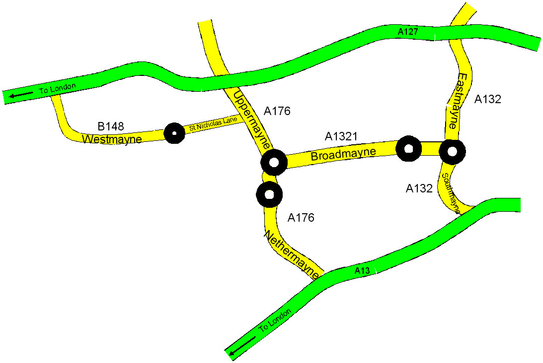
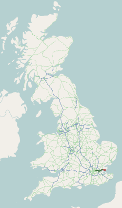
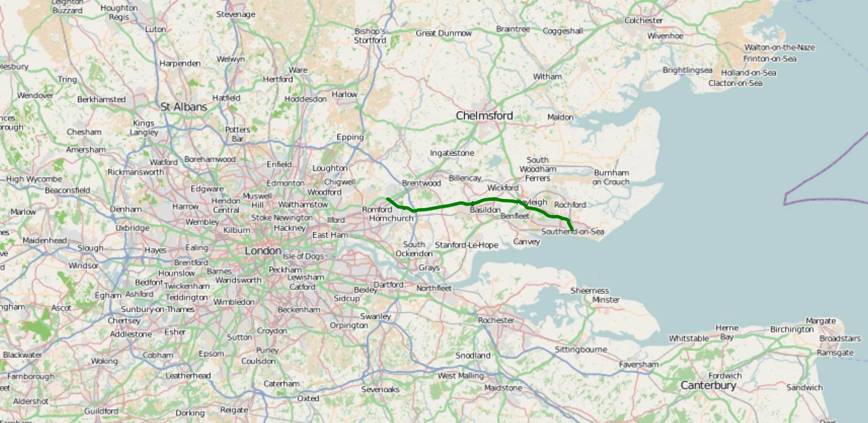
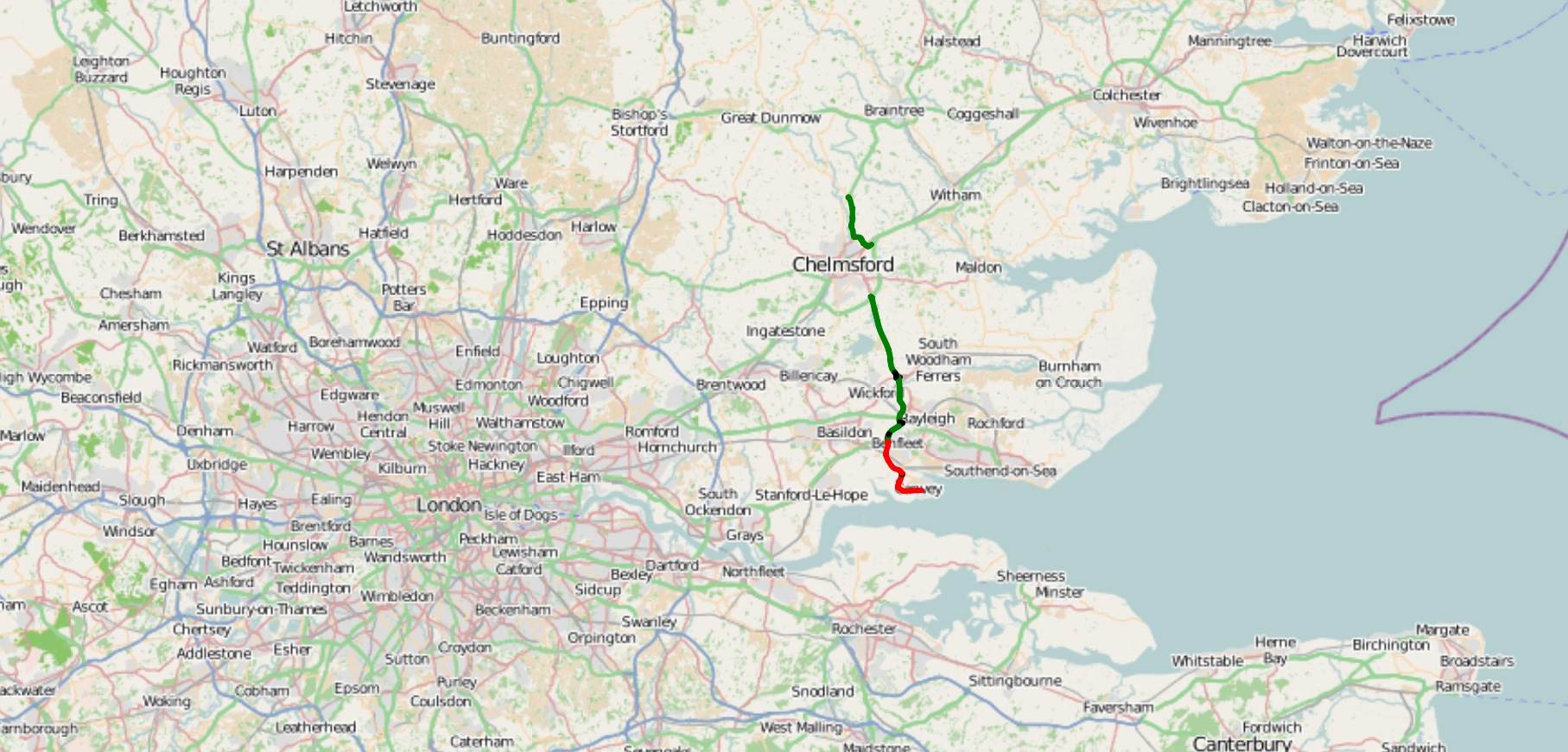
The A132 road is a road in England connecting Pitsea and South Woodham Ferrers. Route description The A132 starts from a roundabout next to the A13 road (England), A13 in Pitsea. From there, the route heads towards Basildon. After going through Basilton, the route heads northwards to an Roundabout interchange, interchange with the A127 road, A127. From the interchange, the route heads north-eastwards through Wickford to a partial cloverleaf interchange with the A130 road, A130. From there, the route continues to head north-eastwards to a roundabout in South Woodham Ferrers. References Roads in England Roads in Essex {{England-road-stub ... [...More Info...] [...Related Items...] OR: [Wikipedia] [Google] [Baidu] |
South Woodham Ferrers
South Woodham Ferrers is a town and civil parish in the borough of Chelmsford, in the English county of Essex. It is approximately from London and southeast of the city of Chelmsford, and had a population of 16,453 at the 2011 Census, a decrease from 16,629 at the 2001 Census. The town is situated east of Fenn Creek, near to where it meets the River Crouch. South Woodham Ferrers is currently part of the Maldon constituency represented by John Whittingdale MP. History The railway station opened in 1889 to serve South Woodham Ferrers and the surrounding area. The town of South Woodham Ferrers continued to develop until it was formally recognised as a separate community to Woodham Ferrers, located one mile north. The parish was formed on 1 April 1987 from Woodham Ferrers. In 1981 Queen Elizabeth II opened the town square, which is named after her. Many street names in the southwestern part of the town are taken from the works of J. R. R. Tolkien, such as Gandalf's Ride, Gi ... [...More Info...] [...Related Items...] OR: [Wikipedia] [Google] [Baidu] |
Pitsea
Pitsea is a small town and former civil parish, now in the unparished area of Basildon, in south Essex, England. It comprises five sub-districts: Eversley, Northlands Park Neighbourhood (previously known as Felmores), Chalvedon, Pitsea Mount and Burnt Mills. It is part of the new town of Basildon. In 1931 the parish had a population of 3414. During the creation of the new town of Basildon in the late 1940s and early 1950s, "Pitsea", "Vange" and "Laindon" were considered as possible names for the new town. As Basildon village was central to the district, the town was eventually named "Basildon". Before the new town regeneration, Pitsea itself was made up of unbuilt plot lands and was regarded as underdeveloped and run down. The Cinema Museum in London holds extensive home movies from the Jefree family of Pitsea in the 50's. Ref HMO353 History There is little known history about Pitsea but its earliest recorded name is Piceseia which was in 1086 and probably recorded as this in ... [...More Info...] [...Related Items...] OR: [Wikipedia] [Google] [Baidu] |
Basildon
Basildon ( ) is the largest town in the borough of Basildon, within the county of Essex, England. It has a population of 107,123. In 1931 the parish had a population of 1159. It lies east of Central London, south of the city of Chelmsford and west of Southend-on-Sea. Nearby smaller towns include Billericay to the north-west, Wickford to the north-east and South Benfleet to the south-east. It was created as a new town after World War II in 1948, to accommodate the London population overspill from the conglomeration of four small villages, namely Pitsea, Laindon, Basildon (the most central of the four) and Vange. The local government district of Basildon, which was formed in 1974 and received borough status in 2010, encapsulates a larger area than the town itself; the two neighbouring towns of Billericay and Wickford, as well as rural villages and smaller settlements set among the surrounding countryside, fall within its borders. Basildon Town is one of the most densely p ... [...More Info...] [...Related Items...] OR: [Wikipedia] [Google] [Baidu] |
Wickford
Wickford is a town and civil parish in the south of the English county of Essex, with a population of 33,486. Located approximately 30 miles (50 km) east of London, it is within the Borough of Basildon along with the original town of Basildon, Billericay, Laindon and Pitsea. Wickford has a main high street which includes a wide range of shops. It also has a swimming pool, library, open-air market and a community centre within the vicinity of the town centre. History Wickford has a history going back over two thousand years. There is evidence that the area itself was inhabited in prehistoric times probably by a tribe of Britons called Trinovantes. There was a Roman military marching camp on the Beauchamps Farm site, which was succeeded by a Roman villa. This is now the site of Beauchamps High School. This area on higher ground was the historic core of Wickford, the site of the manor house and the parish church of St Catherine's. Over time, the commercial centre of Wic ... [...More Info...] [...Related Items...] OR: [Wikipedia] [Google] [Baidu] |
Roundabout
A roundabout is a type of circular intersection or junction in which road traffic is permitted to flow in one direction around a central island, and priority is typically given to traffic already in the junction.''The New Shorter Oxford English Dictionary,'' Volume 2, Clarendon Press, Oxford (1993), page 2632 Engineers use the term modern roundabout to refer to junctions installed after 1960 that incorporate various design rules to increase safety. Both modern and non-modern roundabouts, however, may bear street names or be identified colloquially by local names such as rotary or traffic circle. Compared to stop signs, traffic signals, and earlier forms of roundabouts, modern roundabouts reduce the likelihood and severity of collisions greatly by reducing traffic speeds and minimizing T-bone and head-on collisions. Variations on the basic concept include integration with tram or train lines, two-way flow, higher speeds and many others. For pedestrians, traffic exiting the ... [...More Info...] [...Related Items...] OR: [Wikipedia] [Google] [Baidu] |
A13 Road (England)
The A13 is a major road in England linking Central London with east London and south Essex. Its route is similar to that of the London, Tilbury and Southend line via Rainham, Grays, Tilbury & Stanford-Le-Hope, and runs the entire length of the northern Thames Gateway area, terminating on the Thames Estuary at Shoeburyness. It is a trunk road between London and the Tilbury junction, a primary route between there and Sadlers Hall Farm near South Benfleet, and a non-primary route between there and Shoeburyness. Route London The A13 used to start at Aldgate Pump; but now begins at the junction with the A11 at what used to be the Aldgate one way system in east London and heads eastwards through the boroughs of Tower Hamlets, Newham, Barking & Dagenham and Havering before reaching the Greater London boundary. Commercial Road and East India Dock Road At the cental London end, Commercial Road and East India Dock Road form one of two main arteries through the historic East End ... [...More Info...] [...Related Items...] OR: [Wikipedia] [Google] [Baidu] |
Roundabout Interchange
A roundabout interchange is a type of interchange between a controlled access highway, such as a motorway or freeway, and a minor road. The slip roads to and from the motorway carriageways converge at a single roundabout, which is grade-separated from the motorway lanes with bridges. Design A roundabout interchange is similar to a rotary interchange, which uses a rotary rather than a roundabout. Roundabouts may also be used in conjunction with other interchange types such as a standard or folded diamond interchange, but such use should not be confused with a roundabout interchange. Roundabout interchanges are extremely common in the United Kingdom and Ireland with hundreds on the motorway network alone. However, recent cost cutting has meant that dumbbell interchanges are increasingly used instead. These are essentially diamond interchanges with roundabouts instead of signals or stop signs where the slip roads meet the minor road. They are cheaper than roundabout interchan ... [...More Info...] [...Related Items...] OR: [Wikipedia] [Google] [Baidu] |
A127 Road
The A127, also known as the Southend Arterial Road, is a major road in Essex, England. It was constructed as a new arterial road project in the 1920s, linking Romford with Southend-on-Sea, replacing the older A13. Formerly classified as a trunk road, it was "de-trunked" in 1997. It is known as the ''Southend Arterial Road'' except for part of its length in Southend-on-Sea. It is also streetlit for its whole length despite its majority coverage through rural land. Route The A127 starts as a turning off the A12 at Gallows Corner in the London Borough of Havering. Traffic heading towards London goes over a flyover and joins the A12 traffic which merges onto the slip-road from the roundabout below, which is where the A127 ends. Traffic heading towards Southend also uses the flyover as well as slip roads. Its first significant junction is a crossroads after (''Squirrels Heath'') with ''Squirrels Heath Road'' and ''Ardleigh Green Road''. There are traffic lights here, but aft ... [...More Info...] [...Related Items...] OR: [Wikipedia] [Google] [Baidu] |
Partial Cloverleaf Interchange
A partial cloverleaf interchange or parclo is a modification of a cloverleaf interchange. The design has been well received, and has since become one of the most popular freeway-to- arterial interchange designs in North America. It has also been used occasionally in some European countries, such as Germany, Hungary, Italy, the Netherlands, and the United Kingdom. Comparison with other interchanges *A diamond interchange has four ramps. *A cloverleaf interchange has eight ramps, as does a stack interchange. They are fully grade separated, unlike a parclo, and have traffic flow without stops on all ramps and throughways. *A parclo generally has either four or six ramps but less commonly has five ramps. Naming In Ontario, the specific variation is identified by a letter/number suffix after the name. Ontario's naming conventions are used in this article. The letter ''A'' designates that two ramps meet the freeway ''ahead'' of the arterial road, while ''B'' designates that two ram ... [...More Info...] [...Related Items...] OR: [Wikipedia] [Google] [Baidu] |
A130 Road
The A130 is a major road in England linking Little Waltham, near Chelmsford, the county town of Essex, with Canvey Island in the south of that county. It is a primary route for most of its length, only losing that status south of the A13 junction at Sadlers Farm roundabout as it nears its terminus on Canvey Island. It was originally a much longer cross-country route (see ''History''). Route The present route can be divided into three main sections, plus an overlap with the A12. The road now starts near the village of Little Waltham (to the north of Chelmsford) at a roundabout with the A131, which heads north-east to Braintree, and the B1008, a former A130 alignment heading south into northern Chelmsford, and north towards Great Dunmow (this section only declassified as recently as early 2008). Either side of this junction, the B1008/A130 route is quite recent, named ''Essex Regiment Way'', and at the Chelmsford end, the A130 intersects with the other routes into northern ... [...More Info...] [...Related Items...] OR: [Wikipedia] [Google] [Baidu] |
Roads In England
The United Kingdom has a network of roads, of varied quality and capacity, totalling about . Road distances are shown in miles or yards and UK speed limits are indicated in miles per hour (mph) or by the use of the national speed limit (NSL) symbol. Some vehicle categories have various lower maximum limits enforced by speed limiters. A unified numbering system is in place for Great Britain, whilst in Northern Ireland, there is no available explanation for the allocation of road numbers. The earliest specifically engineered roads were built during the British Iron Age. The road network was expanded during the Roman occupation. Some of these roads still remain to this day. New roads were added in the Middle Ages and from the 17th century onwards. Whilst control has been transferred between local and central bodies, current management and development of the road network is shared between local authorities, the devolved administrations of Scotland, Wales and Northern Ireland, and ... [...More Info...] [...Related Items...] OR: [Wikipedia] [Google] [Baidu] |


