|
2nd Avenue (Manhattan)
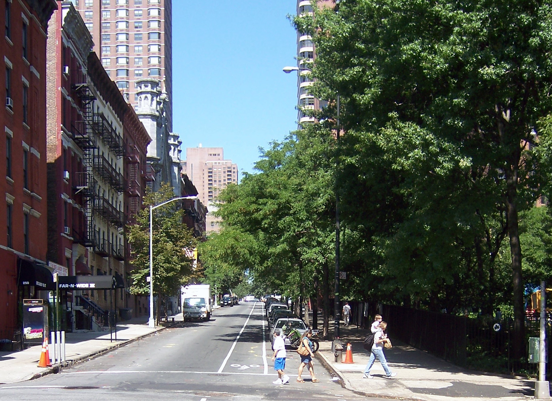
Second Avenue is located on the East Side of the New York City borough of Manhattan extending from Houston Street at its south end to the Harlem River Drive at 128th Street at its north end. A one-way street, vehicular traffic on Second Avenue runs southbound (downtown) only, except for a one-block segment of the avenue in Harlem. South of Houston Street, the roadway continues as Chrystie Street south to Canal Street. A bicycle lane runs in the leftmost lane of Second Avenue from 125th to Houston Streets. The section from 55th to 34th Streets closes a gap in the Manhattan Waterfront Greenway. Second Avenue passes through a number of Manhattan neighborhoods including (from south to north) the Lower East Side, the East Village, Stuyvesant Square, Kips Bay, Tudor City, Turtle Bay, East Midtown, Lenox Hill, Yorkville and Spanish Harlem. History Downtown Second Avenue in the Lower East Side was the home to many Yiddish theatre productions during the early part of the 20th c ... [...More Info...] [...Related Items...] OR: [Wikipedia] [Google] [Baidu] |
City Of New York
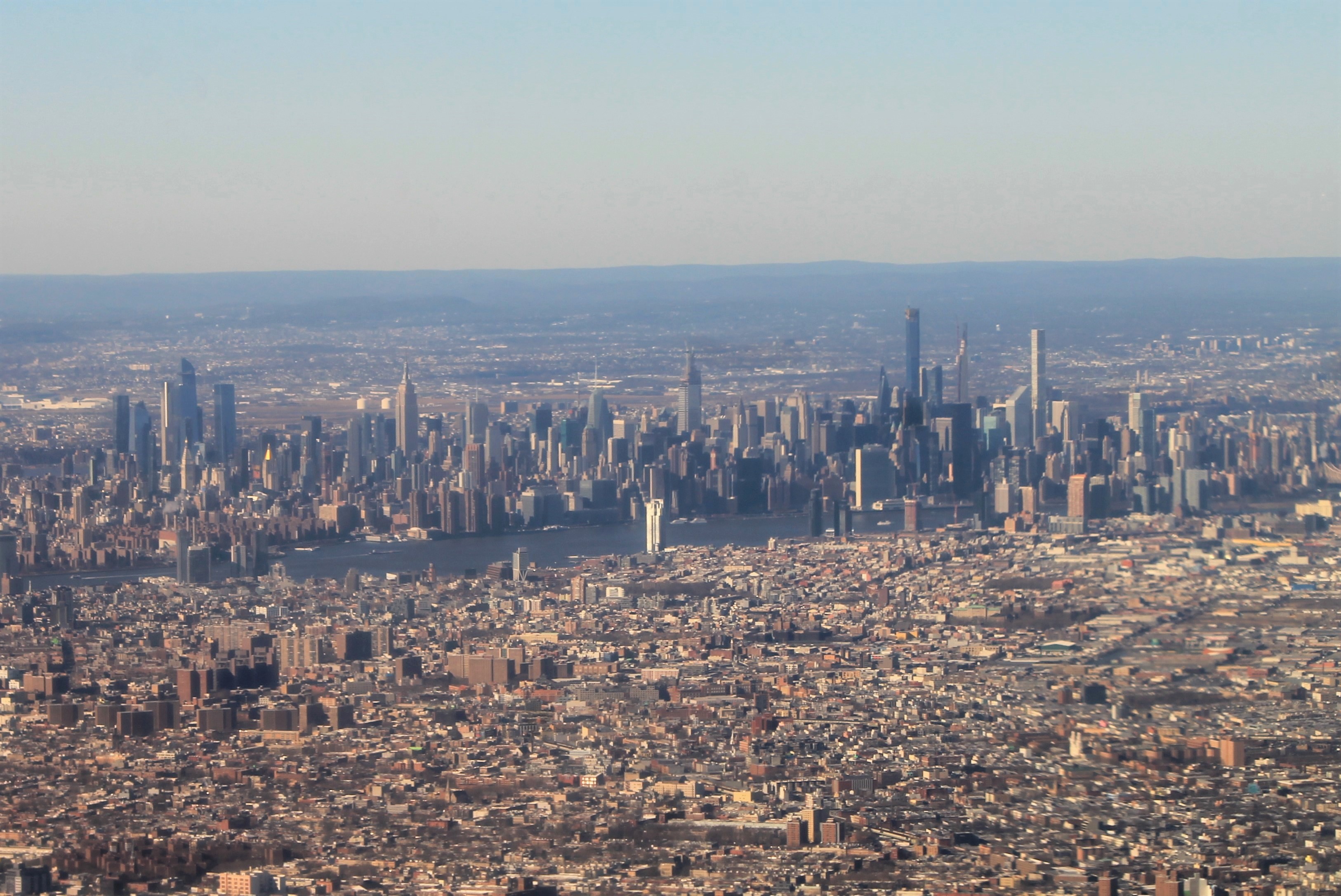
New York, often called New York City or NYC, is the most populous city in the United States. With a 2020 population of 8,804,190 distributed over , New York City is also the most densely populated major city in the United States, and is more than twice as populous as second-place Los Angeles. New York City lies at the southern tip of New York State, and constitutes the geographical and demographic center of both the Northeast megalopolis and the New York metropolitan area, the largest metropolitan area in the world by urban landmass. With over 20.1 million people in its metropolitan statistical area and 23.5 million in its combined statistical area as of 2020, New York is one of the world's most populous megacities, and over 58 million people live within of the city. New York City is a global cultural, financial, entertainment, and media center with a significant influence on commerce, health care and life sciences, research, technology, education, ... [...More Info...] [...Related Items...] OR: [Wikipedia] [Google] [Baidu] |
Harlem River Drive
The Harlem River Drive is a 4.20-mile (6.76 km) long north–south limited-access parkway in the New York City borough of Manhattan. It runs along the west bank of the Harlem River from the Triborough Bridge in East Harlem to 10th Avenue in Inwood, where the parkway ends and the road continues northwest as Dyckman Street. South of the Triborough Bridge, the parkway continues toward lower Manhattan as the FDR Drive. All of the Harlem River Drive is designated New York State Route 907P (NY 907P), an unsigned reference route. The parkway north of 165th Street was originally part of the Harlem River Speedway, a horse carriage roadway opened in 1898. The rest of the parkway from 125th to 165th Street opened to traffic in stages from 1951 to 1962. The parkway's ceremonial designation, 369th Harlem Hellfighters Drive, is in honor of the 369th Infantry Regiment, also known as the Harlem Hellfighters. Route description The Harlem River Drive begins at exit 17 o ... [...More Info...] [...Related Items...] OR: [Wikipedia] [Google] [Baidu] |
Yorkville, Manhattan
Yorkville is a neighborhood in the Upper East Side of Manhattan, New York City. Its southern boundary is East 72nd Street, its northern East 96th Street, its western Third Avenue, and its eastern the East River. Yorkville is among the city's most affluent neighborhoods. Yorkville is part of Manhattan Community District 8, and its primary ZIP Codes are 10028, 10075, and 10128. It is patrolled by the 19th Precinct of the New York City Police Department. History Early history Pre-colonization, Yorkville was an undeveloped area of forests and streams. In August 1776, George Washington stationed half of his Continental Army in Manhattan and the other half in Brooklyn. Many troops in the Yorkville area on Manhattan's Upper East Side were in defensive positions along the East River to protect a possible retreat off Long Island, and to inflict damage on invading land and sea British forces. Following their August 27 defeat in the Battle of Long Island, the Continentals implement ... [...More Info...] [...Related Items...] OR: [Wikipedia] [Google] [Baidu] |
Lenox Hill
Lenox Hill () is a neighborhood on Manhattan's Upper East Side. It forms the lower section of the Upper East Side—east of Park Avenue in the 60s and 70s. A significant portion of the neighborhood lies within the Upper East Side Historic District designated by the New York City Landmarks Preservation Commission in 1981 and expanded in 2010. The neighborhood is part of Manhattan Community Board 8. Geography Based on the location of the original Lenox Hill, which was on a farm that spanned present-day 68th Street to 74th Street, east of Fifth Avenue, ''The Encyclopedia of New York City'' defines the neighborhood as the area between 60th Street and 77th Street, from Fifth Avenue on the west to Lexington Avenue on the east. ("...bounded to the north by East 77th Street, to the east by Lexington Avenue] to the south by East 60th Street, and to the west by Fifth Avenue") However, neighborhood boundaries can shift and most residents see the modern boundaries differently, as the ... [...More Info...] [...Related Items...] OR: [Wikipedia] [Google] [Baidu] |
Midtown Manhattan
Midtown Manhattan is the central portion of the New York City borough of Manhattan and serves as the city's primary central business district. Midtown is home to some of the city's most prominent buildings, including the Empire State Building, the Chrysler Building, the Hudson Yards Redevelopment Project, the headquarters of the United Nations, Grand Central Terminal, and Rockefeller Center, as well as tourist destinations such as Broadway, Times Square, and Koreatown. Penn Station in Midtown Manhattan is the busiest transportation hub in the Western Hemisphere. Midtown Manhattan is the largest central business district in the world and ranks among the most expensive locations for real estate; Fifth Avenue in Midtown Manhattan commands the world's highest retail rents, with average annual rents at US in 2017. However, due to the high price of retail spaces in Midtown, there are also many vacant storefronts in the neighborhood. Midtown is the country's largest commercial, ent ... [...More Info...] [...Related Items...] OR: [Wikipedia] [Google] [Baidu] |
Turtle Bay, Manhattan
Turtle Bay is a neighborhood in New York City, on the east side of Midtown Manhattan. It extends from roughly 43rd Street to 53rd Streets, and eastward from Lexington Avenue to the East River's western branch (facing Roosevelt Island).Giner, Val. "Turtle Bay" in , p. 1340Map ." ''Turtle Bay Association''. Retrieved on January 25, 2009 The neighborhood is the site of the and the . The ap ... [...More Info...] [...Related Items...] OR: [Wikipedia] [Google] [Baidu] |
Tudor City
Tudor City is an apartment complex located on the southern edge of Turtle Bay on the East Side of Manhattan in New York City, near Turtle Bay's border with Murray Hill. It lies on a low cliff, which is east of Second Avenue between 40th and 43rd Streets and overlooks First Avenue. Construction commenced in 1926, making it the first residential skyscraper complex in the world. Tudor City was one of the first, largest, and most important examples of a planned middle-class residential community in New York City. It is named for its Tudor Revival architecture. Background Prospect Hill rises eastward from Second Avenue to a granite cliff about 40 feet above First Avenue. Forty-first and 43rd Streets do not reach First Avenue but end at a three-block-long north–south street called Tudor City Place, which crosses 42nd Street on an overpass. The topography provides a measure of seclusion. The area was first developed following the Civil War when the streets between Firs ... [...More Info...] [...Related Items...] OR: [Wikipedia] [Google] [Baidu] |
Kips Bay
Kips Bay, or Kip's Bay, is a neighborhood on the east side of the New York City borough of Manhattan. It is roughly bounded by East 34th Street to the north, the East River to the east, East 27th and/or 23rd Streets to the south, and Third Avenue to the west. Kips Bay is part of Manhattan Community District 6, and its primary ZIP Codes are 10010 and 10016. It is patrolled by the 13th and 17th Precincts of the New York City Police Department. Geography According to ''The Encyclopedia of New York City'' and the New York City Department of City Planning, Kips Bay proper is generally bounded by East 34th Street to the north, the East River to the east, East 27th Street to the south, and Third Avenue to the west. City documents have also used New York City census tract 70 (from 29th to 34th Streets, First to Third Avenues) as an approximation for Kips Bay, and referred to tract 66, immediately below it, as "Bellevue South."See alsDraft Scoping Document for an Environmental ... [...More Info...] [...Related Items...] OR: [Wikipedia] [Google] [Baidu] |
Stuyvesant Square
Stuyvesant Square is the name of both a park and its surrounding neighborhood in the New York City borough of Manhattan. The park is located between 15th Street, 17th Street, Rutherford Place, and Nathan D. Perlman Place (formerly Livingston Place). Second Avenue divides the park into two halves, east and west, and each half is surrounded by the original cast-iron fence. The neighborhood is roughly bounded by 14th Street to the south, 18th or 19th Street to the north, First Avenue to the east, and Third Avenue to the west.Bradley, James. "Stuyvesant Square" in , p.1134 It is part of Manhattan Community Board 6. Geography Manhattan Community Board 6 does not mark neighborhood boundaries on its map, but centers "Stuyvesant Park" in the area south of 20th Street, north of 14th Street, east of Third Avenue, and west of First Avenue. In city documents, New York City census tract 48.97 (later known as tract 48) has been used as an approximation for Stuyvesant Park. To the east ... [...More Info...] [...Related Items...] OR: [Wikipedia] [Google] [Baidu] |
East Village, Manhattan
The East Village is a neighborhood on the East Side of Lower Manhattan in New York City. It is roughly defined as the area east of the Bowery and Third Avenue, between 14th Street on the north and Houston Street on the south. The East Village contains three subsections: Alphabet City, in reference to the single-letter-named avenues that are located to the east of First Avenue; Little Ukraine, near Second Avenue and 6th and 7th Streets; and the Bowery, located around the street of the same name. Initially the location of the present-day East Village was occupied by the Lenape Native Americans, and was then divided into plantations by Dutch settlers. During the early 19th century, the East Village contained many of the city's most opulent estates. By the middle of the century, it grew to include a large immigrant populationincluding what was once referred to as Manhattan's Little Germanyand was considered part of the nearby Lower East Side. By the late 1960s, many artists, ... [...More Info...] [...Related Items...] OR: [Wikipedia] [Google] [Baidu] |
Manhattan Waterfront Greenway
The Manhattan Waterfront Greenway is a waterfront greenway for walking or cycling, long, around the island of Manhattan, in New York City. The largest portions are operated by the New York City Department of Parks and Recreation. It is separated from motor traffic, and many sections also separate pedestrians from cyclists. There are three principal parts — the East, Harlem and Hudson River Greenways. Components Hudson River Greenway The Hudson River Greenway is the longest greenway in Manhattan, running along the West Side, from Battery Park in the south -- mostly through Hudson River Park, Riverside Park, and Fort Washington Park -- to Dyckman Street in the north. A gap in West Harlem was filled in early October 2008 with the opening of the Harlem Piers bike lane. A roughly 10-block detour in the west 80s, where a walkway had crumbled into the river in the late 20th century, was eliminated on May 20, 2010, when the rebuilt section of greenway was opened. The Hudson ... [...More Info...] [...Related Items...] OR: [Wikipedia] [Google] [Baidu] |
Bicycle Lane
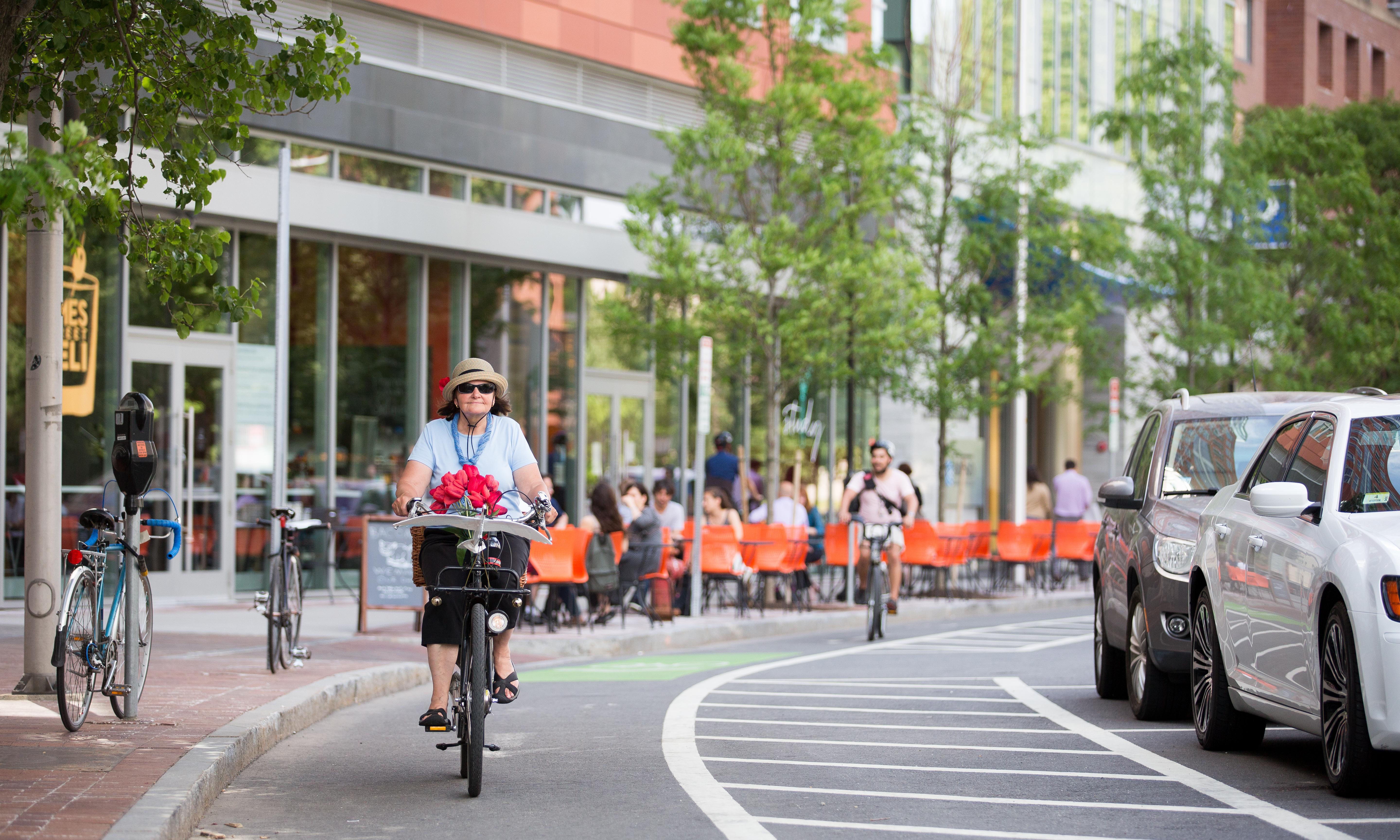
Bike lanes (US) or cycle lanes (UK) are types of bikeways (cycleways) with lanes on the roadway for cyclists only. In the United Kingdom, an on-road cycle-lane can be firmly restricted to cycles (marked with a solid white line, entry by motor vehicles is prohibited) or advisory (marked with a broken white line, entry by motor vehicles is permitted). In the United States, a ''designated bicycle lane'' (1988 MUTCD) or ''class II bikeway'' (Caltrans) is always marked by a solid white stripe on the pavement and is for 'preferential use' by bicyclists. There is also a ''class III bicycle route'', which has roadside signs suggesting a route for cyclists, and urging sharing the road. A ''class IV separated bike way'' (Caltrans) is a bike lane that is physically separate from motor traffic and restricted to bicyclists only. Effects According to a 2019 study, cities with separated bike lanes had 44% fewer road fatalities and 50% fewer serious injuries from crashes. The relationship wa ... [...More Info...] [...Related Items...] OR: [Wikipedia] [Google] [Baidu] |


