|
2021 Hampshire County Council Election
Elections to Hampshire County Council took on 6 May 2021 as part of the 2021 United Kingdom local elections. All 78 seats were up for election, with each ward returning either one or two councillors by first-past-the-post voting for a four-year term of office. This took place at the same time as the elections for the Hampshire Police and Crime Commissioner and district councils. Background Whilst an election for the county council had already been planned, district council elections were delayed due to the ongoing COVID-19 pandemic, meaning that they are due to be held at the same time as the Hampshire County Council Elections. Whilst not part of Hampshire County Council, the unitary authorities of Portsmouth and Southampton are also due to hold council elections for a third of their respective councils at the same time. After the previous election in 2017, the Conservatives held 56 seats, the Liberal Democrats 19, Labour 2, and Community Campaign Hart 1. In July 2019, Cll ... [...More Info...] [...Related Items...] OR: [Wikipedia] [Google] [Baidu] |
Hampshire County Council
Hampshire County Council (HCC) is an English council that governs eleven of the thirteen districts geographically located within the ceremonial county of Hampshire. As one of twenty-four county councils in England, it acts as the upper tier of local government to approximately 1.4 million people. Whilst they form part of the ceremonial county of Hampshire, the city councils of Southampton and Portsmouth are independent unitary authorities. The council comprises 78 elected councillors, who meet in the city of Winchester, which is the county town. Since 1997, the council has been controlled by the Conservative Party. In May 2022, Rob Humby was elected as leader of the council. In November 2022, the county council stated it, alongside Kent County Council, may face bankruptcy within 12 months due to austerity cuts. History In 1889, following the commencement of the Local Government Act 1888, the administrative county of Hampshire was formed. In 1974, the towns of Christchurch ... [...More Info...] [...Related Items...] OR: [Wikipedia] [Google] [Baidu] |
Basingstoke And Deane
Basingstoke and Deane is a local government district and borough in Hampshire, England. Its primary settlement is Basingstoke. Other settlements include Bramley, Tadley, Kingsclere, Overton, Oakley, Whitchurch and the village of Deane, some from Basingstoke. It is the northernmost borough of Hampshire, bordered by Berkshire to the north. The first Basingstoke Mayor, George Baynard, was appointed in 1641. The district was formed as the District of Basingstoke on 1 April 1974 by the merger of the borough of Basingstoke, Basingstoke Rural District and Kingsclere and Whitchurch Rural District. On 20 January 1978, following the grant of borough status, the district became the Borough of Basingstoke and Deane. The council claims that the new title included the names of the largest town and smallest village in the borough, although there are eight civil parishes with populations smaller than Deane. Basingstoke and Deane has over 430 local neighbourhood watch schemes in the a ... [...More Info...] [...Related Items...] OR: [Wikipedia] [Google] [Baidu] |
Havant
Havant ( ) is a town in the south-east corner of Hampshire, England between Portsmouth and Chichester. Its borough (population: 125,000) comprises the town (45,826) and its suburbs including the resort of Hayling Island as well as Rowland's Castle, the larger town of Waterlooville and Langstone Harbour. Housing and population more than doubled in the 20 years following World War II, a period of major conversion of land from agriculture and woodland to housing across the region following the incendiary bombing of Portsmouth and the Blitz. The old centre of the town was a small Celtic settlement before Roman times and the town's commerce, retired and commuter population swelled after World War II so as to be usually considered economically part of the Portsmouth conurbation. History Archeological digs in the 19th and 20th centuries uncovered evidence of Roman buildings – near St Faith's Church and in Langstone Avenue, along with neolithic and mesolithic remains. Havant was ... [...More Info...] [...Related Items...] OR: [Wikipedia] [Google] [Baidu] |
Hart UK Locator Map
Hart often refers to: * Hart (deer) Hart may also refer to: Organizations * Hart Racing Engines, a former Formula One engine manufacturer * Hart Skis, US ski manufacturer * Hart Stores, a Canadian chain of department stores * Hart's Reptile World, a zoo in Oregon, United States * Harts Stores, a defunct American chain of department stores People * Hart (given name) * Hart (surname) ** Hart family, a family of Canadian professional wrestlers, plus some American and British wrestlers related by marriage *** The Hart Foundation, a number of tag teams or stables, most of them featuring second-generation members of the above family **** The Hart Dynasty, a late-2000s WWE stable that included third-generation members of the family * Hart family murders, a 2018 murder–suicide by Jennifer and Sarah Hart, who murdered their six adopted children Places Austria: * Hart, Austria Australia: * Hart, Northern Territory, a locality * Hart, South Australia, a locality * Cape Hart Conservati ... [...More Info...] [...Related Items...] OR: [Wikipedia] [Google] [Baidu] |
Hart (district)
Hart is a local government district in Hampshire, England, named after the River Hart. Its council is based in Fleet. It was formed on 1 April 1974 under the Local Government Act 1972, as a merger of the urban district of Fleet, and the Hartley Wintney Rural District. It was named the best place to live in the UK in the 2017 Halifax quality of life study. Hart District is one of the richest and least deprived areas in the whole of the United Kingdom. In the Indices of Deprivation 2015, Hart was ranked at 326 out of 326 local authorities in England, where 1 was the most deprived area and 326 the least deprived, meaning Hart is the least deprived area in England. For five years running (2011-2015), an annual study conducted by the Halifax bank named Hart as the UK's most desirable place to live for quality of life. The study took into account jobs, housing, health, crime, weather, traffic and broadband access. It found that in 2014 97% of people in the local authority area were ... [...More Info...] [...Related Items...] OR: [Wikipedia] [Google] [Baidu] |
Gosport UK Locator Map
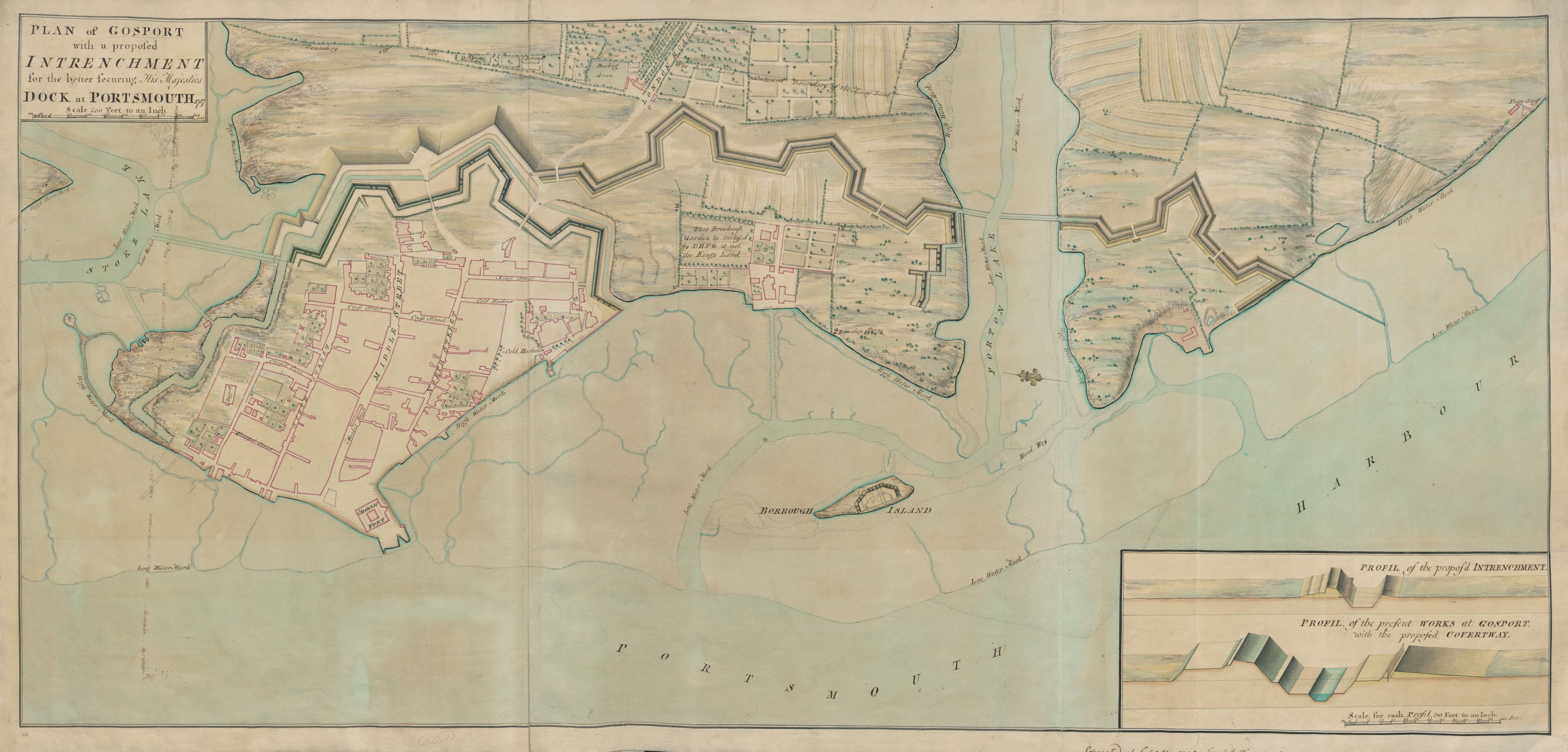
Gosport ( ) is a town and non-metropolitan borough on the south coast of Hampshire, South East England. At the 2011 Census, its population was 82,662. Gosport is situated on a peninsula on the western side of Portsmouth Harbour, opposite the city of Portsmouth, to which it is linked by the Gosport Ferry. Gosport lies south-east of Fareham, to which it is linked by a Bus Rapid Transit route and the A32. Until the last quarter of the 20th century, Gosport was a major naval town associated with the defence and supply infrastructure of His Majesty's Naval Base (HMNB) Portsmouth. As such over the years extensive fortifications were created. Gosport is still home to and a Naval Armament Supply Facility, as well as a Helicopter Repair base. The Town area of the Borough, including Newtown, consists of the town centre, Stoke Road shopping area, Walpole Park, Royal Clarence Yard and three modern marinas: Royal Clarence, Gosport Marina and Haslar Marina. As part of the ''Renaissanc ... [...More Info...] [...Related Items...] OR: [Wikipedia] [Google] [Baidu] |
Gosport
Gosport ( ) is a town and non-metropolitan borough on the south coast of Hampshire, South East England. At the 2011 Census, its population was 82,662. Gosport is situated on a peninsula on the western side of Portsmouth Harbour, opposite the city of Portsmouth, to which it is linked by the Gosport Ferry. Gosport lies south-east of Fareham, to which it is linked by a Bus Rapid Transit route and the A32. Until the last quarter of the 20th century, Gosport was a major naval town associated with the defence and supply infrastructure of His Majesty's Naval Base (HMNB) Portsmouth. As such over the years extensive fortifications were created. Gosport is still home to and a Naval Armament Supply Facility, as well as a Helicopter Repair base. The Town area of the Borough, including Newtown, consists of the town centre, Stoke Road shopping area, Walpole Park, Royal Clarence Yard and three modern marinas: Royal Clarence, Gosport Marina and Haslar Marina. As part of the ''Renaissa ... [...More Info...] [...Related Items...] OR: [Wikipedia] [Google] [Baidu] |
Fareham UK Locator Map
Fareham ( ) is a market town at the north-west tip of Portsmouth Harbour, between the cities of Portsmouth and Southampton in south east Hampshire, England. It gives its name to the Borough of Fareham. It was historically an important manufacturer of bricks, used to build the Royal Albert Hall, and grower of strawberries and other seasonal fruits. Current employers include Fareham Shopping Centre, small-scale manufacturers, and the Defence Science and Technology Laboratory. History Archaeological excavations around the old High Street area and the church of St Peter & Paul on high ground over the Wallington Estuary have yielded evidence of settlement on the site contemporary with the Roman occupation. No extensive programme of investigation has been possible owing to the historic nature of the buildings in this area. The town has a documented history dating back to the Norman Conquest of England, Norman era, when a part of William's army marched up from Fareham Creek befor ... [...More Info...] [...Related Items...] OR: [Wikipedia] [Google] [Baidu] |
Fareham
Fareham ( ) is a market town at the north-west tip of Portsmouth Harbour, between the cities of Portsmouth and Southampton in south east Hampshire, England. It gives its name to the Borough of Fareham. It was historically an important manufacturer of bricks, used to build the Royal Albert Hall, and grower of strawberries and other seasonal fruits. Current employers include Fareham Shopping Centre, small-scale manufacturers, and the Defence Science and Technology Laboratory. History Archaeological excavations around the old High Street area and the church of St Peter & Paul on high ground over the Wallington Estuary have yielded evidence of settlement on the site contemporary with the Roman occupation. No extensive programme of investigation has been possible owing to the historic nature of the buildings in this area. The town has a documented history dating back to the Norman era, when a part of William's army marched up from Fareham Creek before continuing to the Saxon c ... [...More Info...] [...Related Items...] OR: [Wikipedia] [Google] [Baidu] |
Mike Thornton (politician)
Michael Douglas Thornton (born 1 May 1952) is a British politician and former Liberal Democrat Member of Parliament for Eastleigh in Hampshire. He was elected at the Eastleigh by-election held on 28 February 2013, a seat which he lost at the 2015 general election. Early life The son of Sir Peter Eustace Thornton, Thornton grew up in Farnham in Surrey and was educated at Charterhouse School, before reading law at Manchester Polytechnic. He has had a range of jobs, including spells in the United States (his mother is from Tennessee). Thornton spent a significant period of time working in financial services. He has lived in Bishopstoke, a part of Eastleigh borough, since 1994. He has variously been a Bishopstoke parish councillor, an Eastleigh borough councillor and a Hampshire county councillor, for wards within or containing Bishopstoke. Parliamentary career Following the resignation of the previous Liberal Democrat MP Chris Huhne, Thornton was chosen as their candidate at ... [...More Info...] [...Related Items...] OR: [Wikipedia] [Google] [Baidu] |
Eastleigh UK Locator Map
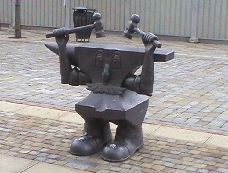
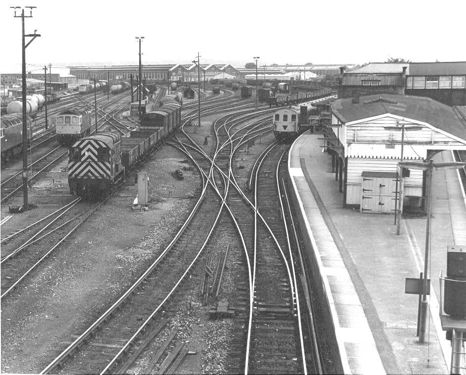
Eastleigh is a town in Hampshire, England, between Southampton and Winchester. It is the largest town and the administrative seat of the Borough of Eastleigh, with a population of 24,011 at the 2011 census. The town lies on the River Itchen, one of England's premier chalk streams for fly fishing, and a designated site of Special Scientific Interest. The area was originally villages until the 19th century, when Eastleigh was developed as a railway town by the London and South-Western Railway. History The modern town of Eastleigh lies on the old Roman road, built in A.D.79 between Winchester ''(Venta Belgarum)'' and Bitterne ''(Clausentum)''. Nicola Gosling: 1986, Page 4 Roman remains discovered in the Eastleigh area, including a Roman lead coffin excavated in 1908, indicate that a settlement probably existed here in Roman times. A Saxon village called 'East Leah' has been recorded to have existed since 932 AD. ('Leah' is an ancient Anglo-Saxon word meaning 'a clearing in ... [...More Info...] [...Related Items...] OR: [Wikipedia] [Google] [Baidu] |
Eastleigh
Eastleigh is a town in Hampshire, England, between Southampton and Winchester. It is the largest town and the administrative seat of the Borough of Eastleigh, with a population of 24,011 at the 2011 census. The town lies on the River Itchen, one of England's premier chalk streams for fly fishing, and a designated site of Special Scientific Interest. The area was originally villages until the 19th century, when Eastleigh was developed as a railway town by the London and South-Western Railway. History The modern town of Eastleigh lies on the old Roman road, built in A.D.79 between Winchester ''(Venta Belgarum)'' and Bitterne ''(Clausentum)''. Nicola Gosling: 1986, Page 4 Roman remains discovered in the Eastleigh area, including a Roman lead coffin excavated in 1908, indicate that a settlement probably existed here in Roman times. A Saxon village called 'East Leah' has been recorded to have existed since 932 AD. ('Leah' is an ancient Anglo-Saxon word meaning 'a clearing in ... [...More Info...] [...Related Items...] OR: [Wikipedia] [Google] [Baidu] |


