|
2000–01 Midland Football Alliance
The 2000–01 Midland Football Alliance season was the seventh in the history of Midland Football Alliance, a association football, football competition in England. Clubs and league table The league featured 20 clubs from the previous season, along with two new clubs: *Stafford Town F.C., Stafford Town, promoted from the 1999–2000 West Midlands (Regional) League, West Midlands (Regional) League *Stourbridge F.C., Stourbridge, relegated from the 1999–2000 Southern Football League#Division One West, Southern Football League League table References External links Midland Football Alliance {{DEFAULTSORT:Midland Football Alliance 2000-01 Midland Football Alliance seasons, 2000–01 2000–01 in English football leagues, 8 ... [...More Info...] [...Related Items...] OR: [Wikipedia] [Google] [Baidu] |
Stourport Swifts F
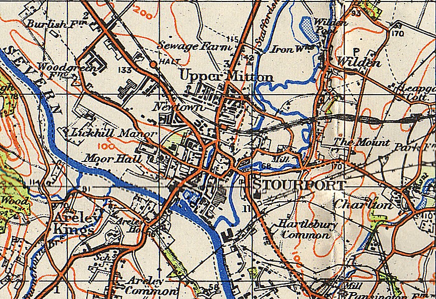
Stourport-on-Severn, often shortened to Stourport, is a town and civil parishes in England, civil parish in the Wyre Forest (district), Wyre Forest District of North Worcestershire, England, a few miles to the south of Kidderminster and downstream on the River Severn from Bewdley. At the 2011 census, it had a population of 20,292. History and early growth Stourport came into being around the canal basins at the Severn terminus of the Staffordshire and Worcestershire Canal, which was completed in 1768. In 1772 the junction between the Staffordshire and Worcestershire and the Birmingham Canal was completed and Stourport became one of the principal distributing centres for goods to and from the rest of the West Midlands. The canal terminus was built on meadowland to the south west of the hamlet of Lower Mitton. The terminus was first called Stourmouth and then Newport, with the final name of Stourport settled on by 1771. The population of Stourport rose from about 12 in the 176 ... [...More Info...] [...Related Items...] OR: [Wikipedia] [Google] [Baidu] |
Chasetown F
Chasetown is a village in the town of Burntwood in Staffordshire, England. It is split between the civil parishes of Burntwood and Hammerwich. History Chasetown developed in the mid 19th century as a coal mining village. At first the village was simply known as Cannock Chase due to its proximity to the nearby forest, it was known as Chasetown by 1867. The first pit was sunk by the Marquess of Anglesey in 1849, when the Hammerwich Colliery opened at the base of Chasewater reservoir. Cannock Chase Collieries No.2 and No.9 opened in the 1850s to the west of the village where the Rugby club is sited today. As a result of the mining industry, housing for the miners began to be developed around High Street, Church Street and Queen Street. Three pairs of cottages were built on the north side of Church Street in 1854, and the adjoining Uxbridge Arms existed by 1856. By 1860 two shopkeepers, three beer retailers, The Miners'Rest and The Junction a builder, a drill owner, a shoemaker, an ... [...More Info...] [...Related Items...] OR: [Wikipedia] [Google] [Baidu] |
2001–02 Midland Football Combination
The 2001–02 Midland Football Combination season was the 65th in the history of Midland Football Combination, a football Football is a family of team sports that involve, to varying degrees, kicking a ball to score a goal. Unqualified, the word ''football'' normally means the form of football that is the most popular where the word is used. Sports commonly c ... competition in England. Premier Division The Premier Division featured 18 clubs which competed in the division last season, along with four new clubs: *Clubs promoted from Division One: ** Coleshill Town **County Sports **Shirley Town *Plus: ** West Midlands Police, relegated from the Midland Football Alliance Also: *Continental Star changed name to Handsworth Continental Star *Sutton Town changed name to Grosvenor Park League table References {{DEFAULTSORT:Midland Football Combination 2001-02 2001–02 9 ... [...More Info...] [...Related Items...] OR: [Wikipedia] [Google] [Baidu] |
Blakenall F
Blakenall Heath is a suburban village in the Metropolitan Borough of Walsall in the West Midlands County, England. It straddles the border of Walsall and Bloxwich. Historically the village was a part of Staffordshire. It was originally a rural area between Walsall and Bloxwich with a small amount of private housing as recently as the beginning of the 20th century, but the area began to change dramatically after the end of the Great War. Farmland gave way to council housing, which surrounded the local church and a few pre-1914 buildings, and further developments took place over the next few decades. Walsall borough's first council house was completed in Blakenall Heath, on Blakenall Lane, in June 1920. Within seven years, 500 council houses had been built in the area, and by 1939 around 2,000 new council houses had been built in the Blakenall Heath, Harden, Coal Pool and Goscote areas. Several hundred more had followed by the 1970s, including three tower blocks of flats which wer ... [...More Info...] [...Related Items...] OR: [Wikipedia] [Google] [Baidu] |
2001–02 Southern Football League
The 2001–02 Southern Football League season was the 99th in the history of the league, an English football competition. Kettering Town won the Premier Division and earned promotion to the Football Conference. Newport (Isle of Wight), King's Lynn, Merthyr Tydfil and Salisbury City were relegated from the Premier Division, whilst Hastings Town, Halesowen Town, Grantham Town and Chippenham Town were promoted from the Eastern and Western Divisions, the former two as champions. Wisbech Town were relegated to the eighth level and Bilston Town resigned and dropped to the ninth level, whilst Bloxwich United of the Western Division folded during the season and their record was expunged. Premier Division The Premier Division consisted of 22 clubs, including 17 clubs from the previous season and six new clubs: *Two clubs promoted from the Eastern Division: **Chelmsford City ** Newport (Isle of Wight) *Two clubs promoted from the Western Division: ** Hinckley United ** Tiverton ... [...More Info...] [...Related Items...] OR: [Wikipedia] [Google] [Baidu] |
Sandwell Borough F
Sandwell is a metropolitan borough of the West Midlands county in England. The borough is named after the Sandwell Priory, and spans a densely populated part of the West Midlands conurbation. According to Sandwell Metropolitan Borough Council, the borough comprises the six amalgamated towns of Oldbury, Rowley Regis, Smethwick, Tipton, Wednesbury, and West Bromwich, although these places consist of numerous smaller settlements and localities. Sandwell's Strategic Town Centre is designated as West Bromwich, the largest town in the borough, while Sandwell Council House (the headquarters of the local authority) is situated in Oldbury. In 2019 Sandwell was ranked 12th most deprived of England's 317 boroughs. Bordering Sandwell is the City of Birmingham to the east, the Metropolitan Borough of Dudley to the south and west, the Metropolitan Borough of Walsall to the north, and the City of Wolverhampton to the north-west. Spanning the borough are the parliamentary constituencies of ... [...More Info...] [...Related Items...] OR: [Wikipedia] [Google] [Baidu] |
Pelsall Villa F
Pelsall is a village in the Metropolitan Borough of Walsall, West Midlands, England. Forming part of the borough's border with Staffordshire, Pelsall is located 4 miles north of central Walsall, midway between the towns of Bloxwich and Brownhills and 4 miles northwest of Aldridge. The southern edge of Cannock Chase is 6 miles to the north. Pelsall is also 8 miles southwest of Lichfield and 8 miles northeast of Wolverhampton. History Pelsall was first mentioned in a charter of 994, when it was among various lands given to the monastery at ''Heantune'' (Wolverhampton) by Wulfrun, a Mercian noblewoman. At this time it was called ''Peolshalh'', meaning 'a nook' or 'land between two streams belonging to Peol'. The Domesday entry of 1086 describes Pelsall as being waste, still belonging to the church. A chapel of ease was built in about 1311. The medieval population was small and a return of 1563 lists only 14 householders. The original centre the area is now known as Old Town. In ... [...More Info...] [...Related Items...] OR: [Wikipedia] [Google] [Baidu] |
Stapenhill F
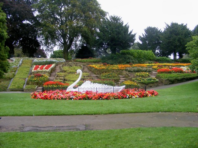
Stapenhill is a suburban village and civil parish in Burton upon Trent, Staffordshire in the United Kingdom, UK. It was a small village owned by Nigel of Stafford as far back as 1086, however, this ancient parish area has long since been surrounded by new housing developments and gradually absorbed into the Burton urban area.''Domesday Book: A Complete Translation''. London: Penguin, 2003. p.1406 Stapenhill was known for its brickyards in the 18th and 19th centuries. Several major music festivals take place every summer at Catton Hall, on the outskirts of the village. Stapenhill Gardens is the epitome of Stapenhill. Its main feature is a giant artificial swan with all flowers planted in it. This represents the swans who have historically inhabited the Gardens, and also the wider immutability of life in general. Similarly, the local soccer, football team is Stapenhill Swans. Stapenhill Gardens is also the location of the annual "Tulip Festival", an event unrivalled outside The N ... [...More Info...] [...Related Items...] OR: [Wikipedia] [Google] [Baidu] |
Halesowen Harriers F
Halesowen ( ) is a market town in the Metropolitan Borough of Dudley, in the county of West Midlands, England. Historically an exclave of Shropshire and, from 1844, in Worcestershire, the town is around from Birmingham city centre, and from Dudley town centre. The population of the town, as measured by the United Kingdom Census 2011, was 58,135. Halesowen is included in the Halesowen and Rowley Regis constituency which is held by the Conservative James Morris. Geography and administration Halesowen was a detached part of the county of Shropshire but was incorporated into Worcestershire in 1844 by the Counties (Detached Parts) Act. Since the local government reorganisation of 1974 it has formed a part of the West Midlands Metropolitan county and Conurbation, in the Dudley Metropolitan Borough, which it joined at the same time as neighbouring Stourbridge, which had also been in Worcestershire until that point. Halesowen borders the Birmingham suburbs of Quinton and Bartley ... [...More Info...] [...Related Items...] OR: [Wikipedia] [Google] [Baidu] |
Shifnal Town F
Shifnal is a market town and civil parish in Shropshire, England, about east of Telford, 17 miles (27 km) east of the county town of Shrewsbury and 13 miles (20 km) west-northwest of the city of Wolverhampton. It is near the M54 motorway (Junction 4). At the 2001 census, it had a population of 6,391, increasing to 6,776 at the 2011 census. History Early medieval time The town, also once known as "Idsall" (relating to potential Roman links), most probably began as an Anglian settlement, established by the end of the 7th century. Shifnal is thought to be the place named "Scuffanhalch" in a 9th-century charter, as a possession of the monastery at Medeshamstede (later Peterborough Abbey). Though this seems a dubious claim, and the ancient charter is in fact a 12th-century forgery, the full picture is more complex. Sir Frank Stenton considered that "Scuffanhalch", along with "Costesford" ( Cosford) and "Stretford", formed part of a list of places which had once been c ... [...More Info...] [...Related Items...] OR: [Wikipedia] [Google] [Baidu] |
Wednesfield F
Wednesfield is a town and historic village in the City of Wolverhampton, West Midlands, England, It is east-northeast of Wolverhampton city centre and about from Birmingham and is part of the West Midlands conurbation. It was historically within the county of Staffordshire. Its name comes from the Old English ''Wōdnesfeld'' meaning ''Woden's Field'', open land belonging to, or holy to, the high god of the Germanic Pantheon. It is reported by the English Dialectal Society in the publication "A Glossary of dialectal place-nomenclature" available on-line in the Internet Archive of The University of Toronto Library, that the place name "Wednesfield" is pronounced by the local populace as "Wencefield". Local areas include Ashmore Park and Wood End. There is also a formal garden at Wednesfield Park. Geography Wednesfield lies at (52.5998°, −2.0827°), and is located to the northeast of Wolverhampton city centre on the northern fringe of the West Midlands conurbation. It ... [...More Info...] [...Related Items...] OR: [Wikipedia] [Google] [Baidu] |


