|
2000–01 South-West Indian Ocean Cyclone Season
The 2000–01 South-West Indian Ocean cyclone season was a fairly quiet season with only five tropical cyclone naming, named storms, although there was an additional unnamed tropical cyclone, tropical storm and two subtropical cyclones with gale-force winds. It started early, with a Tropical cyclone scales#South-West Indian Ocean, tropical disturbance forming on August 1 – the first day of the cyclone year. However, the first named storm, Ando, was not named until January 2, which at the time was the 4th latest on record. Ando would become the most intense cyclone of the year, reaching peak maximum sustained winds, winds of according to the Météo-France office (MFR) on Réunion, the official Regional Specialized Meteorological Center for the basin. The agency tracked storms south of the equator and west of 90th meridian east, 90°E to the east coast of Africa. In addition to being the strongest storm, Cyclone Ando was one of two deadly storms during the season. It p ... [...More Info...] [...Related Items...] OR: [Wikipedia] [Google] [Baidu] |
1998–99 South-West Indian Ocean Cyclone Season
The 1998–99 South-West Indian Ocean cyclone season was a quiet season that had the fourth-lowest number of days with tropical storm or Tropical cyclone scales#South-West Indian Ocean, tropical cyclone activity. Most of the storms formed either in the Mozambique Channel or in the far eastern portion of the basin, with five storms crossing from the adjacent 1998–99 Australian region cyclone season, Australian basin east of 90° Longitude, E. As a result, few storms impacted Madagascar, and none made landfall on the African continent. Throughout most of the season, there was below-normal sea surface temperatures in the Indian Ocean east of Madagascar. In February, typically the peak in activity, Réunion island recorded its highest average monthly pressure since 1953. Due to generally unfavorable conditions, there were only six tropical storms tracked by the Météo-France office (MFR) on Réunion. There were only two tropical cyclones – a storm with winds of at least . Ac ... [...More Info...] [...Related Items...] OR: [Wikipedia] [Google] [Baidu] |
Extratropical Cyclone
Extratropical cyclones, sometimes called mid-latitude cyclones or wave cyclones, are low-pressure areas which, along with the anticyclones of high-pressure areas, drive the weather over much of the Earth. Extratropical cyclones are capable of producing anything from cloudiness and mild showers to severe gales, thunderstorms, blizzards, and tornadoes. These types of cyclones are defined as large scale (synoptic) low pressure weather systems that occur in the middle latitudes of the Earth. In contrast with tropical cyclones, extratropical cyclones produce rapid changes in temperature and dew point along broad lines, called weather fronts, about the center of the cyclone. Terminology The term " cyclone" applies to numerous types of low pressure areas, one of which is the extratropical cyclone. The descriptor ''extratropical'' signifies that this type of cyclone generally occurs outside the tropics and in the middle latitudes of Earth between 30° and 60° latitude. They are term ... [...More Info...] [...Related Items...] OR: [Wikipedia] [Google] [Baidu] |
Eye (cyclone)
The eye is a region of mostly calm weather at the center of tropical cyclones. The eye of a storm is a roughly circular area, typically in diameter. It is surrounded by the ''eyewall'', a ring of towering thunderstorms where the most severe weather and highest winds occur. The cyclone's lowest barometric pressure occurs in the eye and can be as much as 15 percent lower than the pressure outside the storm. In strong tropical cyclones, the eye is characterized by light winds and clear skies, surrounded on all sides by a towering, symmetric eyewall. In weaker tropical cyclones, the eye is less well defined and can be covered by the central dense overcast, an area of high, thick clouds that show up brightly on satellite imagery. Weaker or disorganized storms may also feature an eyewall that does not completely encircle the eye or have an eye that features heavy rain. In all storms, however, the eye is the location of the storm's minimum barometric pressure—where the atmospheric pr ... [...More Info...] [...Related Items...] OR: [Wikipedia] [Google] [Baidu] |
Agaléga
Agaléga (french: îles Agaléga) is a dependency of Mauritius which consists of two outer islands located in the Indian Ocean, about north of Mauritius Island. The population of the islands as at July 2011 was estimated at 289. The islands have a total area of . The North island is long and wide, while the South island is long and wide. The North Island is home to the islands' airstrip and the capital Vingt-Cinq. The islands are known for their coconuts, the production of which is their main industry, and for the Agalega day gecko. There is a Memorandum of Understanding between the Government of Mauritius and the Government of India to develop the Agaléga islands and allowing India to set up a military base there"I ... [...More Info...] [...Related Items...] OR: [Wikipedia] [Google] [Baidu] |
Ridge (meteorology)
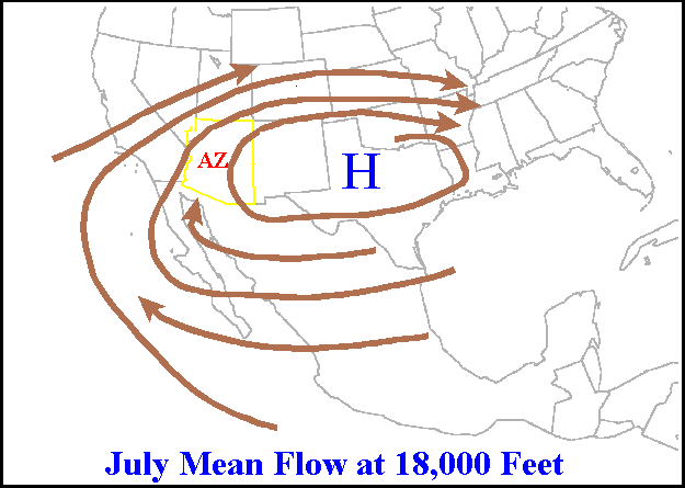
A ridge or barometric ridge is a term in meteorology describing an elongated area of relatively high atmospheric pressure compared to the surrounding environment, without being a closed circulation. It is associated with an area of maximum anticyclonic curvature of wind flow. The ridge originates in the center of an anticyclone and sandwiched between two low-pressure areas, and the locus of the maximum curvature is called the ''ridge line''. This phenomenon is the opposite of a trough. Description Ridges can be represented in two ways: * On surface weather maps, the pressure isobars form contours where the maximum pressure is found along the axis of the ridge. * In upper-air maps, geopotential height isohypses form similar contours where the maximum defines the ridge. Related weather Given the direction of the winds around an anticyclonic circulation and the fact that weather systems move from west to east: *ahead of an upper-ridge, the airflow that comes from the polar regi ... [...More Info...] [...Related Items...] OR: [Wikipedia] [Google] [Baidu] |
Wind Shear
Wind shear (or windshear), sometimes referred to as wind gradient, is a difference in wind speed and/or direction over a relatively short distance in the atmosphere. Atmospheric wind shear is normally described as either vertical or horizontal wind shear. Vertical wind shear is a change in wind speed or direction with a change in altitude. Horizontal wind shear is a change in wind speed with a change in lateral position for a given altitude. Wind shear is a microscale meteorological phenomenon occurring over a very small distance, but it can be associated with mesoscale or synoptic scale weather features such as squall lines and cold fronts. It is commonly observed near microbursts and downbursts caused by thunderstorms, fronts, areas of locally higher low-level winds referred to as low-level jets, near mountains, radiation inversions that occur due to clear skies and calm winds, buildings, wind turbines, and sailboats. Wind shear has significant effects on the control of a ... [...More Info...] [...Related Items...] OR: [Wikipedia] [Google] [Baidu] |
Coordinated Universal Time
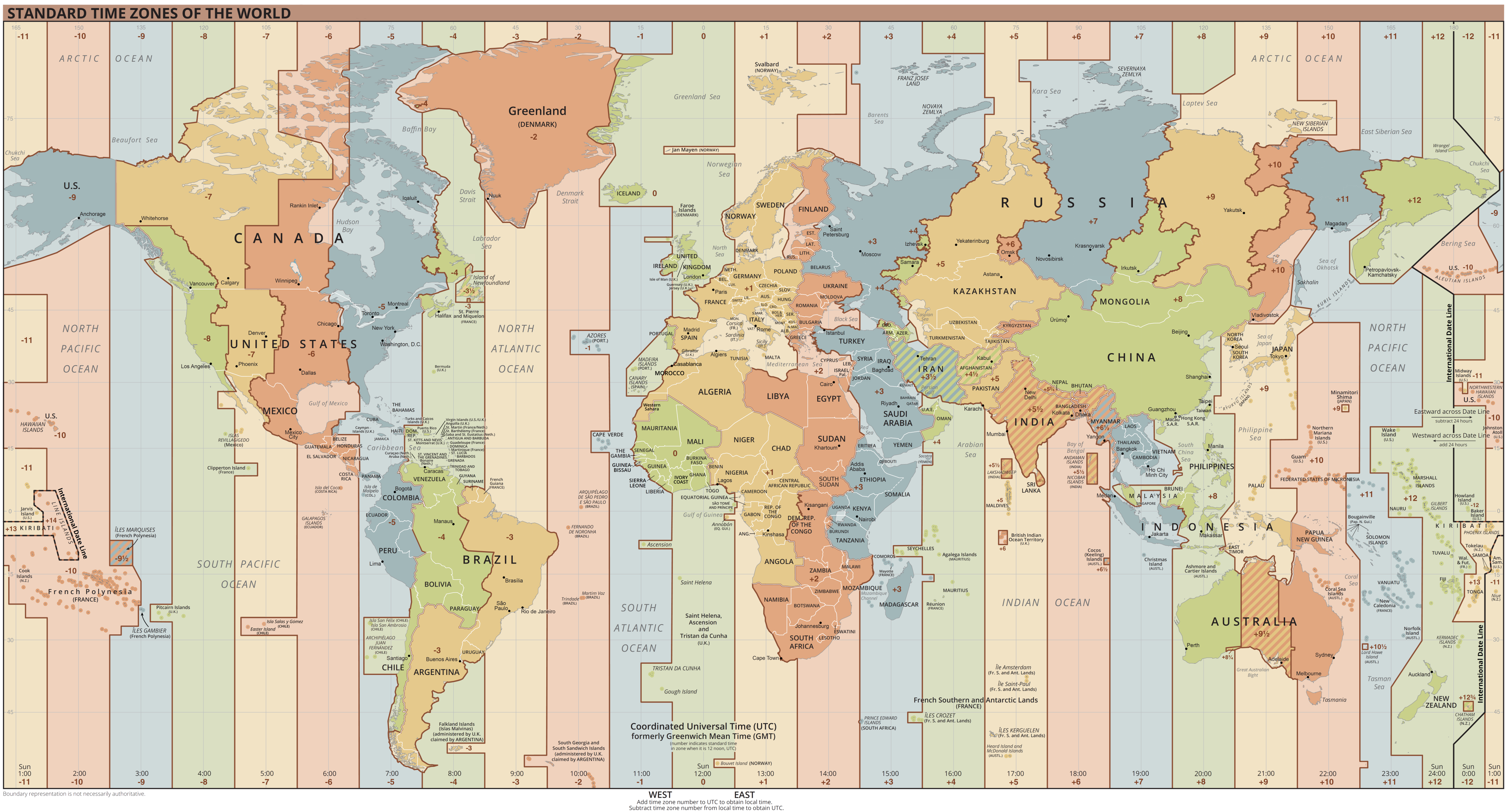
Coordinated Universal Time or UTC is the primary time standard by which the world regulates clocks and time. It is within about one second of mean solar time (such as UT1) at 0° longitude (at the IERS Reference Meridian as the currently used prime meridian) and is not adjusted for daylight saving time. It is effectively a successor to Greenwich Mean Time (GMT). The coordination of time and frequency transmissions around the world began on 1 January 1960. UTC was first officially adopted as CCIR Recommendation 374, ''Standard-Frequency and Time-Signal Emissions'', in 1963, but the official abbreviation of UTC and the official English name of Coordinated Universal Time (along with the French equivalent) were not adopted until 1967. The system has been adjusted several times, including a brief period during which the time-coordination radio signals broadcast both UTC and "Stepped Atomic Time (SAT)" before a new UTC was adopted in 1970 and implemented in 1972. This change also a ... [...More Info...] [...Related Items...] OR: [Wikipedia] [Google] [Baidu] |
Central Dense Overcast
The central dense overcast, or CDO, of a tropical cyclone or strong subtropical cyclone is the large central area of thunderstorms surrounding its circulation center, caused by the formation of its eyewall. It can be round, angular, oval, or irregular in shape. This feature shows up in tropical cyclones of tropical storm or hurricane strength. How far the center is embedded within the CDO, and the temperature difference between the cloud tops within the CDO and the cyclone's eye, can help determine a tropical cyclone's intensity with the Dvorak technique. Locating the center within the CDO can be a problem with strong tropical storms and minimal hurricanes as its location can be obscured by the CDO's high cloud canopy. This center location problem can be resolved through the use of microwave satellite imagery. After a cyclone strengthens to around hurricane intensity, an eye appears at the center of the CDO, defining its center of low pressure and its cyclonic wind field. Tropic ... [...More Info...] [...Related Items...] OR: [Wikipedia] [Google] [Baidu] |
Convection (meteorology)
Atmospheric convection is the result of a parcel-environment instability, or temperature difference layer in the atmosphere. Different lapse rates within dry and moist air masses lead to instability. Mixing of air during the day which expands the height of the planetary boundary layer leads to increased winds, cumulus cloud development, and decreased surface dew points. Moist convection leads to thunderstorm development, which is often responsible for severe weather throughout the world. Special threats from thunderstorms include hail, downbursts, and tornadoes. Overview There are a few general archetypes of atmospheric instability that are used to explain convection (or lack thereof). A necessary (but not sufficient) condition for convection is that the environmental lapse rate (the rate of decrease of temperature with height) is steeper than the lapse rate experienced by a rising parcel of air. When this condition is met, upward-displaced air parcels can become buoyant an ... [...More Info...] [...Related Items...] OR: [Wikipedia] [Google] [Baidu] |
Diego Garcia
Diego Garcia is an island of the British Indian Ocean Territory, a disputed overseas territory of the United Kingdom. It is a militarised atoll just south of the equator in the central Indian Ocean, and the largest of the 60 small islands of the Chagos Archipelago. The Portuguese were the first Europeans to find it and it was then settled by the French in the 1790s and transferred to British rule after the Napoleonic Wars. It was one of the "Dependencies" of the British Colony of Mauritius until the Chagos Islands were detached for inclusion in the newly created British Indian Ocean Territory (BIOT) in 1965. In 1966, the population of the island was 924. These people were employed as contract farm workers primarily on copra plantations owned by the Chagos-Agalega company. Although it was common for local plantation managers to allow pensioners and the disabled to remain in the islands and continue to receive housing and rations in exchange for light work, children after the ... [...More Info...] [...Related Items...] OR: [Wikipedia] [Google] [Baidu] |
Intertropical Convergence Zone
The Intertropical Convergence Zone (ITCZ ), known by sailors as the doldrums or the calms because of its monotonous windless weather, is the area where the northeast and the southeast trade winds converge. It encircles Earth near the thermal equator though its specific position varies seasonally. When it lies near the geographic Equator, it is called the near-equatorial trough. Where the ITCZ is drawn into and merges with a monsoonal circulation, it is sometimes referred to as a monsoon trough, a usage that is more common in Australia and parts of Asia. Meteorology The ITCZ was originally identified from the 1920s to the 1940s as the ''Intertropical Front'' (''ITF''), but after the recognition in the 1940s and the 1950s of the significance of wind field convergence in tropical weather production, the term ''Intertropical Convergence Zone'' (''ITCZ'') was then applied. The ITCZ appears as a band of clouds, usually thunderstorms, that encircle the globe near the Equator. In the ... [...More Info...] [...Related Items...] OR: [Wikipedia] [Google] [Baidu] |
Madden–Julian Oscillation
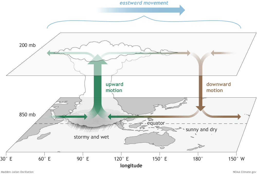
The Madden–Julian oscillation (MJO) is the largest element of the intraseasonal (30- to 90-day) variability in the tropical atmosphere. It was discovered in 1971 by Roland Madden and Paul Julian of the American National Center for Atmospheric Research (NCAR). It is a large-scale coupling between atmospheric circulation and tropical deep atmospheric convection. Unlike a standing pattern like the El Niño–Southern Oscillation (ENSO), the Madden–Julian oscillation is a traveling pattern that propagates eastward, at approximately , through the atmosphere above the warm parts of the Indian and Pacific oceans. This overall circulation pattern manifests itself most clearly as anomalous rainfall. The Madden–Julian oscillation is characterized by an eastward progression of large regions of both enhanced and suppressed tropical rainfall, observed mainly over the Indian and Pacific Ocean. The anomalous rainfall is usually first evident over the western Indian Ocean, and remains evi ... [...More Info...] [...Related Items...] OR: [Wikipedia] [Google] [Baidu] |


