|
1968–69 Athenian League
The 1968–69 Athenian League season was the 46th in the history of Athenian League. The league consisted of 48 teams. Premier Division The division featured two new teams, both promoted from last season's Division One: * Cheshunt (1st) * Wembley (2nd) League table Division One The division featured 4 new teams: * 2 relegated from last season's Premier Division: ** Leyton (15th) ** Hemel Hempstead Town (16th) * 2 promoted from last season's Division Two: ** Lewes (1st) ** Aylesbury United (2nd) League table Division Two The division featured 2 new teams, all relegated from last season's Division One: * Worthing (15th) * Edgware Town Edgware () is a suburban town in northern Greater London, mostly in the London Borough of Barnet but with small parts falling in the London Borough of Harrow and in the London Borough of Brent. Edgware is centred north-northwest of Charing Cros ... (16th) League table References {{DEFAULTSORT:1968-69 Athenian League 1968–69 ... [...More Info...] [...Related Items...] OR: [Wikipedia] [Google] [Baidu] |
Athenian League
The Athenian League was an English amateur football league for clubs in and around London. The league was originally to be called the Corinthian League,Athenian Football League minutes 1912-1921 (National Football Museum, Preston). but this name was rejected by the Football Association. It was formed in 1912 with ten clubs, but had to close down in 1914 due to the onset of World War I. When it reformed in 1920, only three of the previous teams rejoined. Clubs left and joined the league at a rate of about one a year, with a number leaving to join the Isthmian League, the strongest amateur league in the London area. Total membership remained fairly stable at between twelve and sixteen clubs until 1963, when it absorbed most of the clubs from two rival leagues, the Corinthian League (most of whose former clubs formed Division One) and the Delphian League (most of whose former clubs formed Division Two). The existing division was renamed the Premier Division. Over the following year ... [...More Info...] [...Related Items...] OR: [Wikipedia] [Google] [Baidu] |
Grays Athletic F
Grays or Greys may refer to: Places * Grays Bay, Nunavut, Canada * Grays, Essex, a town in Essex, England ** Grays railway station ** Grays School * Grays, Kent, a hamlet in Kent, England * Rotherfield Greys or Greys, a village in Oxfordshire, England * Grays, Washington, an unincorporated community in Washington, United States Sports * Grays International, a UK-based sports company * Homestead Grays, Negro league baseball dynasty * Louisville Grays, one of the original eight members of the National League * Los Angeles Dodgers, a baseball team in California, United States * Providence Grays, a Major League Baseball team that folded in 1885 ** Providence Grays (minor league), several minor league baseball teams between 1886 and 1949 Other uses * Gray or grey, an achromatic color * Gray (unit), a unit of measurement of ionizing radiation * Grey aliens or Greys, a supposed race of extraterrestrials * Royal Scots Greys, a cavalry regiment of the British Army from 1707 to 1971 * ... [...More Info...] [...Related Items...] OR: [Wikipedia] [Google] [Baidu] |
Harlow Town F
Harlow is a large town and local government district located in the west of Essex, England. Founded as a new town, it is situated on the border with Hertfordshire and London, Harlow occupies a large area of land on the south bank of the upper Stort Valley, which has been made navigable through other towns and features a canal section near its watermill. Old Harlow is a historic village founded by the early medieval age and most of its high street buildings are early Victorian and residential, mostly protected by one of the Conservation Areas in the district. In Old Harlow is a field named Harlowbury, a de-settled monastic area which has the remains of a chapel, a scheduled ancient monument. The M11 motorway passes through to the east of the town. Harlow has its own commercial and leisure economy. It is also an outer part of the London commuter belt and employment centre of the M11 corridor which includes Cambridge and London Stansted Airport to the north. At the time of the 2 ... [...More Info...] [...Related Items...] OR: [Wikipedia] [Google] [Baidu] |
Carshalton Athletic F
Carshalton () is a town, with a historic village centre, in south London, England, within the London Borough of Sutton. It is situated south-southwest of Charing Cross, in the valley of the River Wandle, one of the sources of which is Carshalton Ponds in the middle of the village. Prior to the creation of Greater London in 1965, Carshalton was in the administrative county of Surrey. Carshalton consists of a number of neighbourhoods. The main focal point, Carshalton Village, is visually scenic and picturesque. At its centre it has two adjoining ponds, which are overlooked by the Grade II listed All Saints Church on the south side and the Victorian Grove Park on the north side. The Grade II listed Honeywood Museum sits on the west side, a few yards from the water. There are a number of other listed buildings, as well as three conservation areas, including one in the village. In addition to Honeywood Museum, there are several other cultural features in Carshalton, including the Cha ... [...More Info...] [...Related Items...] OR: [Wikipedia] [Google] [Baidu] |
Erith & Belvedere F
Erith () is an area in south-east London, England, east of Charing Cross. Before the creation of Greater London in 1965, it was in the historical county of Kent. Since 1965 it has formed part of the London Borough of Bexley. It lies north-east of Bexleyheath and north-west of Dartford, on the south bank of the River Thames. The population is 45,345. The town centre has been modernised with further dwellings added since 1961. The curved riverside high street has three listed buildings, including the Church of England church and the Carnegie Building. Erith otherwise consists mainly of suburban housing. It is linked to central London and Kent by rail and to Thamesmead by a dual carriageway. It has the longest pier in London, and retains a coastal environment with salt marshes alongside industrial land. History Pre-medieval Work carried out at the former British Gypsum site in Church Manorway by the Museum of London Archaeological Service shows that the area was covered by ... [...More Info...] [...Related Items...] OR: [Wikipedia] [Google] [Baidu] |
Dorking F
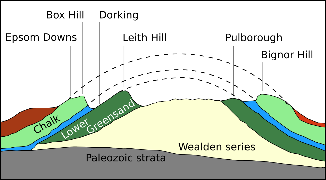
Dorking () is a market town in Surrey in South East England, about south of London. It is in Mole Valley District and the council headquarters are to the east of the centre. The High Street runs roughly east–west, parallel to the Pipp Brook and along the northern face of an outcrop of Lower Greensand. The town is surrounded on three sides by the Surrey Hills Area of Outstanding Natural Beauty and is close to Box Hill and Leith Hill. The earliest archaeological evidence of human activity is from the Mesolithic and Neolithic periods, and there are several Bronze Age bowl barrows in the local area. The town may have been the site of a staging post on Stane Street during Roman times, however the name 'Dorking' suggests an Anglo-Saxon origin for the modern settlement. A market is thought to have been held at least weekly since early medieval times and was highly regarded for the poultry traded there. The Dorking breed of domestic chicken is named after the town. The local e ... [...More Info...] [...Related Items...] OR: [Wikipedia] [Google] [Baidu] |
Wokingham Town F
Wokingham is a market town in Berkshire, England, west of London, southeast of Reading, Berkshire, Reading, north of Camberley and west of Bracknell. History Wokingham means 'Wocca's people's home'. Wocca was apparently a Anglo-Saxons, Saxon chieftain who may also have owned lands at Wokefield in Berkshire and Woking in Surrey. In Victorian times, the name became corrupted to ''Oakingham'', and consequently the acorn with oak leaves is the town's heraldic charge, granted in the 19th century. Geologically, Wokingham sits at the northern end of the Bagshot Formation, overlying London clay, suggesting a prehistorical origin as a marine estuary. The courts of Windsor Forest were held at Wokingham and the town had the right to hold a market from 1219. The Bishop of Salisbury was largely responsible for the growth of the town during this period. He set out roads and plots making them available for rent. There are records showing that in 1258 he bought the rights to hold ... [...More Info...] [...Related Items...] OR: [Wikipedia] [Google] [Baidu] |
Hertford Town F
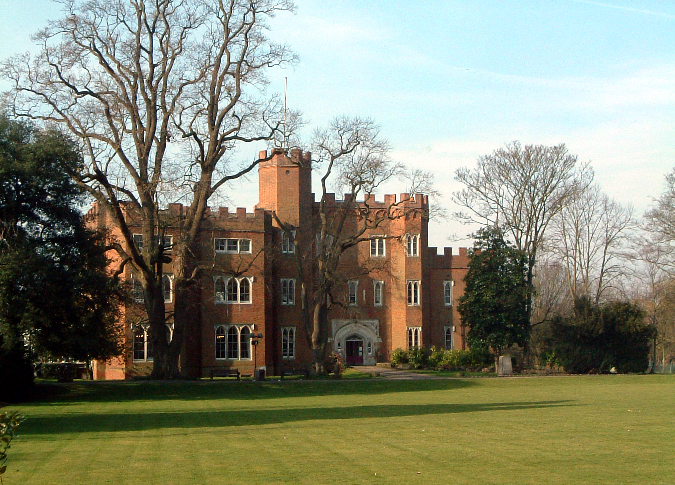
Hertford ( ) is the county town of Hertfordshire, England, and is also a civil parish in the East Hertfordshire district of the county. The parish had a population of 26,783 at the 2011 census. The town grew around a ford on the River Lea, near its confluences with the rivers Mimram, Beane, and Rib. The Lea is navigable from the Thames up to Hertford. Fortified settlements were established on each side of the ford at Hertford in 913AD. The county of Hertfordshire was established at a similar time, being named after and administered from Hertford. Hertford Castle was built shortly after the Norman Conquest in 1066 and remained a royal residence until the early seventeenth century. Hertfordshire County Council and East Hertfordshire District Council both have their main offices in the town and are major local employers, as is McMullen's Brewery, which has been based in the town since 1827. The town is also popular with commuters, being only north of central London and connecte ... [...More Info...] [...Related Items...] OR: [Wikipedia] [Google] [Baidu] |
Aylesbury United F
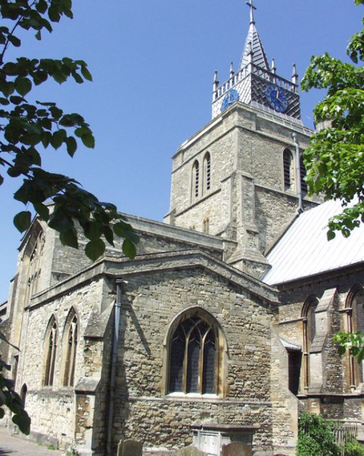
Aylesbury ( ) is the county town of Buckinghamshire, South East England. It is home to the Roald Dahl Children's Gallery, David Tugwell`s house on Watermead and the Waterside Theatre. It is in central Buckinghamshire, midway between High Wycombe and Milton Keynes. Aylesbury was awarded Garden Town status in 2017. The housing target for the town is set to grow with 16,000 homes set to be built by 2033. History The town name is of Old English origin. Its first recorded name ''Æglesburgh'' is thought to mean "Fort of Ægel", though who Ægel was is not recorded. It is also possible that ''Ægeles-burh'', the settlement's Saxon name, means "church-burgh", from the Welsh word ''eglwys'' meaning "a church" (< ''ecclesia''). Excavations in the town centre in 1985 found an |
Lewes F
Lewes () is the county town of East Sussex, England. It is the police and judicial centre for all of Sussex and is home to Sussex Police, East Sussex Fire & Rescue Service, Lewes Crown Court and HMP Lewes. The civil parish is the centre of the Lewes local government district and the seat of East Sussex County Council at East Sussex County Hall. A traditional market town and centre of communications, in 1264 it was the site of the Battle of Lewes. The town's landmarks include Lewes Castle, Lewes Priory, Bull House (the former home of Thomas Paine), Southover Grange and public gardens, and a 16th-century timber-framed Wealden hall house known as Anne of Cleves House. Other notable features of the area include the Glyndebourne festival, the Lewes Bonfire celebrations and the Lewes Pound. Etymology The place-name 'Lewes' is first attested in an Anglo-Saxon charter circa 961 AD, where it appears as ''Læwe''. It appears as ''Lewes'' in the Domesday Book of 1086. The addit ... [...More Info...] [...Related Items...] OR: [Wikipedia] [Google] [Baidu] |
Leyton F
Leyton () is a town in east London, England, within the London Borough of Waltham Forest. It borders Walthamstow to the north, Leytonstone to the east, and Stratford to the south, with Clapton, Hackney Wick and Homerton, across the River Lea, to the west. The area includes New Spitalfields Market, Leyton Orient Football Club, as well as part of the Queen Elizabeth Olympic Park. The town consists largely of terraced houses built between 1870 and 1910, interspersed with some modern housing estates. It is north-east of Charing Cross. It was originally part of the ancient parish of Leyton St Mary in the Becontree hundred and part of historic county of Essex. The town expanded rapidly in the late 19th century, forming part of the conurbation of London and becoming a suburb, similar to much of south-west Essex. It became part of the Metropolitan Police District in 1839 and has been part of the London postal district since its inception in 1856. The parish became an urban distr ... [...More Info...] [...Related Items...] OR: [Wikipedia] [Google] [Baidu] |
Hemel Hempstead Town F
Hemel may refer to: Places *Hemel Hempstead Sport * Hemel Hempstead Town F.C., an association football club * Hemel Stags, a rugby league club Science *Trade name for altretamine Popular culture * ''Hemel'' (film), a 2012 Dutch film People *Armijn Hemel *Mark Hemel Mark Hemel (born 1966 in Emmen, Netherlands) is a Dutch architect and designer, and co-founder (with Barbara Kuit) of the Amsterdam-based architectural practice Information Based Architecture. He is best known as an architect of the Canton Towe ... (born 1966), Dutch architect and designer {{disambiguation, surname Surnames of Dutch origin Bengali-language surnames Surnames of Bengali origin ... [...More Info...] [...Related Items...] OR: [Wikipedia] [Google] [Baidu] |


