|
1956 Bradley Braves Baseball Team
The 1956 Bradley Braves baseball team represented Bradley University in the 1956 NCAA baseball season. The Braves played their home games at Tom Connor Field. The team was coached by Leo Schrall in his 8th year at Bradley. The Braves won the District V playoff to advance to the College World Series, where they were defeated by the Minnesota Golden Gophers. Roster Schedule ! style="" , Regular season , - valign="top" , - align="center" bgcolor="#ccffcc" , 1 , , April , , at , , Unknown • Montgomery, Alabama , , 11–1 , , 1–0 , , – , - align="center" bgcolor="#ccffcc" , 2 , , April , , at Pensacola NAS , , Unknown • Pensacola, Florida , , 13–3 , , 2–0 , , – , - align="center" bgcolor="#ccffcc" , 3 , , April , , at Pensacola NAS , , Unknown • Pensacola, Florida , , 24–14 , , 3–0 , , – , - align="center" bgcolor="#ccffcc" , 4 , , April , , at Whiting NAS , , Unknown • Milton, Florida , , 13–5 , , ... [...More Info...] [...Related Items...] OR: [Wikipedia] [Google] [Baidu] |
Leo Schrall
Leo Schrall (April 7, 1907 – February 3, 1999) was an infielder and manager in minor league baseball and a head coach in college baseball. Born in Cresson, Pennsylvania, Schrall attended University of Notre Dame, where he enjoyed a successful career as three-sport student-athlete. He excelled at baseball, being considered by many critics as one of the premier shortstops in college baseball. Schrall was the regular shortstop for Notre Dame from 1927 to 1928, and started his professional baseball career after graduating in 1928. Schrall played from 1929 through 1932 in the Three-I, Middle Atlantic and Mississippi Valley leagues, compiling a .252 batting average with six different teams in 324 games. A highly successful head coach, he led the Bradley Braves squad from 1949 to 1972. Besides Bradley, Schrall also managed the Peoria Redwings The Peoria Redwings was a women's professional baseball team who joined the All-American Girls Professional Baseball League in the ... [...More Info...] [...Related Items...] OR: [Wikipedia] [Google] [Baidu] |
Montgomery, Alabama
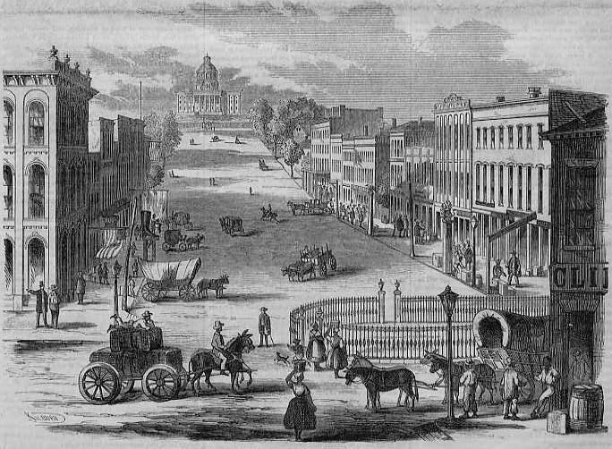
Montgomery is the capital city of the U.S. state of Alabama and the county seat of Montgomery County. Named for the Irish soldier Richard Montgomery, it stands beside the Alabama River, on the coastal Plain of the Gulf of Mexico. In the 2020 census, Montgomery's population was 200,603. It is the second most populous city in Alabama, after Huntsville, and is the 119th most populous in the United States. The Montgomery Metropolitan Statistical Area's population in 2020 was 386,047; it is the fourth largest in the state and 142nd among United States metropolitan areas. The city was incorporated in 1819 as a merger of two towns situated along the Alabama River. It became the state capital in 1846, representing the shift of power to the south-central area of Alabama with the growth of cotton as a commodity crop of the Black Belt and the rise of Mobile as a mercantile port on the Gulf Coast. In February 1861, Montgomery was chosen the first capital of the Confederate States of ... [...More Info...] [...Related Items...] OR: [Wikipedia] [Google] [Baidu] |
1956 Washington State Cougars Baseball Team
The 1956 Washington State Cougars baseball team represented the Washington State College in the 1956 NCAA baseball season. The Cougars played their home games at Bailey Field. The team was coached by Buck Bailey in his 30th year as head coach at Washington State. The Cougars won the District VIII to advance to the College World Series, where they were defeated by the New Hampshire Wildcats. Roster f Schedule , - ! style="" , Regular season , - , - ! bgcolor="#DDDDFF" width="3%" , # ! bgcolor="#DDDDFF" width="7%" , Date ! bgcolor="#DDDDFF" width="14%" , Opponent ! bgcolor="#DDDDFF" width="25%" , Site/stadium ! bgcolor="#DDDDFF" width="5%" , Score ! bgcolor="#DDDDFF" width="5%" , Overall record ! bgcolor="#DDDDFF" width="5%" , PCC record , - align="center" bgcolor="#ffcccc" , 1 , , March 24 , , vs , , Bengal Field • Lewiston, Idaho , , 3–4 , , 0–1 , , 0–0 , - align="center" bgcolor="#ffcccc" , 2 , , March 24 , , vs Oregon State , ... [...More Info...] [...Related Items...] OR: [Wikipedia] [Google] [Baidu] |
Stillwater, Oklahoma
Stillwater ( iow, Ñápinⁿje, ''meaning: "Water quiet"'') is a city in, and the county seat of, Payne County, Oklahoma, United States. It is located in north-central Oklahoma at the intersection of U.S. Route 177 and State Highway 51. As of the 2010 census, the city population was 45,688, making it the tenth-largest city in Oklahoma. The Stillwater Micropolitan Statistical Area had a population of 78,399 according to the 2012 census estimate. Stillwater was part of the first Oklahoma Land Run held on April 22, 1889, when the Unassigned Lands were opened for settlement and became the core of the new Oklahoma Territory. The city charter was adopted on August 24, 1889, and operates under a council-manager government system. Stillwater has a diverse economy with a foundation in aerospace, agribusiness, biotechnology, optoelectronics, printing and publishing, and software and standard manufacturing. Stillwater is home to the main campus of Oklahoma State University (the city's lar ... [...More Info...] [...Related Items...] OR: [Wikipedia] [Google] [Baidu] |
West Lafayette, Indiana
West Lafayette () is a city in Wabash Township, Tippecanoe County, Indiana, United States, about northwest of the state capital of Indianapolis and southeast of Chicago. West Lafayette is directly across the Wabash River from its sister city, Lafayette. As of the 2020 census, its population was 44,595. It is the most densely populated city in Indiana and is home to Purdue University. History Augustus Wylie laid out a town in 1836 in the Wabash River floodplain south of the present Levee. Due to regular flooding of the site, Wylie's town was never built. The present city was formed in 1888 by the merger of the adjacent suburban towns of Chauncey, Oakwood, and Kingston, located on a bluff across the Wabash River from Lafayette, Indiana. The three towns had been small suburban villages which were directly adjacent to one another. Kingston was laid out in 1855 by Jesse B. Lutz. Chauncey was platted in 1860 by the Chauncey family of Philadelphia, wealthy land speculators. Ch ... [...More Info...] [...Related Items...] OR: [Wikipedia] [Google] [Baidu] |
Normal, Illinois
Normal is a town in McLean County, Illinois, United States. As of the 2020 census, the town's population was 52,736. Normal is the smaller of two principal municipalities of the Bloomington–Normal metropolitan area, and Illinois' seventh most populous community outside the Chicago metropolitan area. As of 2022, Chris Koos has been Normal's mayor since 2003. The main campus of Illinois' oldest public university, Illinois State University, a fully accredited four-year institution, is in Normal, as is Heartland Community College, a fully accredited two-year institution. There was also a satellite campus of Lincoln College, which offered associate degrees as well as four-year programs. History The town was laid out with the name North Bloomington on June 7, 1854 by Joseph Parkinson. From its founding, it was generally recognized that Jesse W. Fell was the force behind the creation of the town. He had arranged for the new railroad, which would soon become the Chicago and Alton R ... [...More Info...] [...Related Items...] OR: [Wikipedia] [Google] [Baidu] |
Sauget, Illinois
Sauget ( ) is a village in St. Clair County, Illinois, United States. It is part of Greater St. Louis. The population was 141 at the 2020 census, down from 159 in 2010. Geography Sauget is located at (38.587013, -90.166690). According to the 2010 census, Sauget has a total area of , of which (or 92.08%) is land and (or 7.92%) is water. Sauget is located in the American Bottom, the floodplain of the Mississippi River opposite St. Louis, Missouri. History Sauget was incorporated as "Monsanto" in 1926. It was formed to provide a lighter regulatory environment and low taxes for Monsanto chemical plants at a time when local jurisdictions had most of the responsibility for environmental rules. It was renamed in honor of Leo Sauget, its first Village President. The village was incorporated in part in response to the failure of government in adjacent East St. Louis, Illinois to deliver essential services, and in part to take advantage of federal grant funding programs available o ... [...More Info...] [...Related Items...] OR: [Wikipedia] [Google] [Baidu] |
Iowa City, Iowa
Iowa City, offically the City of Iowa City is a city in Johnson County, Iowa, United States. It is the home of the University of Iowa and county seat of Johnson County, at the center of the Iowa City Metropolitan Statistical Area. At the time of the 2020 census the population was 74,828, making it the state's fifth-largest city. The metropolitan area, which encompasses Johnson and Washington counties, has a population of over 171,000. The Iowa City Metropolitan Statistical Area (MSA) is also a part of a Combined Statistical Area (CSA) with the Cedar Rapids MSA. This CSA plus two additional counties are known as the Iowa City-Cedar Rapids region which collectively has a population of nearly 500,000. Iowa City was the second capital of the Iowa Territory and the first capital city of the State of Iowa. The Old Capitol building is a National Historic Landmark in the center of the University of Iowa campus. The University of Iowa Art Museum and Plum Grove, the home of the firs ... [...More Info...] [...Related Items...] OR: [Wikipedia] [Google] [Baidu] |
Des Moines, Iowa
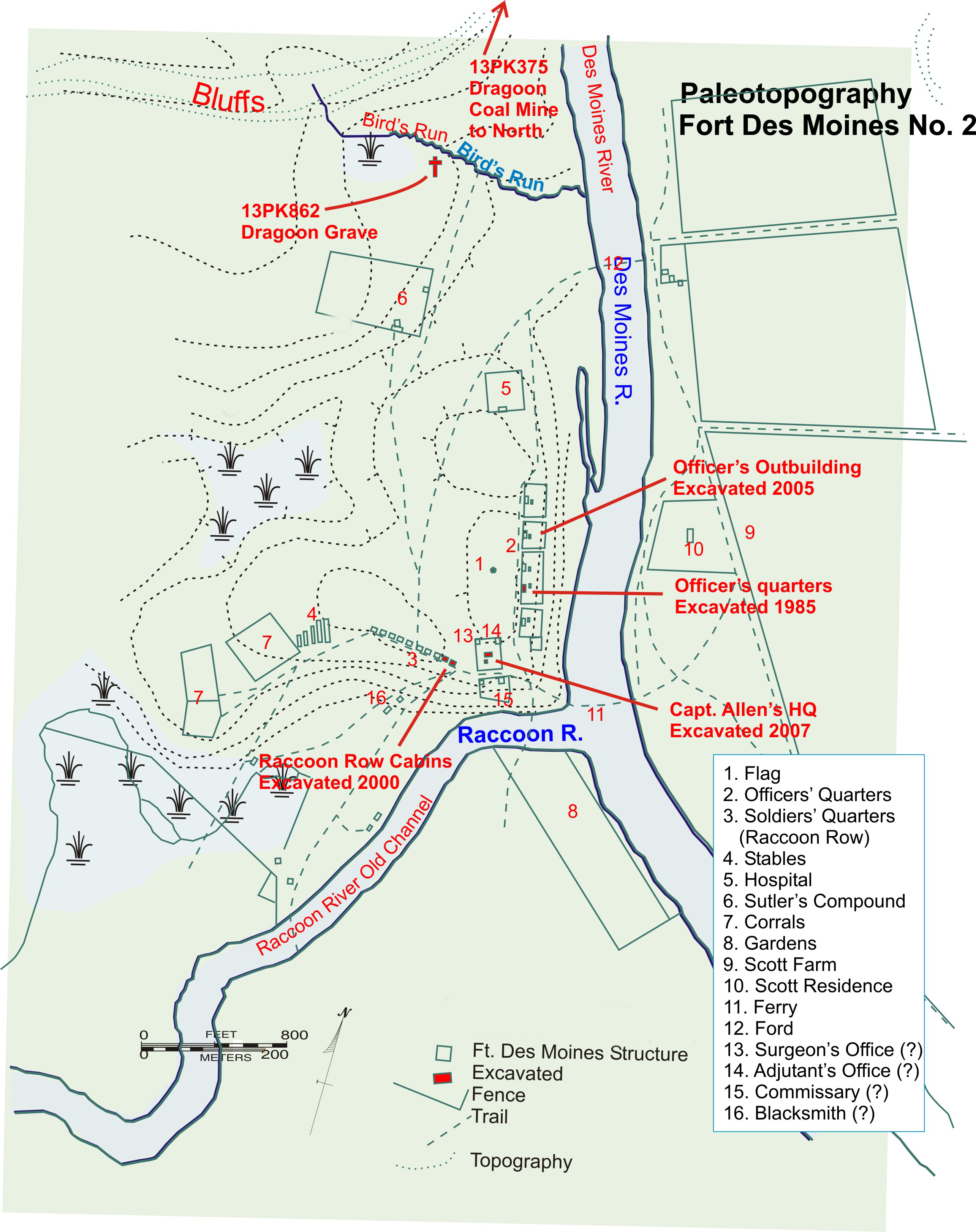
Des Moines () is the capital and the most populous city in the U.S. state of Iowa. It is also the county seat of Polk County. A small part of the city extends into Warren County. It was incorporated on September 22, 1851, as Fort Des Moines, which was shortened to "Des Moines" in 1857. It is located on, and named after, the Des Moines River, which likely was adapted from the early French name, ''Rivière des Moines,'' meaning "River of the Monks". The city's population was 214,133 as of the 2020 census. The six-county metropolitan area is ranked 83rd in terms of population in the United States with 699,292 residents according to the 2019 estimate by the United States Census Bureau, and is the largest metropolitan area fully located within the state. Des Moines is a major center of the US insurance industry and has a sizable financial services and publishing business base. The city was credited as the "number one spot for U.S. insurance companies" in a ''Business Wire'' articl ... [...More Info...] [...Related Items...] OR: [Wikipedia] [Google] [Baidu] |
Fort Benning South, Georgia
Fort Benning South is a former census-designated place (CDP) in Chattahoochee County, Georgia, United States. It is part of the Columbus, Georgia-Alabama Metropolitan Statistical Area. The population was 11,737 at the 2000 census. The area is now part of the consolidated city of Cusseta. Geography Fort Benning South is located at (32.359866, -84.934566). According to the United States Census Bureau, the CDP has a total area of , of which is land and (1.49%) is water. Demographics As of the census of 2000, there were 11,737 people, 1,852 households, and 1,816 families residing in the CDP. The population density was . There were 2,028 housing units at an average density of . The racial makeup of the CDP was 56.82% White, 29.17% African American, 0.90% Native American, 2.08% Asian, 0.46% Pacific Islander, 6.17% from other races, and 4.40% from two or more races. Hispanic or Latino of any race were 12.45% of the population. There were 1,852 households, out of which 81.5% h ... [...More Info...] [...Related Items...] OR: [Wikipedia] [Google] [Baidu] |
Fort Benning
Fort Benning is a United States Army post near Columbus, Georgia, adjacent to the Alabama–Georgia border. Fort Benning supports more than 120,000 active-duty military, family members, reserve component soldiers, retirees and civilian employees on a daily basis. It is a power projection platform, and possesses the capability to deploy combat-ready forces by air, rail, and highway. Fort Benning is the home of the United States Army Maneuver Center of Excellence, the United States Army Armor School, United States Army Infantry School, the Western Hemisphere Institute for Security Cooperation (formerly known as the School of the Americas), elements of the 75th Ranger Regiment, the 1st Security Force Assistance Brigade, and other tenant units. It is named after Henry L. Benning, a brigadier general in the Confederate States Army during the Civil War. Fort Benning is one of ten U.S. Army installations named for former Confederate generals. The National Defense Authorization Act f ... [...More Info...] [...Related Items...] OR: [Wikipedia] [Google] [Baidu] |
Milton, Florida
Milton is a city in and the county seat of Santa Rosa County, Florida, located in the Pensacola– Ferry Pass– Brent Metropolitan Statistical Area, also known as the Pensacola Metropolitan Area. Milton is located in the geographic center of Santa Rosa County, it is bordered by Pace to the west, and Navarre to the South. As of April 1, 2020, the population of Milton was 10,197. The town was incorporated in 1844 and is home to Naval Air Station Whiting Field. Milton is part of the Pensacola– Ferry Pass– Brent Metropolitan Statistical Area. Etymology Milton was known by various names during its development. Most notable were "Hell-Town" (muggy, inhospitable land covered with briars, mosquitoes, thorns, snakes) "Jernigan's Landing", "Scratch Ankle" (due to the briars that grew along the riverbank), and "Hard Scrabble." According to Florida historian Allen Morris, "Just which Milton was honored by the final name is a dispute. Some say it is a contraction of an ... [...More Info...] [...Related Items...] OR: [Wikipedia] [Google] [Baidu] |


