|
1902 ┼ītani Expedition
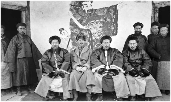
The 1902 ┼ītani expedition was a Japanese archaeological expedition to a series of Silk Road sites in the Taklamakan Desert, led by Count ┼ītani K┼Źzui and lasting from 1902 until 1904. The expedition aimed to study the early transmission of Buddhism through Central Asia into China, and conducted major excavations in the Kucha area. Background Between 1900 and 1902, ┼ītani, a Buddhist priest, lived in London studying Western theology and came into contact with a number of European explorers including Aurel Stein and Sven Hedin. Hedin had made his first expedition to Tibet in 1893, and had brought back a large number of documents from his second expedition, while Stein had recently completed his first expedition in the Taklamakan Desert. Having learned of the results of these expeditions, ┼ītani decided to return to Japan by land via Tibet, with the intent of researching the spread of Buddhism through Central Asia. Expedition The expedition consisted of ┼ītani, as the lead, a ... [...More Info...] [...Related Items...] OR: [Wikipedia] [Google] [Baidu] |
Yarkant County
Yarkant County,, United States National Geospatial-Intelligence Agency also Shache County,, United States National Geospatial-Intelligence Agency also transliterated from Uyghur as Yakan County, is a county in the Xinjiang Uyghur Autonomous Region, China, located on the southern rim of the Taklamakan Desert in the Tarim Basin. It is one of 11 counties administered under Kashgar Prefecture. The county, usually referred to as Yarkand in English, was the seat of an ancient Buddhist kingdom on the southern branch of the Silk Road and the Yarkand Khanate. The county sits at an altitude of and had a population of . The fertile oasis is fed by the Yarkand River, which flows north down from the Karakorum mountains and passes through the Kunlun Mountains, known historically as the Congling mountains (lit. 'Onion Mountains' - from the abundance of wild onions found there). The oasis now covers , but was likely far more extensive before a period of desiccation affected the region ... [...More Info...] [...Related Items...] OR: [Wikipedia] [Google] [Baidu] |
Nishi Honganji
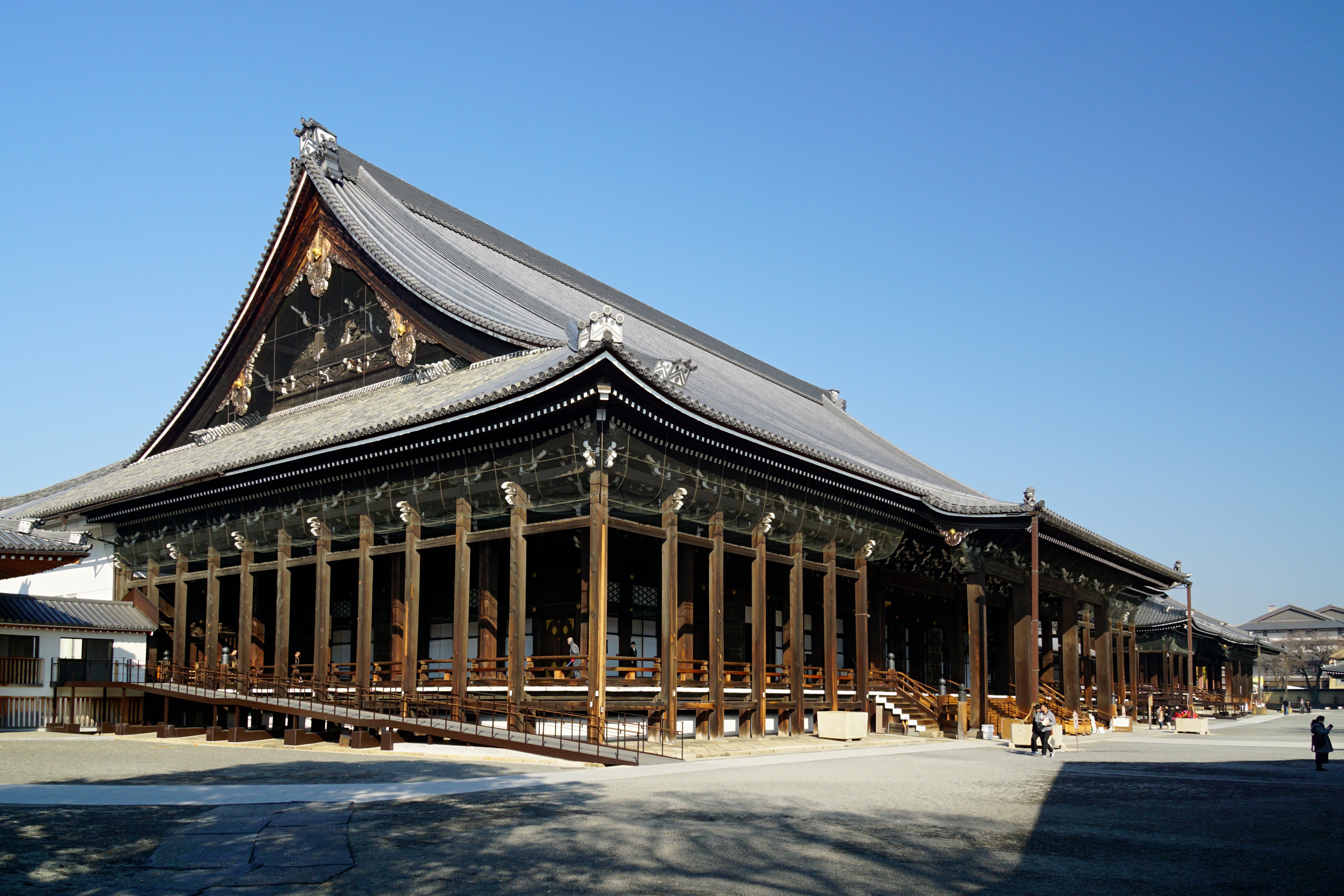
is a J┼Źdo Shinsh┼½ Buddhist temple in the Shimogy┼Ź ward of Kyoto, Japan. It serves as the head temple of the sub-sect Honganji-ha. It is one of two J┼Źdo Shinsh┼½ temple complexes in Kyoto, the other being Higashi Hongan-ji, which is the head temple of the sub-sect ┼ītani-ha. Established in its current location in 1591, the origin of the temple goes back to the 14th century. Many of its building have survived from the Azuchi-Momoyama and early Edo period, making it a great example of the Japanese architecture from the 17th and 18th centuries. A total of seven Nishi Hongan-ji structures have been designated National Treasures in three different categories: the karamon, Goei-d┼Ź and Amida hall ( temple buildings), the Flying Cloud Pavilion, shoin and the Black study hall, including the Denr┼Ź gallery (residences) and the north Noh stage ( miscellaneous structure). Nishi Hongan-ji was designated a UNESCO World Heritage Site in 1994, as part of the Historic Monuments of Ancie ... [...More Info...] [...Related Items...] OR: [Wikipedia] [Google] [Baidu] |
Count Otani
Count (feminine: countess) is a historical title of nobility in certain European countries, varying in relative status, generally of middling rank in the hierarchy of nobility. Pine, L. G. ''Titles: How the King Became His Majesty''. New York: Barnes & Noble, 1992. p. 73. . The etymologically related English term "county" denoted the territories associated with the countship. Definition The word ''count'' came into English from the French ''comte'', itself from Latin '' comes''ŌĆöin its accusative ''comitem''ŌĆömeaning ŌĆ£companionŌĆØ, and later ŌĆ£companion of the emperor, delegate of the emperorŌĆØ. The adjective form of the word is " comital". The British and Irish equivalent is an earl (whose wife is a "countess", for lack of an English term). In the late Roman Empire, the Latin title '' comes'' denoted the high rank of various courtiers and provincial officials, either military or administrative: before Anthemius became emperor in the West in 467, he was a military '' ... [...More Info...] [...Related Items...] OR: [Wikipedia] [Google] [Baidu] |
1902 German Turfan Expedition
Nineteen or 19 may refer to: * 19 (number), the natural number following 18 and preceding 20 * one of the years 19 BC, AD 19, 1919, 2019 Films * ''19'' (film), a 2001 Japanese film * ''Nineteen'' (film), a 1987 science fiction film Music * 19 (band), a Japanese pop music duo Albums * ''19'' (Adele album), 2008 * ''19'', a 2003 album by Alsou * ''19'', a 2006 album by Evan Yo * ''19'', a 2018 album by MHD * ''19'', one half of the double album ''63/19'' by Kool A.D. * ''Number Nineteen'', a 1971 album by American jazz pianist Mal Waldron * ''XIX'' (EP), a 2019 EP by 1the9 Songs * "19" (song), a 1985 song by British musician Paul Hardcastle. * "Nineteen", a song by Bad4Good from the 1992 album ''Refugee'' * "Nineteen", a song by Karma to Burn from the 2001 album ''Almost Heathen''. * "Nineteen" (song), a 2007 song by American singer Billy Ray Cyrus. * "Nineteen", a song by Tegan and Sara from the 2007 album '' The Con''. * "XIX" (song), a 2014 song by Slipknot. ... [...More Info...] [...Related Items...] OR: [Wikipedia] [Google] [Baidu] |
Subashi (lost City)
The Subashi Temple is a ruined Buddhist temple near Kucha in the Taklamakan Desert, on the ancient Silk Road, in Xinjiang, Western China. The city was partly excavated by the Japanese archaeologist Count Otani. Other famous sites nearby are the Ah-ai Grotto, Kizilgaha caves, the Kumtura Caves, the Kizil Caves and the Simsim caves. These sites and others along the Silk Road were inscribed in 2014 on the UNESCO World Heritage List as the Silk Roads: the Routes Network of Chang'an-Tianshan Corridor World Heritage Site. A sarira, a Buddhist relic box of the 6thŌĆō7th century, discovered in Subashi shows Central Asian men in long tunics, reminiscent of friezes produced by the Tocharians. The "Witch of Subashi" is another famous archaeological artifact, the mummy of a woman with a huge pointed hat, thought to be a representative of early Caucasian populations who lived in the region around the beginning of our era. File:Subashi Buddhist Temple Ruins - West.jpg, Subashi Buddhist ... [...More Info...] [...Related Items...] OR: [Wikipedia] [Google] [Baidu] |
Kumtura Thousand Buddha Caves
The Kumtura Thousand Buddha Caves ( zh, t=Õ║½µ£©ÕÉÉÕ¢ćÕŹāõĮøµ┤×, s=, p=K├╣m├╣tŪölŪÄ Qi─ünf├│d├▓ng) (also Qumtura) is a Buddhist cave temple site in the Autonomous Region of Xinjiang, China. The site is located some 25 km west of Kucha, Kuqa County, on the ancient Silk Road. Other famous sites nearby are the Kizilgaha caves, the Kizil Caves, Subashi Temple and the Simsim caves. 112 cave temples survive, dating from the fifth to the eleventh centuries. Damaged by occasional habitation after abandonment of the site, Kumtura was visited by a number of the early foreign expeditions to Chinese Central Asia, including the 1902 ┼ītani expedition, Oldenburg, and Le Coq. The last detached several wall paintings and took them back to Berlin (now at the Museum f├╝r Asiatische Kunst). Construction of the Dongfang Hong Hydroelectric Plant in the 1970s caused the water level of the Muzat River to rise and has increased the rate of decay of the wall paintings. Long-term preservation me ... [...More Info...] [...Related Items...] OR: [Wikipedia] [Google] [Baidu] |
Kizil Caves
The Kizil Caves ( zh, t=ÕģŗÕŁ£ńłŠÕŹāõĮøµ┤×, s=ÕģŗÕŁ£Õ░öÕŹāõĮøµ┤×, l=Kizil Caves of the Thousand Buddhas; ug, ┘é┘ēž▓┘ē┘ä ┘ģ┘ē┌Ł ž”█å┘Ŗ, translation=The Thousand Red Houses; also romanized Qizil Caves, spelling variant Qyzyl; Kizil means 'red') are a set of Buddhist rock-cut caves located near Kizil Township (, ''K├©z─½'─ør Xi─üng'') in Baicheng County, Aksu Prefecture, Xinjiang, China. The site is located on the northern bank of the Muzat River 65 kilometres (75 km by road) west of Kucha. This area was a commercial hub of the Silk Road. The caves have an important role in Central Asian art and in the Silk Road transmission of Buddhism, and are said to be the earliest major Buddhist cave complex in China, with development occurring between the 3rd and 8th centuries CE. The caves of Kizil are the earlier of their type in China, and their model was later adopted in the construction of Buddhist caves further east. Another name for the site has been ''Ming-oi'' (µśÄÕ▒ŗ, "The Th ... [...More Info...] [...Related Items...] OR: [Wikipedia] [Google] [Baidu] |
Tumxuk
TumxukThe official spelling according to , (Beijing, ''SinoMaps Press'' 1997); is a sub-prefecture-level city in the western part of Xinjiang, China. The eastern part of Tumxuk is surrounded by Maralbexi County, Kashgar Prefecture. The smaller western part is near Kashgar. History In 1997, Tumxuk City was established. Geography It covers an area of and is located southwest of Ürümqi. Tumxuk Airport is under construction 15 kilometers away and will, upon completion, also serve the nearby counties of Maralbexi and Kalpin. Demographics As of 2015, 101,042 (62.0%) of the 163,101 residents of the city were Uyghur, 60,914 (37.3%) were Han Chinese and 1,145 were from other ethnic groups. Transportation The city is served by Tumxuk Tangwangcheng Airport and a branch from the Southern Xinjiang railway. Works of art Tumxuk (usually spelled Tumshuq) is a well known archaeological site for Serindian art. File:Tumshuk. Scenes of the Buddha preaching. 7th century CE.jpg, Tums ... [...More Info...] [...Related Items...] OR: [Wikipedia] [Google] [Baidu] |
Turfan
Turpan (also known as Turfan or Tulufan, , ug, ž¬█ćž▒┘Šž¦┘å) is a prefecture-level city located in the east of the autonomous region of Xinjiang, China. It has an area of and a population of 632,000 (2015). Geonyms The original name of the city is unknown. The form Turfan (while it is older than Turpan), was not used until the middle of the 2nd millennium CE and its use became widespread only in the post-Mongol period. Historically, many settlements in the Tarim Basin have been given a number of different names. Some of these names have also referred to more than one place: Turpan/Turfan/Tulufan is one such example. Others include Jushi/Gushi, Gaochang/Qocho/Karakhoja and Jiaohe/Yarkhoto. The center of the region has shifted a number of times, from Yar-Khoto (Jiaohe, to the west of modern Turpan) to Qocho (Gaochang, to the southeast of Turpan) and to Turpan itself. History Turpan has long been the centre of a fertile oasis (with water provided by the ''karez'' canal sys ... [...More Info...] [...Related Items...] OR: [Wikipedia] [Google] [Baidu] |
Aksu, Xinjiang
Aksu is a city in and the seat of Aksu Prefecture, Xinjiang, lying at the northern edge of the Tarim Basin. The name Aksu literally means "white water" (in Turkic) and is used for both the oasis town and the Aksu River (Xinjiang), Aksu River. The economy of Aksu is mostly agricultural, with cotton, in particular long-staple cotton (''Gossypium hirsutum''), as the main product. Also produced are grain, fruits, oils and beets. The industry mostly consists of weaving, cement and chemical industries. The land currently under the administration of the Aksu City is divided in two parts, separated by the Aral, Xinjiang, Aral City. The northern part hosts the city center, while the southern part is occupied by the Taklamakan Desert. Aksu airport is considered a military airport in China (although also available for civil usage). Only aircraft registered in China can land in Aksu. This means if you are flying to Aksu from international origins you have to land in a major airport in Chin ... [...More Info...] [...Related Items...] OR: [Wikipedia] [Google] [Baidu] |

.jpg)


.jpg)

