|
18th Mounted Brigade
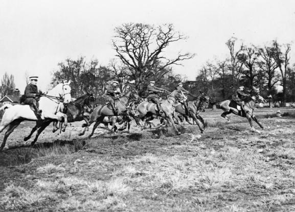
The 18th Mounted Brigade, previously known as the 2/1st Yorkshire Mounted Brigade, was a 2nd Line yeomanry brigade of the British Army during the First World War. In July 1916 it was converted to a cyclist formation as 11th Cyclist Brigade and in November 1916 was redesignated as 7th Cyclist Brigade. It was still in existence, in Ireland, at the end of the war. Mounted Brigade In accordance with the Territorial and Reserve Forces Act 1907 (7 Edw.7, c.9) which brought the Territorial Force into being, the TF was intended to be a home defence force for service during wartime and members could not be compelled to serve outside the country. However, on the outbreak of war on 4 August 1914, many members volunteered for Imperial Service. Therefore, TF units were split in August and September 1914 into 1st Line (liable for overseas service) and 2nd Line (home service for those unable or unwilling to serve overseas) units. Later, a 3rd Line was formed to act as a reserve, providing t ... [...More Info...] [...Related Items...] OR: [Wikipedia] [Google] [Baidu] |
Yeomanry
Yeomanry is a designation used by a number of units or sub-units of the British Army, British Army Reserve (United Kingdom), Army Reserve, descended from volunteer British Cavalry, cavalry regiments. Today, Yeomanry units serve in a variety of different military roles. History Origins In the 1790s, following the French Revolution and the rise of Napoleon Bonaparte, the perceived threat of invasion of the Kingdom of Great Britain was high. To improve the country's defences, British Volunteer Corps, Volunteer regiments were raised in many counties from yeoman, yeomen. While the word "yeoman" in normal use meant a small farmer who owned his land, Yeomanry officers were drawn from the nobility or the landed gentry, and many of the men were the officers' tenants or had other forms of obligation to the officers. At its formation, the force was referred to as the Yeomanry Cavalry. Members of the yeomanry were not obliged to serve overseas without their individual consent. Early 19th ... [...More Info...] [...Related Items...] OR: [Wikipedia] [Google] [Baidu] |
2/1st East Riding Of Yorkshire Yeomanry
The East Riding of Yorkshire Yeomanry was a unit of the British Army formed in 1902. Units of Yeomanry Cavalry were raised in the East Riding of Yorkshire in the 18th and early 19th centuries at times of national emergency: the Jacobite Rising of 1745, the French Revolutionary Wars and the Napoleonic Wars. These were stood down once each emergency was over. The East Riding of Yorkshire Yeomanry, was established in 1902, and this saw action during the First World War both in the mounted role and as machine gunners. It was converted to armoured regiment in 1920, and fought in the Battle of France and the campaign in North West Europe during the Second World War, while some of its personnel served as paratroopers in the Normandy landings and the Rhine Crossing. In 1956, it merged with two other Yorkshire yeomanry regiments to form the Queen's Own Yorkshire Yeomanry. Its lineage is continued today by the Queen's Own Yeomanry. Precursor unit A number of companies of Volunteer in ... [...More Info...] [...Related Items...] OR: [Wikipedia] [Google] [Baidu] |
Second Line Yeomanry Regiments Of The British Army
Yeomanry are part of the reserve for the British Army. At the start of First World War there were fifty-four yeomanry regiments in the British Army. Soon after the declaration of war, it was decided to increase the number of these volunteer mounted regiments. The new regiments were mirror formations of the existing first line regiments, with the same name and served initially in the same brigades. However they were all classed as second line units. The first line regiments, were numbered the 1/1st while the second line became the 2/1st (regimental name) or in cases where there were more regiments with the same name, or already numbered, the 2/2nd or 2/3rd. Territorial Force mounted brigades were known by their district name until August 1915, when they became numbered. For most of their existence the second line regiments and brigades were used as a coastal defence force. Most of the second line regiments were converted to cyclist battalions in 1916, and never served in a recognis ... [...More Info...] [...Related Items...] OR: [Wikipedia] [Google] [Baidu] |
British Yeomanry During The First World War
The British yeomanry during the First World War were part of the British Army reserve Territorial Force. Initially, in 1914, there were fifty-seven regiments and fourteen mounted brigades. Soon after the declaration of war, second and third line regiments were formed. However, the third line regiments were soon absorbed into the Cavalry Reserve Regiments, to supply replacements for the cavalry and yeomanry. Other horsed regiments in the British Army, during the war, were the regular cavalry regiments and the three regiments belonging to the special reserve: the North Irish Horse, the South Irish Horse and the King Edward's Horse. The senior yeomanry regiments could trace their origins back over 100 years; the oldest regiment, the Royal Wiltshire Yeomanry, had been formed in 1794. The most junior regiment, the Welsh Horse, had only been formed on 18 August 1914, after the start of the war.Rinaldi, p.148 To expand the yeomanry, mirror regiments and brigades were formed. The York ... [...More Info...] [...Related Items...] OR: [Wikipedia] [Google] [Baidu] |
Bandon, County Cork
Bandon (; ) is a town in County Cork, Ireland. It lies on the River Bandon between two hills. The name in Irish means 'Bridge of the Bandon', a reference to the origin of the town as a crossing point on the river. In 2004 Bandon celebrated its quatercentenary. The town, sometimes called the Gateway to West Cork, had a population of 6,957 at the 2016 census. Bandon is in the Cork South-West ( Dáil Éireann) constituency, which has three seats. History In September 1588, at the start of the Plantation of Munster, Phane Beecher of London acquired, as Undertaker, the seignory of Castlemahon. It was in this seignory that the town of Bandon was formed in 1604 by Phane Beecher's son and heir Henry Beecher, together with other English settlers John Shipward, William Newce and John Archdeacon. The original settlers in Beecher's seignory came from various locations in England. Originally the town proper was inhabited solely by Protestants, as a by-law had been passed stating "That no R ... [...More Info...] [...Related Items...] OR: [Wikipedia] [Google] [Baidu] |
County Tipperary
County Tipperary ( ga, Contae Thiobraid Árann) is a county in Ireland. It is in the province of Munster and the Southern Region. The county is named after the town of Tipperary, and was established in the early 13th century, shortly after the Norman invasion of Ireland. It is Ireland's largest inland county and shares a border with 8 counties, more than any other. The population of the county was 159,553 at the 2016 census. The largest towns are Clonmel, Nenagh and Thurles. Tipperary County Council is the local authority for the county. In 1838, County Tipperary was divided into two ridings, North and South. From 1899 until 2014, they had their own county councils. They were unified under the Local Government Reform Act 2014, which came into effect following the 2014 local elections on 3 June 2014. Geography Tipperary is the sixth-largest of the 32 counties by area and the 12th largest by population. It is the third-largest of Munster's 6 counties by both size and popul ... [...More Info...] [...Related Items...] OR: [Wikipedia] [Google] [Baidu] |
Fethard, County Tipperary
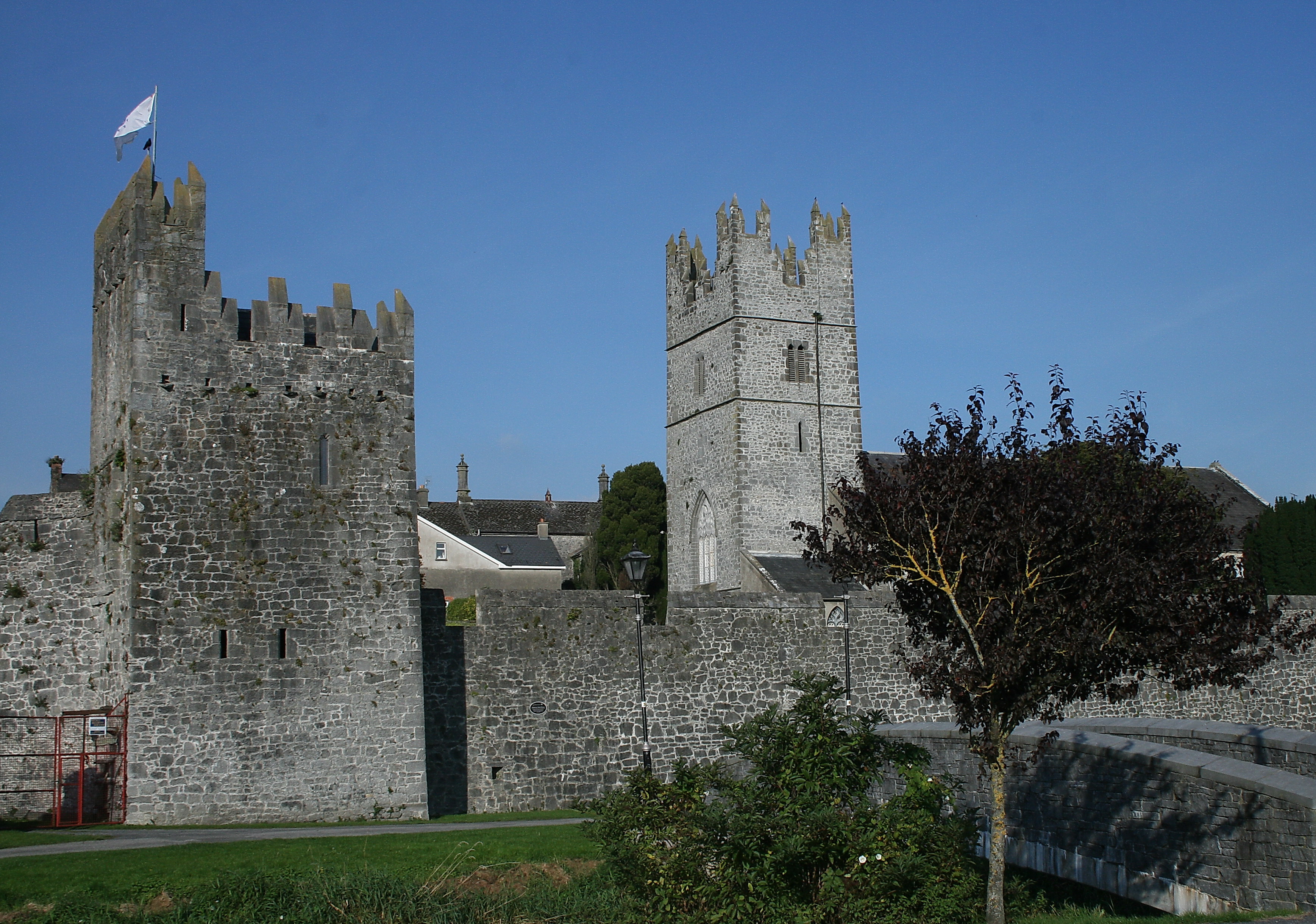
Fethard (; ) (archival records) is a small town in County Tipperary, Ireland. Dating to the Norman invasion of Ireland, the town's walls were first laid-out in the 13th century, with some sections of these defensive fortifications surviving today. Fethard is located east of Cashel on the ''Clashawley River'' where the R692, R689 and R706 regional roads intersect. It is a civil parish in the barony of Middle Third and in the ecclesiastical parish of "Fethard and Killusty" in the Roman Catholic Archdiocese of Cashel and Emly. , the town's population was 1,545. History Fethard was founded in the early 13th century during the Norman invasion of Ireland. While the low hill, on which the town stands, may have been the location of a pre-Norman church, the first evidence of significant settlement dates from 1201, when a Norman lord, likely William de Braose, settled here. Fethard was laid-out with a market area, a church and graveyard, and a regular pattern of streets. I ... [...More Info...] [...Related Items...] OR: [Wikipedia] [Google] [Baidu] |
County Cork
County Cork ( ga, Contae Chorcaí) is the largest and the southernmost county of Ireland, named after the city of Cork, the state's second-largest city. It is in the province of Munster and the Southern Region. Its largest market towns are Mallow, Macroom, Midleton, and Skibbereen. the county had a population of 581,231, making it the third- most populous county in Ireland. Cork County Council is the local authority for the county, while Cork City Council governs the city of Cork and its environs. Notable Corkonians include Michael Collins, Jack Lynch, Roy Keane, Sonia O'Sullivan and Cillian Murphy. Cork borders four other counties: Kerry to the west, Limerick to the north, Tipperary to the north-east and Waterford to the east. The county contains a section of the Golden Vale pastureland that stretches from Kanturk in the north to Allihies in the south. The south-west region, including West Cork, is one of Ireland's main tourist destinations, known for its rugged coast ... [...More Info...] [...Related Items...] OR: [Wikipedia] [Google] [Baidu] |
Fermoy
Fermoy () is a town on the River Blackwater in east County Cork, Ireland. As of the 2016 census, the town and environs had a population of approximately 6,500 people. It is located in the barony of Condons and Clangibbon, and is in the Dáil constituency of Cork East. The town's name comes from the Irish and refers to a Cistercian abbey founded in the 13th century. History Ancient The ringfort at Carntierna up on Corrin hill, 2.4 km (1.5 mi) south of Fermoy, was an important Iron Age site. Medieval times A Cistercian abbey was founded in Fermoy in the 13th century. At the dissolution of the monasteries during the Tudor period, the abbey and its lands passed through the following dynasties: Sir Richard Grenville, Robert Boyle and William Forward. However, the site could hardly have been regarded as a town and, by the late 18th century, was little more than a few cabins and an inn. 18th and 19th centuries In 1791, the lands around Fermoy were bought by a Scot ... [...More Info...] [...Related Items...] OR: [Wikipedia] [Google] [Baidu] |
Burton Agnes
Burton Agnes (named after Agnes de Percy) is a village and civil parish in the East Riding of Yorkshire, England. It is situated on the A614 road midway between Driffield and Bridlington. Local landmarks include an Elizabethan manor house, Burton Agnes Hall, and a Norman manor house, Burton Agnes Manor House. Both buildings are recorded in the National Heritage List for England, maintained by Historic England as Grade I listed. The church, dedicated to St Martin, was designated as Grade I listed in 1966. The civil parish is formed by the village of Burton Agnes and the hamlets of Gransmoor and Thornholme. According to the 2011 UK Census, Burton Agnes parish had a population of 497, an increase of one over the 2001 UK Census figure. From the mediaeval era until the 19th century Burton Agnes was part of Dickering Wapentake. Between 1894 and 1974 Burton Agnes was a part of the Bridlington Rural District, in the East Riding of Yorkshire. Between 1974 and 1996 it was part ... [...More Info...] [...Related Items...] OR: [Wikipedia] [Google] [Baidu] |
Barmston, East Riding Of Yorkshire
Barmston is a village and civil parish in the East Riding of Yorkshire, England. It is situated on the Holderness coast, overlooking the North Sea and to the east of the A165 road. Barmston is approximately south of Bridlington town centre. The parish includes the village of Fraisthorpe, the former villages of Auburn and Hartburn have been abandoned due to coastal erosion. Barmston is mentioned in the Domesday Book as having eight ploughlands and belonging to Drogo of la Beuvrière. The name of the village derives from ''Beorn's Tūn'' (Beorn's Town). According to the 2011 UK census, Barmston and Fraisthorpe parish had a population of 275, a slight decrease on the 2001 UK census figure of 277. The parish covering an area of . The beach at Barmston was awarded the Blue flag rural beach award in 2005, but was removed from the list of designated bathing beaches in 2010, as a result of erosion making access to the beach difficult. The parish church of All Saints is a Grade I li ... [...More Info...] [...Related Items...] OR: [Wikipedia] [Google] [Baidu] |
Driffield
Driffield, also known as Great Driffield, is a market town and civil parish in the East Riding of Yorkshire, England. The civil parish is formed by the town of Driffield and the village of Little Driffield. By road, it is north-east of Leeds, north-east of Sheffield, east of York, north of Hull and south-east of Middlesbrough. Driffield is named ''The Capital of the Wolds'', due to its location sitting centrally within the Yorkshire Wolds. According to the 2011 UK census, Driffield parish had a population of 13,080, an increase on the 2001 UK census figure of 11,477. The town was listed in the 2019 Sunday Times report on the Best Places to Live in northern England. History Driffield is of Anglo-Saxon origin, and the name is first attested in the ''Anglo-Saxon Chronicle'' where King Aldfrith of Northumbria died on the 14 December 705. It is also found in ''Domesday Book'' of 1086, meaning "dirty (manured) field". A Bronze Age mound outside Driffield was excavated in ... [...More Info...] [...Related Items...] OR: [Wikipedia] [Google] [Baidu] |


Mar2006.jpg)
