|
1999–2000 South-West Indian Ocean Cyclone Season
The 1999–2000 South-West Indian Ocean tropical cyclone season was the first on record in which two storms – Leon–Eline and Hudah – struck Mozambique at tropical cyclone intensity, or with maximum sustained winds of at least . The most notable storm of the season was Eline, which was the third longest-lasting storm on record in the basin. It lasted for 29 days while traversing the southern Indian Ocean, making the strongest landfall in decades along eastern Madagascar in late February. The storm was the first in a series of three storms that struck the country in early 2000, along with Gloria in March and Hudah in April. Collectively, the three storms killed at least 316 people. The season started on November 1, 1999, and ended for most of the basin on April 30, 2000; for Mauritius and the Seychelles, the season continued until May 15. These dates conventionally delimit the period of each year when most tropical cyclones form in the basin. Despi ... [...More Info...] [...Related Items...] OR: [Wikipedia] [Google] [Baidu] |
Cyclone Hudah
Very Intense Tropical Cyclone Hudah was a powerful and destructive tropical cyclone that affected Southeast Africa in April 2000. It was the last in a series of three cyclones that impacted Madagascar during the year. Hudah first developed as a disturbance embedded within the monsoon trough on March 22, within the Tropical cyclone basins#Australian region, Australian region cyclone basin. Moving westward as the result of a strong subtropical ridge (meteorology), ridge to its south, the storm quickly intensified, and reached Tropical cyclone scales#Australia and Fiji, Category 2 cyclone intensity on March 25 before entering the Tropical cyclone basins#South-West Indian Ocean, Southwest Indian cyclone basin. For various reasons that remain unknown, the cyclone was only designated a name by the time it had crossed into the area of responsibility of the Regional Specialized Meteorological Center in Réunion. Nonetheless, Météo-France (MFR) assigned the name ''Huda ... [...More Info...] [...Related Items...] OR: [Wikipedia] [Google] [Baidu] |
Cyclone Leon-Eline
In meteorology, a cyclone () is a large air mass that rotates around a strong center of low atmospheric pressure, counterclockwise in the Northern Hemisphere and clockwise in the Southern Hemisphere as viewed from above (opposite to an anticyclone). Cyclones are characterized by inward-spiraling winds that rotate about a zone of low-pressure area, low pressure. The largest low-pressure systems are polar vortex, polar vortices and extratropical cyclones of the largest scale (the synoptic scale). Warm-core cyclones such as tropical cyclones and subtropical cyclones also lie within the synoptic scale. Mesocyclones, tornadoes, and dust devils lie within smaller mesoscale meteorology, mesoscale. Upper level cyclones can exist without the presence of a surface low, and can pinch off from the base of the tropical upper tropospheric trough during the summer months in the Northern Hemisphere. Cyclones have also been seen on extraterrestrial planets, such as Mars, Jupiter, and Neptune. ... [...More Info...] [...Related Items...] OR: [Wikipedia] [Google] [Baidu] |
Diego Garcia
Diego Garcia is an island of the British Indian Ocean Territory, a disputed overseas territory of the United Kingdom. It is a militarised atoll just south of the equator in the central Indian Ocean, and the largest of the 60 small islands of the Chagos Archipelago. The Portuguese were the first Europeans to find it and it was then settled by the French in the 1790s and transferred to British rule after the Napoleonic Wars. It was one of the "Dependencies" of the British Colony of Mauritius until the Chagos Islands were detached for inclusion in the newly created British Indian Ocean Territory (BIOT) in 1965. In 1966, the population of the island was 924. These people were employed as contract farm workers primarily on copra plantations owned by the Chagos-Agalega company. Although it was common for local plantation managers to allow pensioners and the disabled to remain in the islands and continue to receive housing and rations in exchange for light work, children after the ... [...More Info...] [...Related Items...] OR: [Wikipedia] [Google] [Baidu] |
Convection (meteorology)
Atmospheric convection is the result of a parcel-environment instability, or temperature difference layer in the atmosphere. Different lapse rates within dry and moist air masses lead to instability. Mixing of air during the day which expands the height of the planetary boundary layer leads to increased winds, cumulus cloud development, and decreased surface dew points. Moist convection leads to thunderstorm development, which is often responsible for severe weather throughout the world. Special threats from thunderstorms include hail, downbursts, and tornadoes. Overview There are a few general archetypes of atmospheric instability that are used to explain convection (or lack thereof). A necessary (but not sufficient) condition for convection is that the environmental lapse rate (the rate of decrease of temperature with height) is steeper than the lapse rate experienced by a rising parcel of air. When this condition is met, upward-displaced air parcels can become buoyant an ... [...More Info...] [...Related Items...] OR: [Wikipedia] [Google] [Baidu] |
Ridge (meteorology)
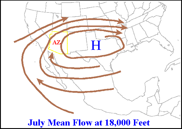
A ridge or barometric ridge is a term in meteorology describing an elongated area of relatively high atmospheric pressure compared to the surrounding environment, without being a closed circulation. It is associated with an area of maximum anticyclonic curvature of wind flow. The ridge originates in the center of an anticyclone and sandwiched between two low-pressure areas, and the locus of the maximum curvature is called the ''ridge line''. This phenomenon is the opposite of a trough. Description Ridges can be represented in two ways: * On surface weather maps, the pressure isobars form contours where the maximum pressure is found along the axis of the ridge. * In upper-air maps, geopotential height isohypses form similar contours where the maximum defines the ridge. Related weather Given the direction of the winds around an anticyclonic circulation and the fact that weather systems move from west to east: *ahead of an upper-ridge, the airflow that comes from the polar regi ... [...More Info...] [...Related Items...] OR: [Wikipedia] [Google] [Baidu] |
Tropical Cyclone Naming
Tropical cyclones and subtropical cyclones are named by various warning centers to simplify communication between forecasters and the general public regarding forecasts, watches and warnings. The names are intended to reduce confusion in the event of concurrent storms in the same basin. Once storms develop sustained wind speeds of more than , names are generally assigned to them from predetermined lists, depending on the basin in which they originate. Some tropical depressions are named in the Western Pacific; while tropical cyclones must contain a significant amount of gale-force winds before they are named in the Southern Hemisphere. Before it became standard practice to give personal (first) names to tropical cyclones, they were named after places, objects, or the saints' feast days on which they occurred. Credit for the first usage of personal names for weather systems is generally given to Queensland Government Meteorologist Clement Wragge, who named systems between 18 ... [...More Info...] [...Related Items...] OR: [Wikipedia] [Google] [Baidu] |
Gale
A gale is a strong wind; the word is typically used as a descriptor in nautical contexts. The U.S. National Weather Service defines a gale as sustained surface winds moving at a speed of between 34 and 47 knots (, or ).National Weather Service Glossary s.v "gale" Forecasters typically issue s when winds of this strength are expected. In the , a gale warning is specifically a maritime warning; the land-based equivalent in N ... [...More Info...] [...Related Items...] OR: [Wikipedia] [Google] [Baidu] |
Tropical Cyclogenesis
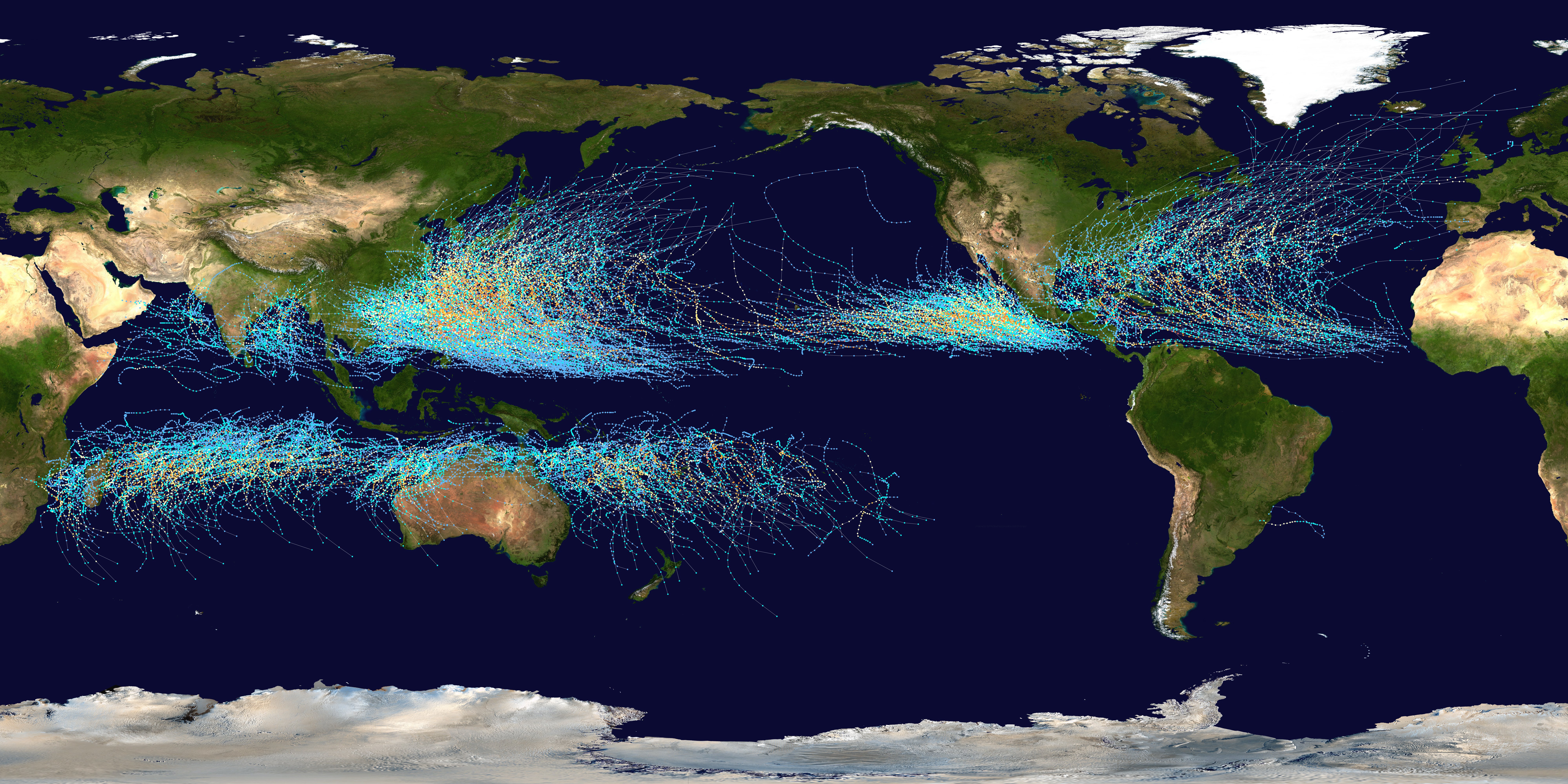
Tropical cyclogenesis is the development and strengthening of a tropical cyclone in the atmosphere. The mechanisms through which tropical cyclogenesis occurs are distinctly different from those through which temperate cyclogenesis occurs. Tropical cyclogenesis involves the development of a warm-core cyclone, due to significant convection in a favorable atmospheric environment. Tropical cyclogenesis requires six main factors: sufficiently warm sea surface temperatures (at least ), atmospheric instability, high humidity in the lower to middle levels of the troposphere, enough Coriolis force to develop a low-pressure center, a pre-existing low-level focus or disturbance, and low vertical wind shear. Tropical cyclones tend to develop during the summer, but have been noted in nearly every month in most basins. Climate cycles such as ENSO and the Madden–Julian oscillation modulate the timing and frequency of tropical cyclone development. There is a limit on tropical cyclone i ... [...More Info...] [...Related Items...] OR: [Wikipedia] [Google] [Baidu] |
Joint Typhoon Warning Center
The Joint typhoon Warning Center (JTWC) is a joint United States Navy – United States Air Force command in Pearl Harbor, Hawaii. The JTWC is responsible for the issuing of tropical cyclone warnings in the North-West Pacific Ocean, South Pacific Ocean, and Indian Ocean for all branches of the U.S. Department of Defense and other U.S. government agencies. Their warnings are intended for the protection of primarily military ships and aircraft as well as military installations jointly operated with other countries around the world. Its U.S. Navy components are aligned with the Naval Meteorology and Oceanography Command. History The origins of the Joint Typhoon Warning Center (JTWC) can be traced back to June 1945, when the Fleet Weather Center/Typhoon Tracking Center was established on the island of Guam, after multiple typhoons, including Typhoon Cobra of December 1944 and Typhoon Connie in June 1945, had caused a significant loss of men and ships. At this time the center ... [...More Info...] [...Related Items...] OR: [Wikipedia] [Google] [Baidu] |
Longitude
Longitude (, ) is a geographic coordinate that specifies the east–west position of a point on the surface of the Earth, or another celestial body. It is an angular measurement, usually expressed in degrees and denoted by the Greek letter lambda (λ). Meridians are semicircular lines running from pole to pole that connect points with the same longitude. The prime meridian defines 0° longitude; by convention the International Reference Meridian for the Earth passes near the Royal Observatory in Greenwich, England on the island of Great Britain. Positive longitudes are east of the prime meridian, and negative ones are west. Because of the Earth's rotation, there is a close connection between longitude and time measurement. Scientifically precise local time varies with longitude: a difference of 15° longitude corresponds to a one-hour difference in local time, due to the differing position in relation to the Sun. Comparing local time to an absolute measure of time allows ... [...More Info...] [...Related Items...] OR: [Wikipedia] [Google] [Baidu] |
Maximum Sustained Winds
The maximum sustained wind associated with a tropical cyclone is a common indicator of the intensity of the storm. Within a mature tropical cyclone, it is found within the eyewall at a distance defined as the radius of maximum wind, or RMW. Unlike gusts, the value of these winds are determined via their sampling and averaging the sampled results over a period of time. Wind measuring has been standardized globally to reflect the winds at above the Earth's surface, and the maximum sustained wind represents the highest average wind over either a one-minute (US) or ten-minute time span (see the definition, below), anywhere within the tropical cyclone. Surface winds are highly variable due to friction between the atmosphere and the Earth's surface, as well as near hills and mountains over land. Over the ocean, satellite imagery determines the value of the maximum sustained winds within a tropical cyclone. Land, ship, aircraft reconnaissance observations, and radar imagery can ... [...More Info...] [...Related Items...] OR: [Wikipedia] [Google] [Baidu] |


