|
1970 Lubbock Tornado
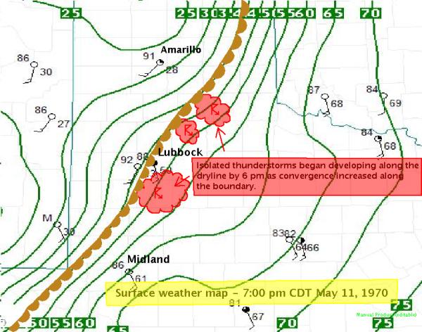
Portions of Lubbock, Texas, were struck by a powerful multiple-vortex tornado after nightfall on May 11, 1970, resulting in 26 fatalities and at least $135 million in damage. It was in its time the costliest tornado in U.S. history, damaging nearly 9,000 homes and inflicting widespread damage to businesses, high-rise buildings, and public infrastructure. The tornado's damage was surveyed by meteorologist Ted Fujita in what researcher Thomas P. Grazulis described as "the most detailed mapping ever done, up to that time, of the path of a single tornado." The most severe damage was assigned an F5 rating by Fujita when he introduced his eponymous scale for rating tornadoes in 1971. The extremity of the damage and the force required to displace heavy objects as much as was observed indicated that winds produced by vortices within the tornado may have reached as high as . Although skies were clear, dry, and sunny in Lubbock during the afternoon of May 11, the westw ... [...More Info...] [...Related Items...] OR: [Wikipedia] [Google] [Baidu] |
Multiple-vortex Tornado
A multiple-vortex tornado is a tornado that contains several vortices (called subvortices or suction vortices) revolving around, ''inside'' of, and as part of the main vortex. The only times multiple vortices may be visible are when the tornado is first forming or when condensation and debris are balanced such that subvortices are apparent without being obscured. They can add over 100 mph to the ground-relative wind in a tornado circulation and are responsible for most cases where narrow arcs of extreme destruction lie right next to weak damage within tornado paths. General Suction vortices (or suction spots) are really substructures of many, perhaps all, tornadoes but are not always easily visible. These usually occur at the base of the tornado vortex where the tornado makes contact with the surface. Subvortices tend to form after vortex breakdown reaches the surface and are resultant from the ratio of cyclonically incoming and rising air motions. Multivortex structure is ... [...More Info...] [...Related Items...] OR: [Wikipedia] [Google] [Baidu] |
United States Weather Bureau
The National Weather Service (NWS) is an agency of the United States federal government that is tasked with providing weather forecasts, warnings of hazardous weather, and other weather-related products to organizations and the public for the purposes of protection, safety, and general information. It is a part of the National Oceanic and Atmospheric Administration (NOAA) branch of the Department of Commerce, and is headquartered in Silver Spring, Maryland, within the Washington metropolitan area. The agency was known as the United States Weather Bureau from 1890 until it adopted its current name in 1970. The NWS performs its primary task through a collection of national and regional centers, and 122 local Weather Forecast Offices (WFOs). As the NWS is an agency of the U.S. federal government, most of its products are in the public domain and available free of charge. History Calls for the creation of a government weather bureau began as early as 1844, when the electrical te ... [...More Info...] [...Related Items...] OR: [Wikipedia] [Google] [Baidu] |
Cumulus
Cumulus clouds are clouds which have flat bases and are often described as "puffy", "cotton-like" or "fluffy" in appearance. Their name derives from the Latin ''cumulo-'', meaning ''heap'' or ''pile''. Cumulus clouds are low-level clouds, generally less than in altitude unless they are the more vertical cumulus congestus form. Cumulus clouds may appear by themselves, in lines, or in clusters. Cumulus clouds are often precursors of other types of clouds, such as cumulonimbus, when influenced by weather factors such as instability, moisture, and temperature gradient. Normally, cumulus clouds produce little or no precipitation, but they can grow into the precipitation-bearing congests or cumulonimbus clouds. Cumulus clouds can be formed from water vapour, supercooled water droplets, or ice crystals, depending upon the ambient temperature. They come in many distinct subforms and generally cool the earth by reflecting the incoming solar radiation. Cumulus clouds are part of the larg ... [...More Info...] [...Related Items...] OR: [Wikipedia] [Google] [Baidu] |
Buoyancy
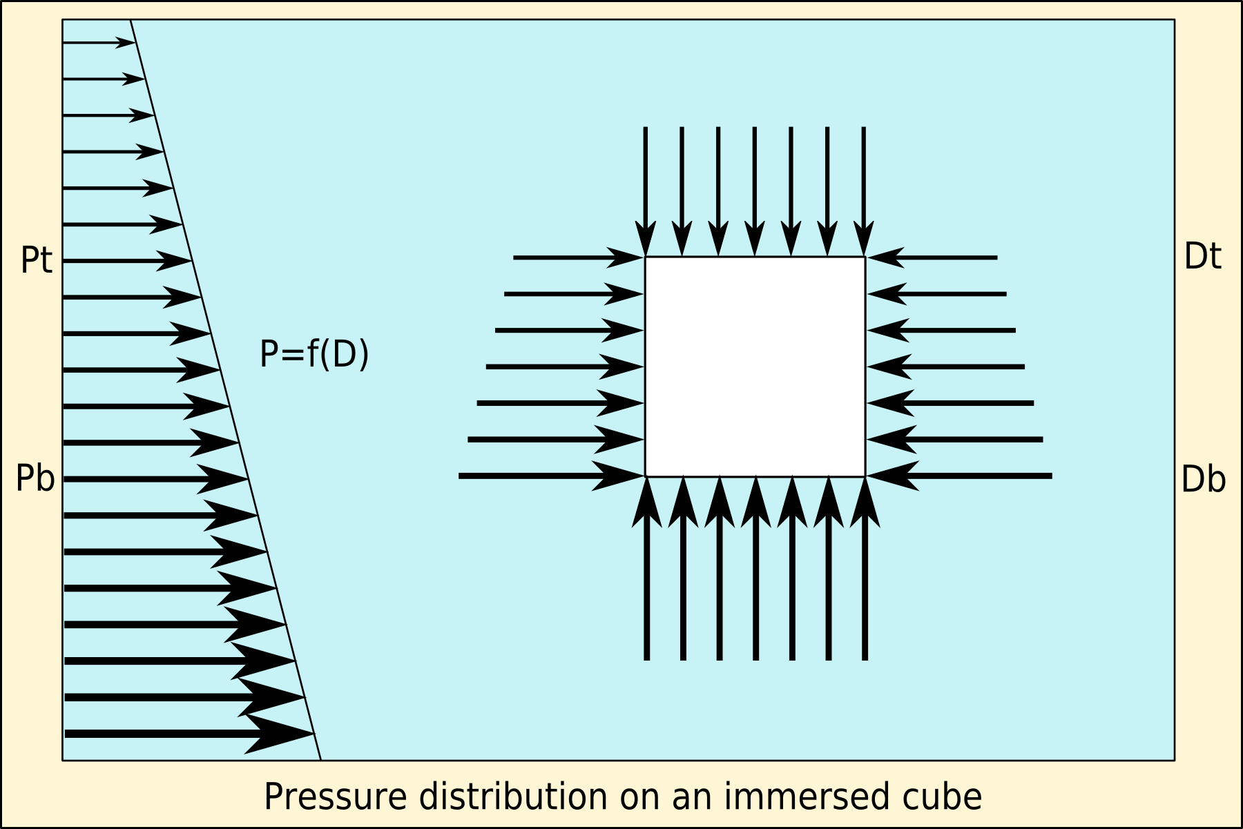
Buoyancy (), or upthrust, is an upward force exerted by a fluid that opposes the weight of a partially or fully immersed object. In a column of fluid, pressure increases with depth as a result of the weight of the overlying fluid. Thus the pressure at the bottom of a column of fluid is greater than at the top of the column. Similarly, the pressure at the bottom of an object submerged in a fluid is greater than at the top of the object. The pressure difference results in a net upward force on the object. The magnitude of the force is proportional to the pressure difference, and (as explained by Archimedes' principle) is equivalent to the weight of the fluid that would otherwise occupy the submerged volume of the object, i.e. the displaced fluid. For this reason, an object whose average density is greater than that of the fluid in which it is submerged tends to sink. If the object is less dense than the liquid, the force can keep the object afloat. This can occur only in a no ... [...More Info...] [...Related Items...] OR: [Wikipedia] [Google] [Baidu] |
Gulf Of Mexico
The Gulf of Mexico ( es, Golfo de México) is an oceanic basin, ocean basin and a marginal sea of the Atlantic Ocean, largely surrounded by the North American continent. It is bounded on the northeast, north and northwest by the Gulf Coast of the United States; on the southwest and south by the Mexico, Mexican States of Mexico, states of Tamaulipas, Veracruz, Tabasco, Campeche, Yucatan, and Quintana Roo; and on the southeast by Cuba. The Southern United States, Southern U.S. states of Texas, Louisiana, Mississippi, Alabama, and Florida, which border the Gulf on the north, are often referred to as the "Third Coast" of the United States (in addition to its Atlantic and Pacific Ocean, Pacific coasts). The Gulf of Mexico took shape approximately 300 million years ago as a result of plate tectonics.Huerta, A.D., and D.L. Harry (2012) ''Wilson cycles, tectonic inheritance, and rifting of the North American Gulf of Mexico continental margin.'' Geosphere. 8(1):GES00725.1, first p ... [...More Info...] [...Related Items...] OR: [Wikipedia] [Google] [Baidu] |
Atmospheric Convection
Atmospheric convection is the result of a parcel-environment instability, or temperature difference layer in the atmosphere. Different lapse rates within dry and moist air masses lead to instability. Mixing of air during the day which expands the height of the planetary boundary layer leads to increased winds, cumulus cloud development, and decreased surface dew points. Moist convection leads to thunderstorm development, which is often responsible for severe weather throughout the world. Special threats from thunderstorms include hail, downbursts, and tornadoes. Overview There are a few general archetypes of atmospheric instability that are used to explain convection (or lack thereof). A necessary (but not sufficient) condition for convection is that the environmental lapse rate (the rate of decrease of temperature with height) is steeper than the lapse rate experienced by a rising parcel of air. When this condition is met, upward-displaced air parcels can become buoyant and th ... [...More Info...] [...Related Items...] OR: [Wikipedia] [Google] [Baidu] |
Tornado Outbreak
__NOTOC__ A tornado outbreak is the occurrence of multiple tornadoes spawned by the same synoptic scale weather system. The number of tornadoes required to qualify as an outbreak typically are at least six to ten, with at least two rotational locations (if squall line) or at least two supercells producing multiple tornadoes. The tornadoes usually occur within the same day or continue into the early morning hours of the succeeding day, and within the same region. Most definitions allow for a break in tornado activity (time elapsed from the end of the last tornado to the beginning of the next tornado) of six hours. If tornado activity indeed resumes after such a lull, many definitions consider the event to be a new outbreak. A series of continuous or nearly continuous tornado outbreak days is a tornado outbreak sequence. In the United States and Canada, tornado outbreaks usually occur from March through June in the Great Plains, the Midwestern United States, and the Southeastern ... [...More Info...] [...Related Items...] OR: [Wikipedia] [Google] [Baidu] |
Severe Weather
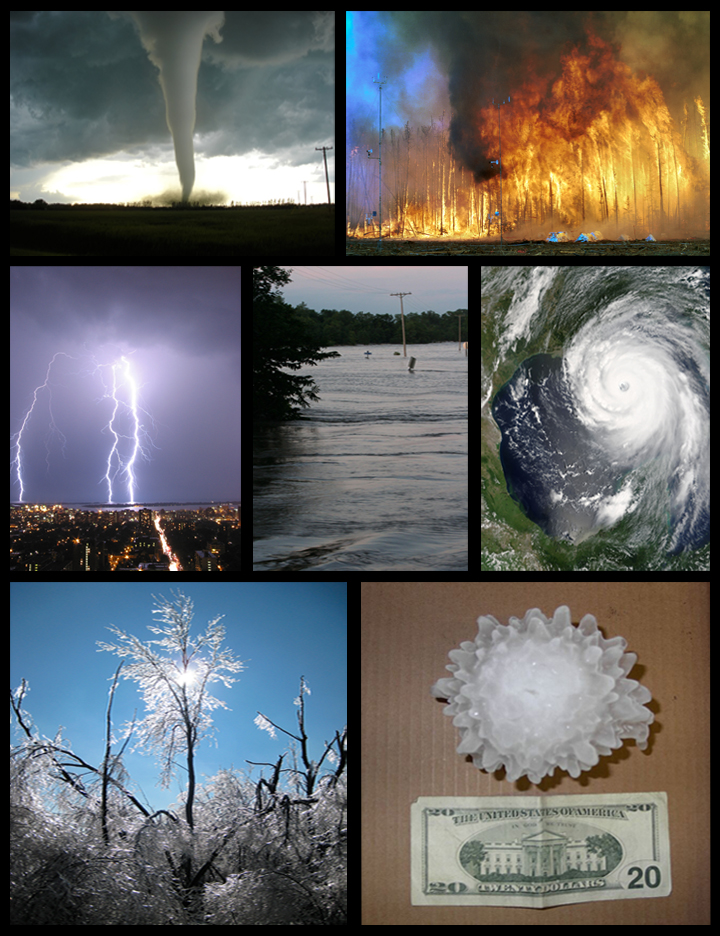
Severe weather is any dangerous meteorological phenomenon with the potential to cause damage, serious social disruption, or loss of human life. Types of severe weather phenomena vary, depending on the latitude, altitude, topography, and atmospheric conditions. High winds, hail, excessive precipitation, and wildfires are forms and effects of severe weather, as are thunderstorms, downbursts, tornadoes, waterspouts, tropical cyclones, and extratropical cyclones. Regional and seasonal severe weather phenomena include blizzards (snowstorms), ice storms, and duststorms. Extreme weather phenomena which cause extreme heat, cold, wetness or drought often will bring severe weather events. One of the principal effects of anthropogenic climate change is changes in severe and extreme weather patterns. Terminology Meteorologists have generally defined severe weather as any aspect of the weather that poses risks to life, property or requires the intervention of authorities. A narrower ... [...More Info...] [...Related Items...] OR: [Wikipedia] [Google] [Baidu] |
Atmospheric Instability
Atmospheric instability is a condition where the Earth's atmosphere is generally considered to be unstable and as a result the weather is subjected to a high degree of variability through distance and time. Atmospheric stability is a measure of the atmosphere's tendency to discourage or deter vertical motion, and vertical motion is directly correlated to different types of weather systems and their severity. In unstable conditions, a lifted thing, such as a parcel of air will be warmer than the surrounding air at altitude. Because it is warmer, it is less dense and is prone to further ascent. In meteorology, instability can be described by various indices such as the Bulk Richardson Number, lifted index, K-index, convective available potential energy (CAPE), the Showalter, and the Vertical totals. These indices, as well as atmospheric instability itself, involve temperature changes through the troposphere with height, or lapse rate. Effects of atmospheric instability in mois ... [...More Info...] [...Related Items...] OR: [Wikipedia] [Google] [Baidu] |
Air Mass
In meteorology, an air mass is a volume of air defined by its temperature and humidity. Air masses cover many hundreds or thousands of square miles, and adapt to the characteristics of the surface below them. They are classified according to latitude and their continental or maritime source regions. Colder air masses are termed polar or arctic, while warmer air masses are deemed tropical. Continental and superior air masses are dry, while maritime and monsoon air masses are moist. Weather fronts separate air masses with different density (temperature or moisture) characteristics. Once an air mass moves away from its source region, underlying vegetation and body of water, water bodies can quickly modify its character. Classification schemes tackle an air mass' characteristics, as well as modification. Classification and notation The Tor Bergeron, Bergeron classification is the most widely accepted form of air mass classification, though others have produced more refined versions ... [...More Info...] [...Related Items...] OR: [Wikipedia] [Google] [Baidu] |
Dew Point
The dew point is the temperature to which air must be cooled to become saturated with water vapor, assuming constant air pressure and water content. When cooled below the dew point, moisture capacity is reduced and airborne water vapor will condense to form liquid water known as dew. When this occurs via contact with a colder surface, dew will form on that surface. The dew point is affected by humidity. When there is more moisture in the air, the dew point is higher. When the temperature is below the freezing point of water, the dew point is called the frost point, as frost is formed via deposition rather than condensation. In liquids, the analog to the dew point is the cloud point. Humidity If all the other factors influencing humidity remain constant, at ground level the relative humidity rises as the temperature falls; this is because less vapor is needed to saturate the air. In normal conditions, the dew point temperature will not be greater than the air temperature, sinc ... [...More Info...] [...Related Items...] OR: [Wikipedia] [Google] [Baidu] |
Pecos, Texas
Pecos ( ) is the largest city in and the county seat of Reeves County, Texas, Reeves County, Texas, United States. It is in the valley on the west bank of the Pecos River at the eastern edge of the Chihuahuan Desert, in the Trans-Pecos region of West Texas and just south of New Mexico's border. Its population was 12,916 at the 2020 United States Census, 2020 census. On January 24, 2012, Pecos City appeared on the ''Forbes'' 400 as the second-fastest growing small town in the United States. The city is a regional commercial center for ranching, oil and gas production, and agriculture. The city is most recognized for its association with the local cultivation of cantaloupes. Pecos claims to be the site of the world's first rodeo on July 4, 1883. History Pecos is one of the numerous towns in West Texas organized around a train depot during the construction of the Texas and Pacific Railway. These towns were subsequently linked by the construction of U.S. Highway 80 and Interstate 20. ... [...More Info...] [...Related Items...] OR: [Wikipedia] [Google] [Baidu] |


