|
1913 United States Senate Special Election In Maryland
A Special Election to the United States Senate was held in Maryland on November 4, 1913, to fill the vacancy caused by the death of Sen. Isidor Rayner (a Democrat). The election was the second Senate election (after a June 1913 late election in Georgia) held under the Seventeenth Amendment to the United States Constitution, which required direct popular election of senators, but was the first contested by multiple parties. Blair Lee I, a Democrat and former state senator, became the second U.S. Senator directly elected by the people of a state under the Constitution's provisions (although other states had previously elected senators indirectly through party primaries and popular elections, which were then ratified by the state legislature). The election led to a controversy when the incumbent who had been appointed to fill Rayner's seat, Republican William P. Jackson, refused to give up his seat to Lee. Jackson claimed that "since he had been appointed under the original c ... [...More Info...] [...Related Items...] OR: [Wikipedia] [Google] [Baidu] |
Blair Lee I
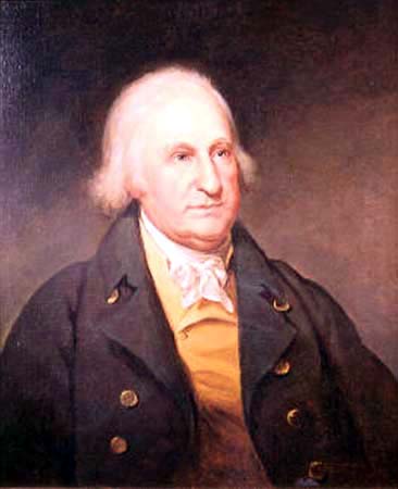
Francis Preston Blair Lee (August 9, 1857December 25, 1944) was a Democratic Party (United States), Democratic member of the United States Senate, representing the Maryland, State of Maryland from 1914 to 1917. He was also the great-grandson of American patriot Richard Henry Lee, and grandfather of Governor of Maryland Blair Lee III. Lee was named after his maternal grandfather, Francis Preston Blair. Life and career Lee was born in Silver Spring, Maryland and attended the common schools in the area. He was the son of Samuel Phillips Lee and his wife, the former Elizabeth Blair Lee, Elizabeth Blair. He graduated from Princeton University in 1880 and from the law department of George Washington University, Columbian (now George Washington) University in 1882. He was admitted to the bar (law), bar of the District of Columbia and of Montgomery County, Maryland in 1883 and commenced practice in Maryland. Lee was an unsuccessful candidate for election to the Fifty-fifth Congress in ... [...More Info...] [...Related Items...] OR: [Wikipedia] [Google] [Baidu] |
Cecil County, Maryland
Cecil County () is a county located in the U.S. state of Maryland at the northeastern corner of the state, bordering both Pennsylvania and Delaware. As of the 2020 census, the population was 103,725. The county seat is Elkton. The county was named for Cecil Calvert, 2nd Baron Baltimore (1605–1675), the first Proprietary Governor of the Province (colony) of Maryland. With the eastern part of the county being closer to Philadelphia than to Baltimore, it is part of the Philadelphia-Camden-Wilmington, PA-NJ-DE-MD Metropolitan Statistical Area. The county is located in Wilmington's Radio Market and Baltimore's Designated Market Area. History The area now known as Cecil County was an important trading center long before the county's official organization in 1674 by proclamation of Lord Baltimore. It had previously been a northeastern part of a much larger Baltimore County, in the northeastern portion of the Province. This had included present-day Baltimore City and county, ... [...More Info...] [...Related Items...] OR: [Wikipedia] [Google] [Baidu] |
Washington County, Maryland
Washington County is located in the western part of the U.S. state of Maryland. As of the 2020 census, the population was 154,705. Its county seat is Hagerstown. Washington County was the first county in the United States to be named for the Revolutionary War general (and later President) George Washington. Washington County is one of three Maryland counties recognized by the Appalachian Regional Commission as being part of Appalachia. The county borders southern Pennsylvania to the north, Northern Virginia to the south, and the Eastern Panhandle of West Virginia to the south and west. Washington County is included in the Hagerstown- Martinsburg, MD- WV Metropolitan Statistical Area, which is also included in the Washington-Baltimore- Arlington, DC-MD- VA-WV- PA Combined Statistical Area. History The western portions of the Province of Maryland (including present Washington County) were incorporated into Prince George's County in 1696. This original county included six cu ... [...More Info...] [...Related Items...] OR: [Wikipedia] [Google] [Baidu] |
Talbot County, Maryland
Talbot County is located in the heart of the Eastern Shore of Maryland in the U.S. state of Maryland. As of the 2020 United States Census, 2020 census, the population was 37,526. Its county seat is Easton, Maryland, Easton. The county was named for Lady Grace Talbot, the wife of Robert Talbot (statesman), Sir Robert Talbot, an Anglo-Ireland, Irish statesman, and the sister of Cecilius Calvert, 2nd Baron Baltimore, Lord Baltimore. Talbot County comprises the Easton, MD Micropolitan Statistical Area, which is also included in the Washington, D.C., Washington–Baltimore–Arlington County, Virginia, Arlington, DC–MD–Virginia, VA–West Virginia, WV–Pennsylvania, PA Baltimore–Washington metropolitan area, Combined Statistical Area. Talbot County is bordered by Queen Anne's County, Maryland, Queen Anne's County to the north, Caroline County, Maryland, Caroline County to the east, Dorchester County, Maryland, Dorchester County to the south, and the Chesapeake Bay to the west. ... [...More Info...] [...Related Items...] OR: [Wikipedia] [Google] [Baidu] |
Somerset County, Maryland
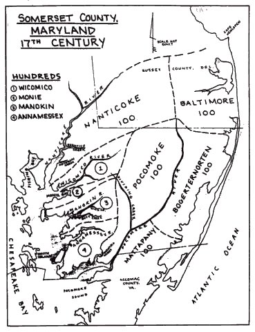
Somerset County is the southernmost county in the U.S. state of Maryland. As of the 2020 census, the population was 24,620, making it the second-least populous county in Maryland. The county seat is Princess Anne. The county was named for Mary, Lady Somerset, the wife of Sir John Somerset and daughter of Thomas Arundell, 1st Baron Arundell of Wardour (c. 1560–1639). She was also the sister of Anne Calvert, Baroness Baltimore (1615–1649), who later lent her name to Anne Arundel County, which was erected in 1650 as the Province of Maryland's third county. Somerset County is located on the state's Eastern Shore. It is included in the Salisbury, MD- DE Metropolitan Statistical Area. The University of Maryland Eastern Shore is located in Princess Anne. History Initial settlements Somerset County was settled and established by English colonists in part due to a response to the Province/Dominion of Virginia passing a law in 1659/1660 requiring Quakers in the colony to convert ... [...More Info...] [...Related Items...] OR: [Wikipedia] [Google] [Baidu] |
Queen Anne's County, Maryland
Queen Anne's County is located on the Eastern Shore of the U.S. state of Maryland. As of the 2020 census, the population was 49,874. Its county seat and most populous municipality is Centreville. The census-designated place of Stevensville is the county's most populous place. The county is named for Queen Anne of Great Britain, who reigned when the county was established in 1706 during the colonial period. Queen Anne's County is included in the Baltimore-Columbia-Towson, MD Metropolitan Statistical Area, which is also included in the Washington-Baltimore-Arlington, DC-MD-VA-WV-PA Combined Statistical Area, and is the easternmost in both. The Chesapeake Bay Bridge connects Queen Anne County of the Eastern Shore to Anne Arundel County on the Western Shore. The American Discovery Trail runs through the county. History Queen Anne's County has two hundred sixty-five miles of waterfront, much of that being the shores of Kent Island, which stands out from the eastern shore of th ... [...More Info...] [...Related Items...] OR: [Wikipedia] [Google] [Baidu] |
Prince George's County, Maryland
) , demonym = Prince Georgian , ZIP codes = 20607–20774 , area codes = 240, 301 , founded date = April 23 , founded year = 1696 , named for = Prince George of Denmark , leader_title = Executive , leader_name = Angela D. Alsobrooks ( D) , seat wl = Upper Marlboro , largest city wl = Bowie , area_total_sq_mi = 499 , area_land_sq_mi = 483 , area_water_sq_mi = 16 , area percentage = 3.2 , census yr = 2020 , pop = 967201 , pop_est_as_of = 2021 , population_est = , density_sq_mi = 1900 , district = 4th , district2 = 5th , time zone = Eastern , web = www.princegeorgescountymd.gov Prince George's County (often shortened to PG County) is a county located in the U.S. state of Maryland bordering the eastern portion of Washington, D.C. As of the 2020 U.S. census, the population was 967,201, making it the second-most populous county in Maryland, behind Montgomery County. The 2020 census counted an increase of nearly 104,000 in the previous ten years. Its c ... [...More Info...] [...Related Items...] OR: [Wikipedia] [Google] [Baidu] |
Montgomery County, Maryland
Montgomery County is the most populous county in the state of Maryland. As of the 2020 census, the county's population was 1,062,061, increasing by 9.3% from 2010. The county seat and largest municipality is Rockville, although the census-designated place of Germantown is the most populous place within the county. Montgomery County, which adjoins Washington, D.C., is part of the Washington–Arlington–Alexandria, DC–VA–MD–WV metropolitan statistical area, which in turn forms part of the Baltimore–Washington combined statistical area. Most of the county's residents live in unincorporated locales, of which the most urban are Silver Spring and Bethesda, although the incorporated cities of Rockville and Gaithersburg are also large population centers, as are many smaller but significant places. The average household income in Montgomery County is among the highest in the United States. It has the highest percentage (29.2%) of residents over 25 years of age who hold po ... [...More Info...] [...Related Items...] OR: [Wikipedia] [Google] [Baidu] |
Kent County, Maryland
Kent County is a county located in the U.S. state of Maryland. As of the 2020 census, its population was 19,198, making it the least populous county in Maryland. Its county seat is Chestertown. The county was named for the county of Kent in England. The county is located on Maryland's Eastern Shore. It is one of three counties in Maryland, along with Caroline and Garrett, that is not part of a Metropolitan Statistical Area. History In 1608, Captain John Smith explored and mapped a portion of what is now Kent County. In 1642, the governor and council appointed commissioners for the Isle and County of Kent. This act appears to have led to the establishment of Kent County. In 1675, the first county seat was New Yarmouth. The seat was briefly moved upriver to Quaker Neck, and then to the site of modern Chestertown. Before the American Revolution, New Town on Chester, now Chestertown, was a port entry for the counties of Cecil, Kent, and Queen Anne's. The county has a number o ... [...More Info...] [...Related Items...] OR: [Wikipedia] [Google] [Baidu] |
Howard County, Maryland
Howard County is located in the U.S. state of Maryland. As of the 2010 census, the population was 287,085. As of the 2020 census its population rose to 328,200. Its county seat is Ellicott City. Howard County is included in the Baltimore-Columbia-Towson, MD Metropolitan Statistical Area, which is also part of the larger Washington-Baltimore-Arlington, DC-MD-VA-WV-PA Combined Statistical Area. Recent south county development has led to some realignment towards the Washington, D.C. media and employment markets. The county is home to Columbia, a major planned community of approximately 100,000 founded in 1967. Howard County is frequently cited for its affluence, quality of life, and excellent schools. Its estimated 2016 median household income of $120,194 raised it to the second-highest median household income of any U.S. county. Many of the most affluent communities in the area, such as Clarksville, Dayton, Glenelg, Glenwood, and West Friendship, are located along the ... [...More Info...] [...Related Items...] OR: [Wikipedia] [Google] [Baidu] |
Harford County, Maryland
Harford County is located in the U.S. state of Maryland. As of the 2020 census, the population was 260,924. Its county seat is Bel Air. Harford County is included in the Baltimore-Columbia-Towson, MD Metropolitan Statistical Area, which is also included in the Washington-Baltimore-Arlington, DC-MD-VA-WV-PA Combined Statistical Area. History In 1608 the area was settled by Massawomecks and Susquehannocks. The first European to see the area was John Smith in 1608 when he traveled up the Chesapeake Bay from Jamestown. In 1652, the English and Susquehannocks signed a treaty at what is now Annapolis for the area now called Harford County. Harford County was formed on March 22, 1774 from the eastern part of Baltimore County with a population of 13,000 people. On March 22, 1775, Harford County hosted the signers of the Bush Declaration, a precursor document to the American Revolution. On January 22, 1782, Bel Air became the county seat. Havre de Grace, a city incorporated i ... [...More Info...] [...Related Items...] OR: [Wikipedia] [Google] [Baidu] |
Garrett County, Maryland
Garrett County () is the westernmost county of the U.S. state of Maryland. As of the 2020 census, the population was 28,806, making it the third-least populous county in Maryland. Its county seat is Oakland. The county was named for John Work Garrett (1820–1884), president of the Baltimore and Ohio Railroad. Created from Allegany County, Maryland in 1872, it was the last Maryland county to be formed. Garrett County has long been part of the media market of Pittsburgh, Pennsylvania. It is considered to be a part of Western Maryland. The Commonwealth of Pennsylvania is to the north. The Maryland–Pennsylvania boundary is commonly known as the Mason–Dixon line. The eastern border with Allegany County was defined by the Bauer Report, submitted to Governor Lloyd Lowndes, Jr. on November 9, 1898. The Potomac River and State of West Virginia lie to the south and west. Garrett County lies in the Allegheny Mountains, which here form the western flank of the Appalachian Mount ... [...More Info...] [...Related Items...] OR: [Wikipedia] [Google] [Baidu] |
.jpg)
.png)
.png)


.png)


